Dokdo Recorded in Jang Han Sang’s 1694 Inspection of Ulleungdo – Korea’s Ulleungdo Sa-Jeok
Ancient Korean records confirm Chosun cognizance of Dokdo and exclude the islets from Japan.
The following page is the translated inspection report of Ulleungdo written by Korean Inspector named Jang Han Sang in September of 1694. This document is important in that it clearly records Korean cognizance of Dokdo Island hundreds of years before Japan annexed the island. Dokdo island is called Takeshima by Japan and is sometimes referred to as Liancourt Rocks by western nations.
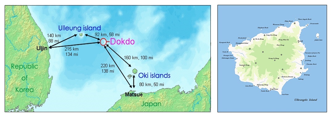
The Ulleungdo Sajeok is one of the Korean records that show Chosun officials considered Dokdo Island within Korea’s sphere of influence and outside of Japanese territory. To familiarize readers with the region a map below shows the Korean coast, Ulleungdo and Dokdo Island. A pdf image of Inspector Jang Han Sang’s original report can be seen at this link ( ulleungdo-sajeok-pdf )
First we will get an overview of the Dokdo region by examining some maps. The map below left shows the entire East Sea (Sea of Japan). Ulleungdo is located West of Dokdo Island and was historically known from being visible from there. Many historical records also describe Korea being visible from the Ulleungdo – Dokdo region. The map below right shows Ulleungdo Island.
Above left: The map above shows Korea’s East coast, Ulleungdo and Dokdo. The Korean government dispatched inspectors to Ulleungdo every two or three years. These voyages originated from Uljin or Samcheok. Maps show the travel time to be around two days, however some inspection reports record Ulleungdo could be reached in about a day in favourable winds. Above right: This map of Ulleungdo Island shows the islands major geographical features for reference
The Ulleungdo Sa-Jeok 蔚陵島事蹟 – Hanja (Chinese Characters) and English Translation
“…Gab-Sul (1694) September Samcheok Base Commander of Ganwang Province, Chang Han Sang urgently reported to the central government that Ulleungdo had just been invaded. After this, on September 19th between 9:00 and 11:00 AM, boats waiting for favourable winds were dispatched from Samcheok-Bu, Namyang-Jang, Ori Port. Based on the earlier report, Military Official Yu-Jae Gwa and Translator Ahn Shin Me led workers of different trades, oarsmen and soldiers totalling 150 men in two boats and four boats with water supplies. The men were allocated according to the size of each boat. They decided to set sail when westerly winds picked up at the time mentioned before…”
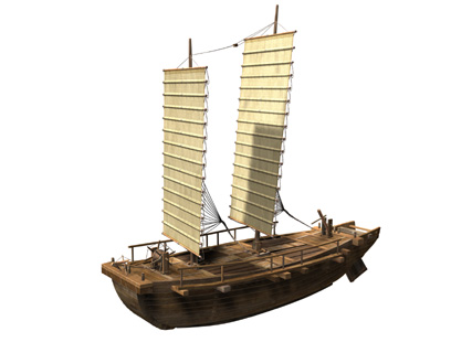
Above are two typical examples of Chosun era boats. The one on the left was a boat for defense or reconnaissance. The other Korean boat was more suitable for the transport of cargo or supplies
“…With this plan they departed between 7:00 and 9:00 PM but when they met with huge waves and thus had no option but to sail into the wave crests that were about five ri away. But the boats slammed into the waves and broke formation and then were not to be seen. Between 11:00 PM and 1:00 AM on the 20th of September, they gradually entered the deep ocean. Black clouds rolled in from the North making the sky overcast with lightning. Shadows were cast across the waves. Suddenly it poured rain in buckets and the winds blew fiercely. Violent waves towered toward the sky and it was as if the clouds and sea became mixed together as one. The boats were repeatedly swallowed by the waves only to surface again. The danger was beyond comprehension. The people on the boats were petrified with fear and being thrown about. To make matters worse, the helm was damaged and thus the boat couldn’t be controlled…”
“…We barely managed to keep the boat from capsizing by putting the oars to the stern, port and starboard sides of the boat but we could have overturned at any time. Finally, the winds and rain subsided and the sky cleared. To the North an island (Ulleungdo) was to be seen but the ocean currents ran toward the East. The people in the boat tried to stay focused and kept the bow pointed toward the island with all their might. Between 9;00 and 11:00 AM using all of our strength we arrived at the corner of many rocks on the South side of the island (Ulleungdo) for mooring. We landed on the island (Ullengdo) for a short while and were cooking rice when the four water supply boats were sighted approaching slowly in the distance. However, the supply boats were nowhere to be seen. Between 5:00 and 7:00 PM from the southern ocean, the boats arrived and all the boats could avoid disaster. We stayed at a valley southeast of the southern hill on the island where we moored our boats from (September) 20th…”
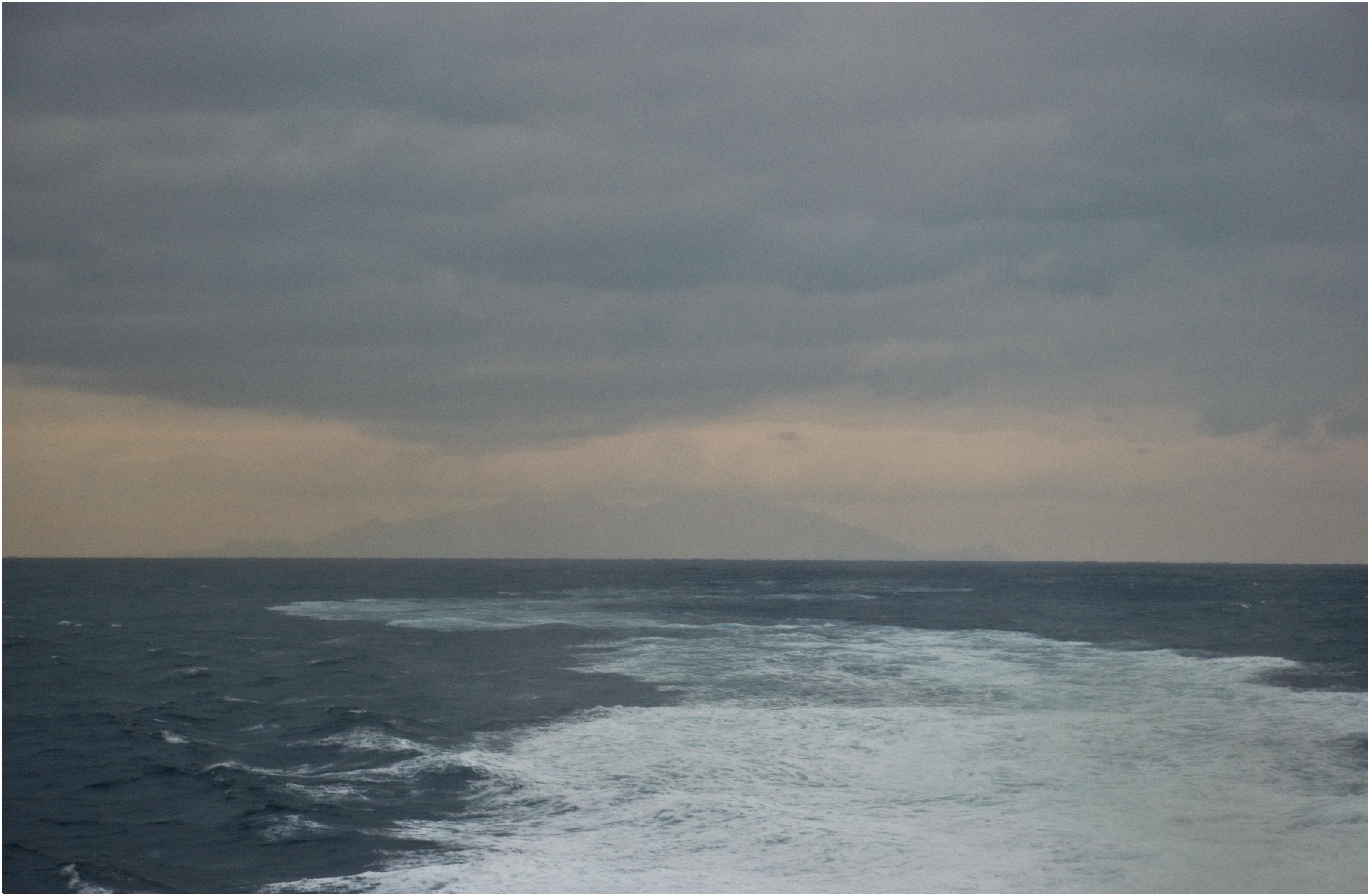
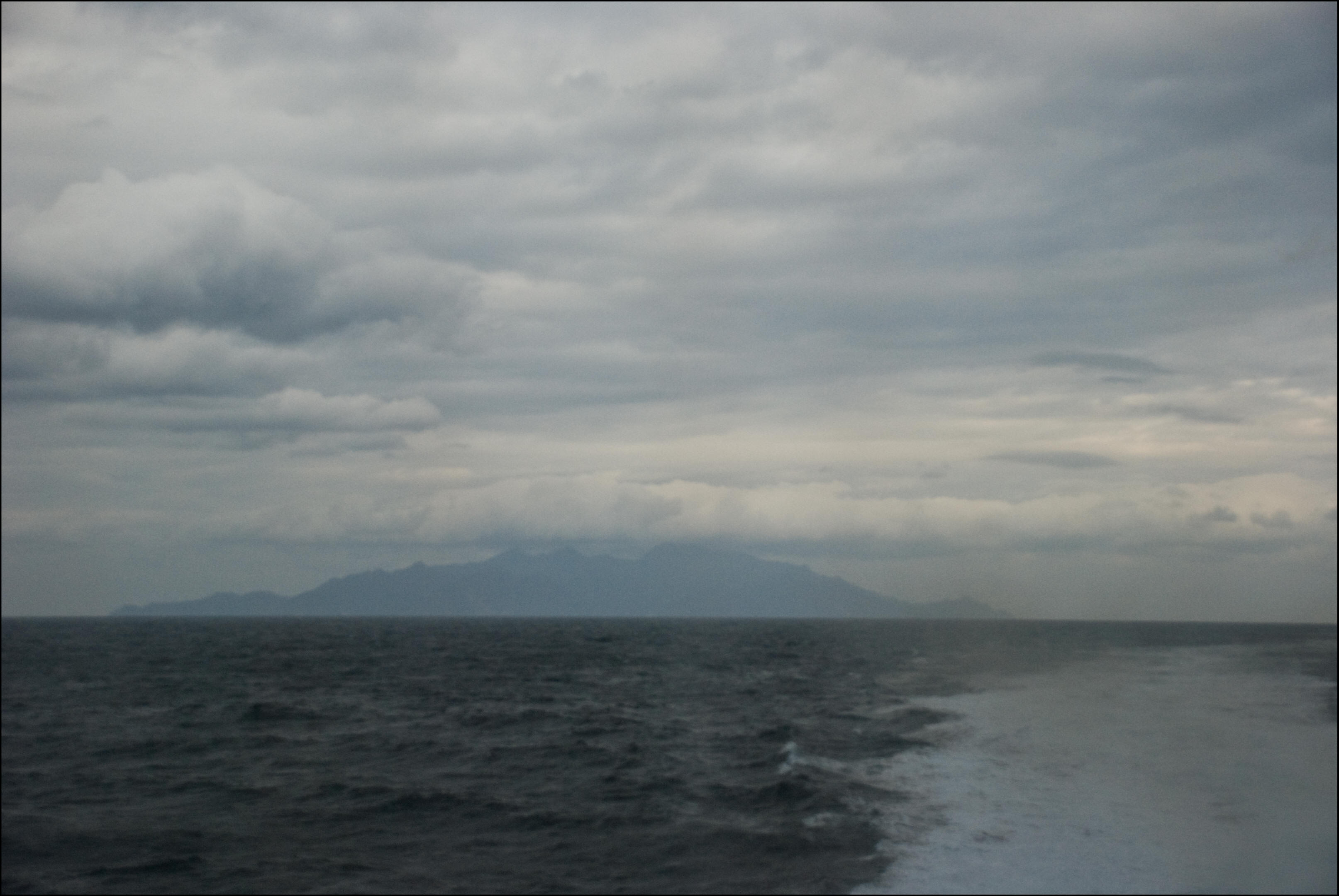
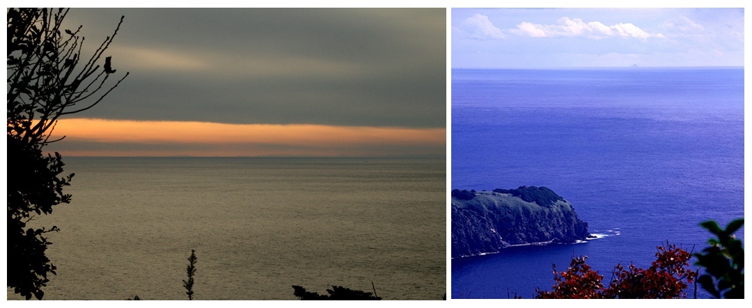
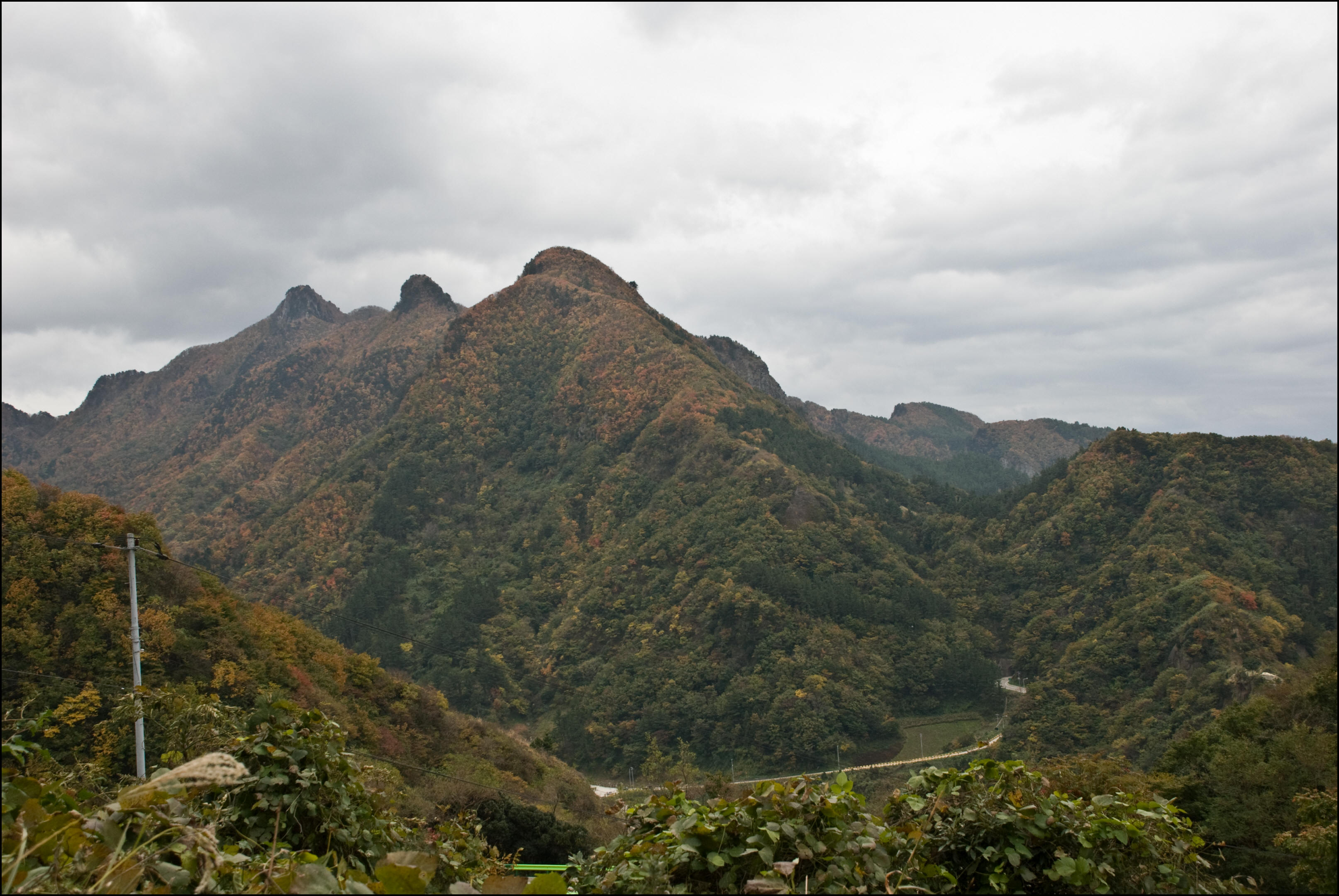
Above left: Even at 60kms distance, in the late dismal afternoon, Chosun’s Ulleungdo island was still visible. At 30kms Ulleungdo towers in the distance. Weather permitting, Koreans could voyage to Ulleungdo and not lose sight of both Korea’s coastal mountains and Ulleungdo Island.
“…to October 3rd. For the duration of our stay, it rained all the time without sunshine. There were alternating periods of heavy snow and (sleet?) About half-way up the central peak (Seong-In Bong) there was one ja (30cms?) of snow. Sailing around the shoreline of the island, (Ulleungdo) there were numerous overlapping cliffs and they were so high they seemed to soar toward the sky. Between the gaps of the rocks on the hills, run little streams from the valleys. The streams and brooks flowing from between the rocks run incessantly as if they wouldn’t cease even during times of severe drought. It took as many as two days to circumnavigate around the island (Ulleungdo) but we came to learn the circumference is only 150 to 160 ri. On the southern beach there was a bamboo grove and a field once used for farming. About 5 ri away to the East from there was an island which was not that big with a lot of haejang bamboo growing on one side…”
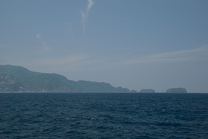
Above left. The spectacular mountains and rock formations of Ulleungdo’s North shore have impressed all those who dared voyage to the island. Right. Jukdo Islet from Seommok on Ulleungdo’s northwest shore is a near-vertical slab of rock.
“…On a day when the rain stopped and the fog lifted, we climbed Seong-In Bong (Mountain) and saw two peaks, one to the North the other to the South facing each other and towering to the sky. We then learned they are “Sambong”. Looking toward the West, we could see (Korea’s) Dae-Gwal Yeong mountain range on the horizon. Toward the East, in the middle of the ocean, an island was vaguely visible to the east-southeast (辰方). It is not quite one third the size of Ulleungdo and only 300 ri away. We traveled about 20 ri to the North and about 40 ri back down to the South and looked toward the West again still the distance looked the same. At this very location, looking straight toward the West, there were three households in the middle of a big valley and two more houses nearby. In a long valley to the southeast, were also seven houses and nineteen stone burial tombs…”
Above left: Korea’s Tae-baek Mountain range from Ulleungdo Island much the same as Han Jang San saw it in 1694. Above right: A photo of Dokdo Island taken from Ulleungdo Island.
“…Between these rocks to the southeast of where we were anchored, there was only enough space to moor about four or five boats and no place to cover our boats. Looking around we saw three grain sacks and three cooking pots not those of our (Korean) kind which are different. The rice cooking pots have neither legs nor lids but could be used for cooking and had a capacity of two mal (measurement) of rice. The grain sacks are one cheok (measurement) in diameter and about 2 cheok deep with a capacity 4 or 5 tong. The brook from the big valley to the West forms a large stream. The surroundings are open, therefore this could be the best region to moor boats. However, though the boats could avoid southeasterly winds they were still exposed to winds from the West. Even so, this place seems suitable because there was a cooking pot and some rice where we first moored our boats…”
“…At the foot of this mountain we found a potter’s wheel which was not from our country either. On Ulleungdo Island there are layers of overlapping mountains and from halfway up to the mountain tops there is nothing but jagged rocks, and below is covered in soil. The terrain was very rough. Because the valley was deep and huge trees were blocking the sunlight it was impossible to guess how long it had been since people had visited this place. Due to the tangled vines, rotten grass and trees densely wrapped around each other, there is no possible way to for man pass through. The valley was so narrow we couldn’t go to its end. The trees growing in this place are Camellia, Thuja, Hwang-Byeok, Kalopanax, Geum-mok, Gwae-Mok, Yu-mok, Mulberry, and Maple…”
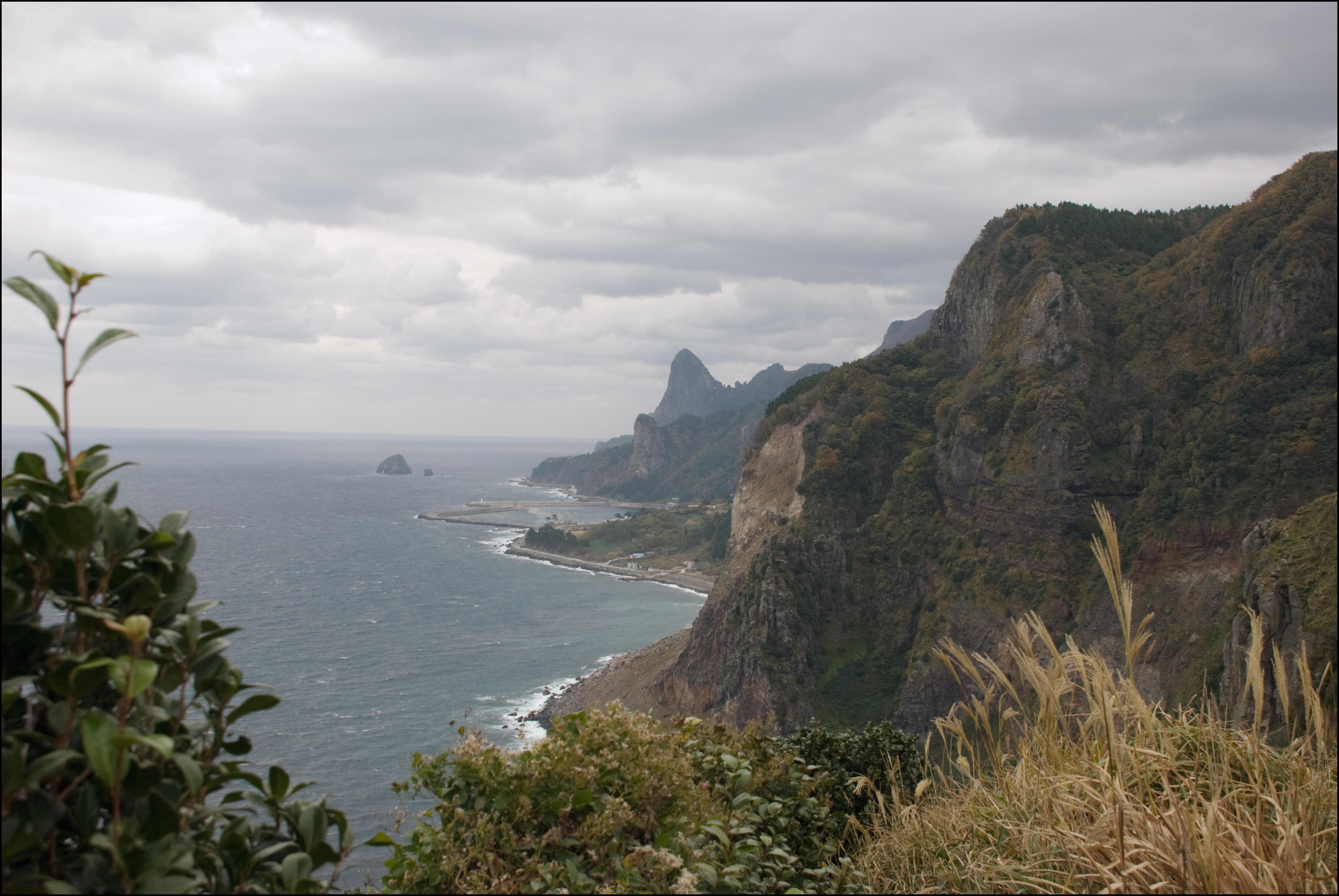
Above left. Jang Han Sang’s inspection team most likely set up base on the rocky shores of Ulleungdo’s southeast Sadong area. Above right: Ulleungdo’s impressive Three Brother’s Mountains and deep valleys are choked with vines and trees. This made surveying Ulleungdo Island a very difficult task.
“…Among the trees the most common one is dongjadan (a kind of sandalwood). Pine trees jikmok, hazel trees, oak trees etc., were not to be seen. As for winged animals, seagulls were the only kind and cats were the only wild animals. No other winged or wild animals were to be seen. There were no people living there and no edible fruit to be seen. As for marine animals octopus were the only kind to be found and there were tens or even hundreds of them. They had burrowed holes and lived in colonies where there are piles of rocks at the seaside. The large octopus were about the size of a pony or calf the smaller around the size of a small dog or pig. Sometimes live abalone were to be found attached to small rocks by the seashore they were small and didn’t taste well. Surrounding an inlet, boards used for boats were floating on the surface of the water here and there. Some boards had steel nails and others had wooden nails in them. Other boards were already rotten and looking closely they were made of cho-mok (wood)…”
“…This (wood) was no different from ours but it was already broken into pieces and most of it was floating below the southeastern cliff. At three locations on southeastern ridges there were the most dense bamboo fields. Here and there we noticed some locations for planting about 30 seok of crops. However, two bamboo fields of them had a lot of plants cut down. About one thousand of these bamboo trees could be seen piled up along the perimeter. Some of them had already been dried and others were still not. About 50 ri toward the bamboo field from the valley between the East and South extends a path which must have been made by bamboo carriers. In general, every mountain we reached on the island was impressive. All around cliffs soar toward the sky and between separate precipices run streams. Just one location on the West ridge has a large stream at the entrance. However, it (the stream) did not form a bay and thus made it difficult to moor because there were deposits of sand and gravel…”
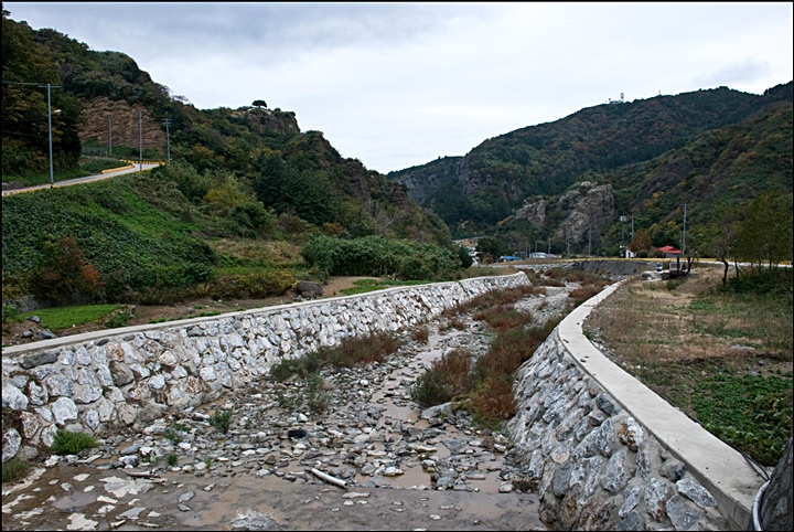
The above photos are of Ulleungdo’s Tae-ha Valley and Tae-ha Stream. This rocky stream meets the ocean on Ulleugdo’s northwest shore. Jang Han Sang wrote this area as 大川流出寬豁 Subsequent maps also marked Tae-ha accordingly.
“…Amid this, the peaks soar irregularly and the valley is windy so there was not open land. But there was enough space to lay a straw mat. Around the once inhabited low-lying mountains and flat valley some stone burial tombs could be seen here and there with grave bushes growing nearby. Probably because the island stands in the middle of the three thousand ri ocean, boats could not travel at will and therefore even if that country (Japan) had taken it over forcefully, they could not have been stopped. It appears when they tried to construct an iron fort they could not have resided there anyway. Even reclaimable land was thickly crowded with trees and choked with vines. On top of that, even in September there were banks of snow and it was colder than the winter. The middle of the night came and the cold winds blew…”
“…In one way the wind sounded like a child crying or perhaps a woman weeping. So the loud noise rang in our ears sometimes very shrilly or gently moaning in the distance. This ship’s bow that can be seen nearby looks like an ogre that is said to spread ocean poison using magic spells. Sometimes sounds similar to a shell horns, cannons or drums used to summon soldiers for border defense could be heard and then would disappear again. While circumnavigating the island, we arrived at this place when the evening came. We moored and got off the boat and walked on the sandy beach to cook rice next to a large rock. On the way, something was vaguely seen in the distance, so with An Shin Mi, we walked about three ri and found the jagged middle peak extending. All around the foot of the mountain, were overlapping rocks and cliffs and wide open area was to be seen in the distance. Looking in that direction, along the way, a path led toward a stone cave halfway up the mountain. With An Shin Mi…”
“…We discussed if there were poisonous creatures which could harm us in that cave and if we should moor the boat somewhere else. After 11:00 P.M. and 1:00 A.M. it started pouring rain and there were unyielding waves. Lightning stuck the mountain reached echoed with thunder the ocean seemed churned violently and then after a while was totally calm. Fog rolled in around the island (Ulleungdo) the red sky disappeared and from the distance the stirring noise of people came from the stone cave. While shouting and looking toward the cave from the bow of the boat, a bright lamplight was seen. The next day, after eating a meal, we moored somewhere else to look into the peculiar place (cave) we saw the night before. Then we told Officer Bak Chung Jeong to take about 20 soldiers and look into the place. They were in the cave for some time and had still come out, so we became concerned that there might be a trap. So we called to make everyone come out and Bak Chung Jeong walked out in front. About 30 paces inside the cave lies a wide opening and in that place were four levels of eaves…”
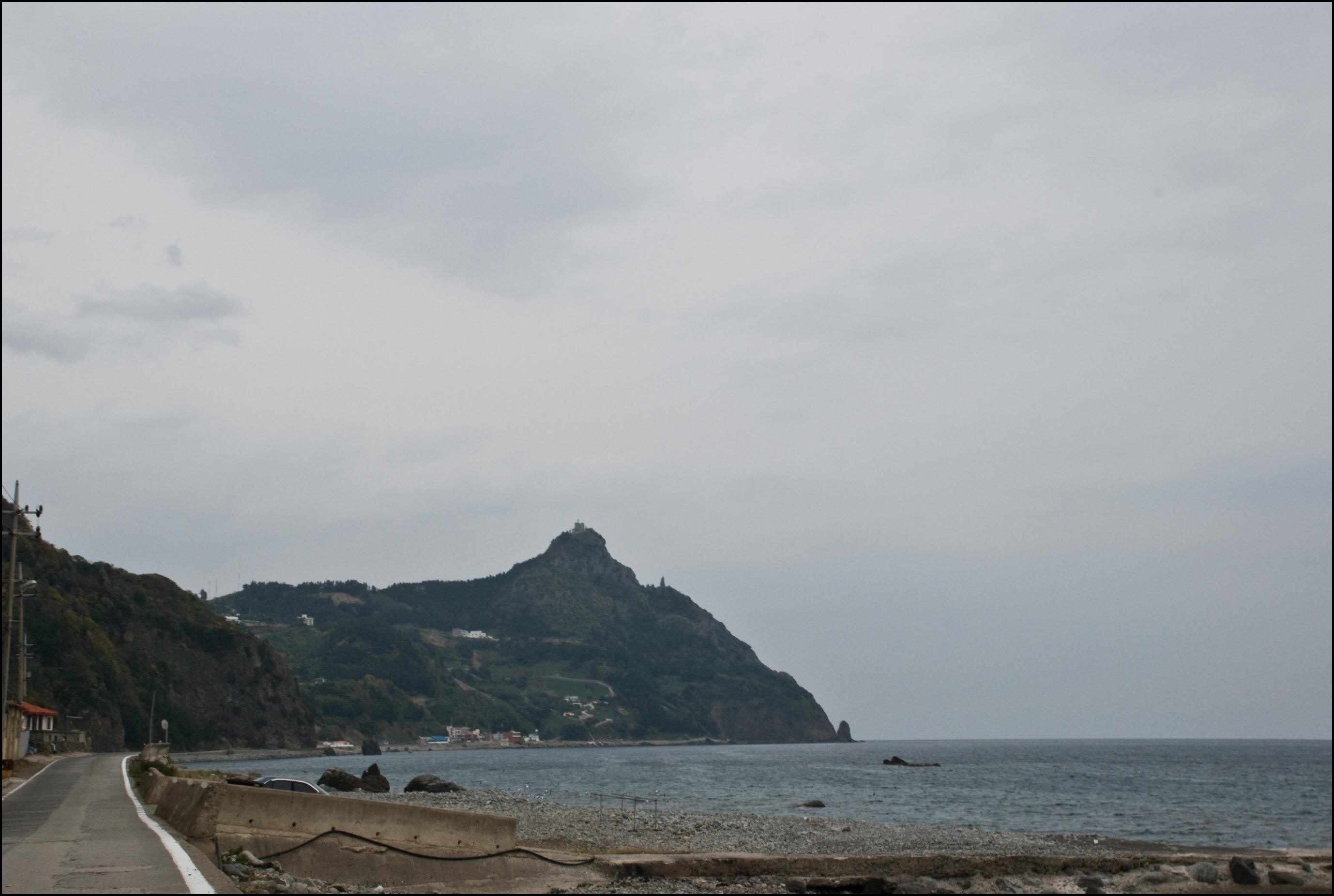
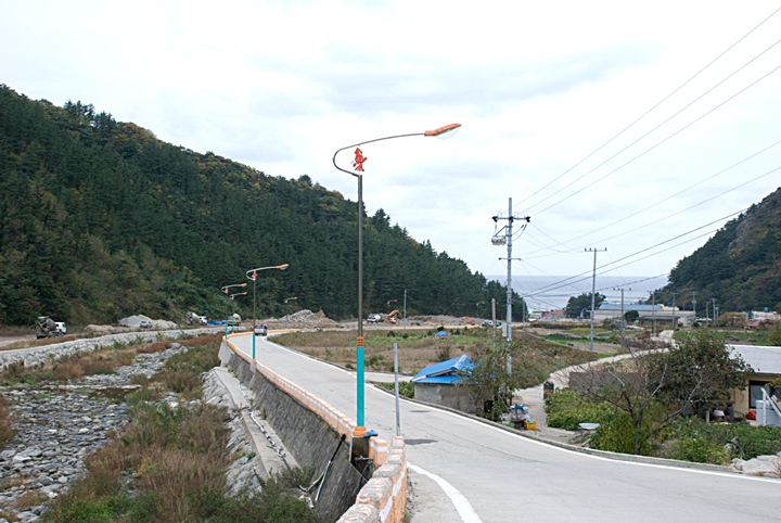
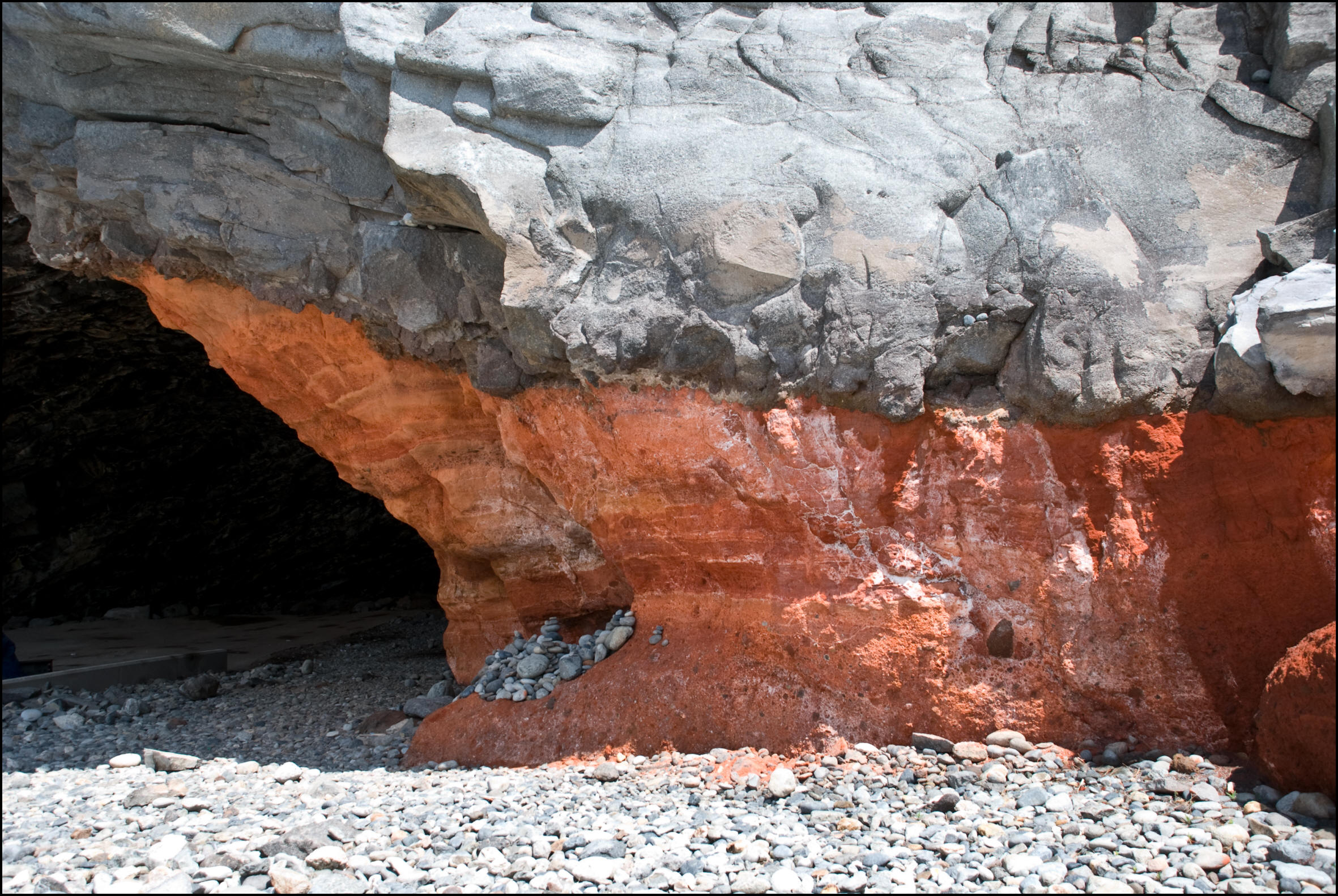
Above left: Hyangmok Rock on Ulleungdo’s northwest shore was near a point where Chosun inspection teams waited for favourable winds to return home. Above right: A photo of Hwangto Cave. Japanese who voyaged to Chosun’s territory apparently took shelter in Ulleungdo’s caves.
“…There were about ten rooms of stone levels that are smooth with jade ornaments the last room is decorated with many different colours. Looking at its decoration, it’s quite different from the manner and shape in which can be commonly seen in our country. Nothing else was to been seen, getting closer under the eaves, a smell like sulfur or rotting meat burned the nose therefore it was said we couldn’t go further. Another official took about 60 soldiers and they walked inside themselves and confirmed what Bak Chung Jeong said. At the top of the dwelling vines wrapped around and amid the inside of the tiered was very calm and clean even dust was not to be found. Thus, it didn’t appear to be a place where people lived…”
“…Although I knew I should enter this place, to clear any doubts I still didn’t dare get close under the tiers. On the day coming back on the boat, from Chung Bong (Seong In Mountain) Mountain, clouds and fog were gradually pushed away toward the ocean. Some mysterious object as big as a hill (or mountain name) surfaced and submerged several times and then vanished. In the mountain winds howled and rain poured. The mountain was shaken as if it were about to crumble by a sound unlike thunder. With regard to what features Ulleungdo has apart from other islands. Bamboo fields are everywhere, there are four thousand of these places that are similar to the one mentioned above. Small ones (fields) had about 20 Seok Rak Ji (unit of measurement) and large ones with about 30 Seok Rak Ji. All of them had a source that could provide the fields with water. Of the trees, Red Sandalwood could be used as gwanal but they are all located between rocks on the mountainside…”
“..Judging from this place still intact, once resided by ancient people, it appears it became vacant only about 100 years ago. There is an entrance to the valley, at the stream and upon looking for a strategy to drive away the enemy, this could be a place where one person could defeat a hundred men. Their boats (Japanese) can’t be grouped together for an extended time. Also if there are any strong winds or waves, even maintaining the boats would be difficult. Climbing on top of the (Ulleungdo’s Seong In Mountain) mountain looking closely, toward their (Japan’s) country, it is dark and distant and no islands caught my eye, thus the distance to their country (Japan) cannot be determined. The topography of the island (Ulleungdo) is like a rice cooking pot placed between us (Korea) and them (Japan) and the paths for carrying bamboo were probably made by those people (Japanese) I suppose. So I report this promptly, (names and date follows).
Jang Han Sang’s Ulleungdo Sajeok 蔚陵島事蹟 Some Conclusions from the Evidence
From the Ulleungdo Sa-jeok a few important conclusions can be reached about the territorial limits of Korea and Japan prior to the Shogunate’s travel ban on Ulleungdo in 1696.
First, it should be noted. Inspector Jang Han Sang (and the Chosun government) regarded Japanese involvement on Ulleungdo as an outright invasion as stated on page one above. Chosun vacant island policy on Ulleungdo was by no means abandonment as some Japanese historians have claimed. Korea clearly considered the Ulleungdo area as Chosun territory.
Second, the Ulleungdo Sajeok confirms Dokdo’s visibility from Ulleungdo. This fact was denied by Japanese scholars for decades. A few other records such as the 1714 report and the Black Dragon Fishing report. Even some recent photographs have proven Dokdo’s visibility and laid this argument to rest.
On page six of the Ulleungdo Sajeok, Jang Han Sang recorded seeing Dokdo Island about 300 ri (60 kms) away. He also said the island was less than one-third the size of Ulleungdo. Of course both of his calculations were slightly off. Naturally because Inspector Jang thought Dokdo was bigger he overestimated the distance. It should be noted all historical records of Dokdo albeit Japanese or Korea overestimated the distance between Ulleungdo and Dokdo. In fact Jang Han Sang’s distance estimate is more accurate than Japanese records of the day which estimated Dokdo was 160kms from Ulleungdo. (40ri).
Another important fact can be ascertained from Jang’s Ulleungdo Sajeok. Although Jang Han Sang saw Dokdo as recorded on page six, he later summarizes his inspection and states. “I saw no Japanese island..” From these statements we can safely conclude Koreans of this era considered Dokdo within Korea’s sphere of influence and excluded from Japanese territory. This was even before Japan’s ‘Shogunate openly declared the Ulleungdo region as Korean territory in 1696.
It’s not surprising clear historical records regarding territorial ownership of Dokdo Takeshima are few and far between. After all, Dokdo Island is little more than a collection of large rocks in the middle of an immense sea once considered perilous. However, pooling the historical data from both Japanese and Korean sides a clear picture of Dokdo’s historical ownership emerges. Much like the Korean record above, Japanese documents such as Inbashu’s and Hoki’s response to the Shogunate’s inquiry (link) and the Hachiemon Takeshima Incident also exclude Dokdo from Japan and/or are proof of Korean territorial ownership.