
In this three page series however, original historical records from three of Japan’s battle cruisers the Niitaka, the Tsushima and the Hashidate help to remove the veil of secrecy that once concealed the motivation behind Japan’s claim to Dokdo. The ships’ records are arranged chronologically to show how the Japanese Imperial Navy systematically surveyed, mapped and zoned Dokdo Island before the island was finally integrated into Japan’s war plan against the Russian Navy during the Russo~Japanese War of 1904~1905.
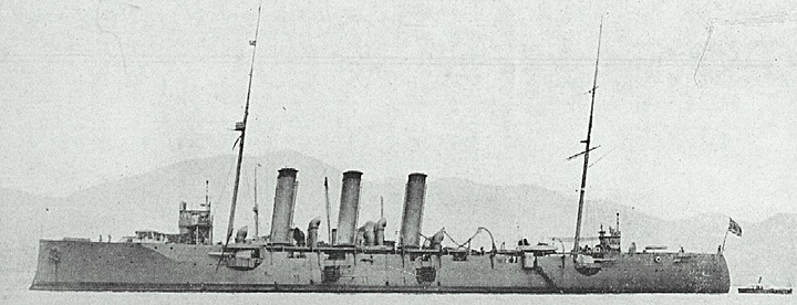
 The Niitaka (新高) was an protected cruiser of the Imperial Japanese Navy, designed and built in Japan by the Yokosuka Naval Yards. It was the sister ship of the Tsushima. The Niitaka is named after Mount Niitaka in Taiwan, at the time, the tallest mountain in the Japanese Empire.
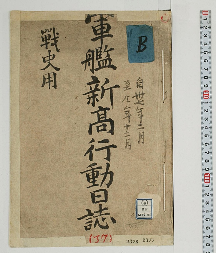
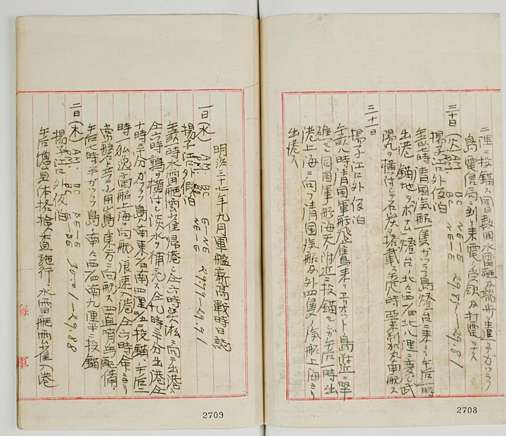
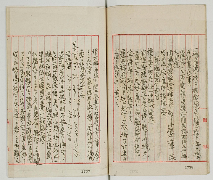
The Niitaka’s original records which are relevant from September 1904 (shown above and to the right) help to clarify some important facts about Korean involvement on Liancourt Rocks (Dokdo) prior to Japan’s annexation of the island months later. (click images) Note: Japanese text and pages numbers read right to left.
To: December 37th Year of Meiji (1904)
“Dropped anchor at 2 nautical miles. A torpedo boat and a little boat were repeatedly dispatched to Katchrahu Island on the same day to receive information at the telegraph office. The received information got transferred (transmitted)……”
Tuesday 30th AM BC NE – E 29.88 – 29-18
PM BC NE – E
“Anchored temporarily at the mouth of the Yangja River. At 7:00 A.M. a Chinese ship arrived at the lighthouse on Katchrahu Island. At 1:00 P.M. we weighed anchor. Cast anchor one quarter North-Northwest off the lighthouse on Bonamu Island. Later changed to North 8 nautical miles. We loaded coal from the ship Buyomaru (ship’s name) alongside. At 8:00 P.M. an American ship came to our port and went southbound…”
31st
“Anchored temporarily at the mouth of the Yangja River. At 8:00 A.M. the Bitojo (thought to be a Chinese ship) got stranded on the rocks at Aeriotdo Island. We moored near another Chinese ship at departed at 1:00 P.M. A Chinese ship bound for Shanghai and with four others….”
Page 2
The Log of the Warship Niitaka, September 37th Year of Meiji
Wednesday September 1st A.M. BC E – NE 29.99 – 29-91
P.M. BC NE – E
“Moored temporarily off the mouth of the Yangja River. At 1:00 the torpedo boat ” Unjak” returned home. At 6:00 A.M. it sailed off for Osong in Shanghai. At 6:00 A.M. we were supplied with water from the “Uzura” alongside. Weighed anchor at 9:30 A.M. At 10:30 A.M. and cast anchor a quarter southeast, 2 fifths south 4 nautical miles off Katshrahu Island. At 2:00 P.M. a German merchant ship sailed for Shanghai and arrived at Rangsok. At 6 P.M. carrying out our instructions, we sailed off toward the East of Soyongsando with Sangban. At 7:30 P.M. moored at the position of 9 nautical miles south a fourth south-southwest of Katchrahu Island….”
Thursday September 2nd A.M. BC SE – E 30.01 – 29.88
P.M. BC E SE
“Moored temporarily off the mouth of the Yangja River. In the afternoon the whole crew underwent a physical examination. The torpedo boat “Unjak” entered port…(continued)
“Part of the crew were dispatched. At 5:10 P.M. we received a telegram as left. The wireless telegraph and the Tokawamaru (ship) telegraph. There was a report that the repair of the fleet Urajjyo Stoku got completed. The completion of the restoration of the Okinawa Maru requires urgency. Development of the progress is required. The commander of the Second Fleet continued to receive information (Okinawa Maru telegraph). We received a report that the Urajiyo Stoku Fleet leaves the dock on the night of the 21st, discontinue the work on the Okinawa Maru and return to Ojaki. The Commander of the Second Fleet. The telegraph above is reported as left. The emergency welding is to be done in an hour, and after the completion went South along the coast at the rate of 12 nautical miles…..” (continued)
Page 4
“Thus we took in the dispatched from the Okinawa Maru and accelerated the repair. At 8:30 P.M. the complete junction was done. At 9:20 P.M. we sailed off returning to Matsushima guiding the Okinawa Maru…”
Monday September 25th A.M. BC NE – NNE 2 – 4 30.24 – 30.17
P.M BC NNW – N 1 – 4
The postion at noon 34 – 54 ON 129 – 17 – 15E
“At 11:00 A.M. we departed from the Okinawa Maru at Busan Harbour and increased speed to arrive in Takeshiki Port at 3:00 P.M. and cast anchor 2 ryun (1 ryun = 182.88M) West of three fourths north-northwest of Kanaega islet. At 5:00 P.M. the Okinawa Maru entered dock and loaded coal. the 12th Fleet Sadoku Maru departed. The 18th Fleet arrived…..”
Page 5
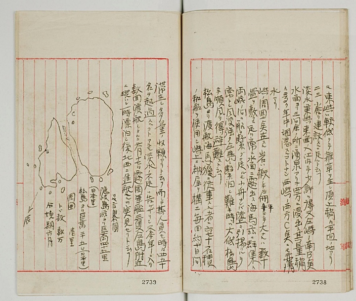
“The East Islet, however, is relatively low with weeds , and the top of it is flat. It is suitable to have two or three buildings built on it. A small quantity of salt water runs out at the East mouth of the East islet. Ground water flows out in all directions from 5.4 meters below the surface at South of the East islet marked “B”. (see attached map on page 7 above) It is quite a large amount and never dries up year round. There is clear water (fresh water) at the West end of the West islet marked “C” (see attached map page 7 above) as well. The scattered rocks around the islet are flat, and the large ones are so wide that they could have dozens of tattami (Japanese floor mats) on top. They stand above the surface all of the time. There are also a number of sea lions here. Boats can connect the two islets, and a small boat can be pulled up onto the shore. There are always strong winds blowing, and when strong winds are blowing fishermen usually return to Matsushima (Ulleungdo Island) . It is said that they made a voyage from Matsushima (Ulleungdo Island), climb up the island and built a hut with sea lion hunters by using a Japanese boat with a capacity of 60~70 stones. They stay there ten days on each trip…”
Page 6
“and they caught many fish. There are some times when the number of people exceeded forty or fifty. He says that he has made several voyages across to the island within this year due to lack of water. And on the date of June 17th he observed in person , three Russian warships appear near the island, wander about for a while, and then sail off toward the northwest…”
A Sketch of Liancourt Rocks (Dokdo)
45 Japanese ri from Oki Island
25 Japanese ri from Matsushima (Ulleungdo)
1 ri in circumference
Number of sea lions: Tens of thousands.
Breeding season: June.
Page 7
Map of Liancourt through binoculars see from the southeast watch tower on Matsushima (Ulleungdo)
Monday September 26th A.M. BC N 0 – 1 30.27 – 30.12
P.M. BC NE 1
“Anchored at Takeshiki. In the morning the Chihaya and the Takachi departed for Ojaki. The ships O- and Ko- and Naniwa arrived. In the afternoon they departed including the ship “Ko-4″. The ship Aechiko Maru arrived….”
Tuesday September 27th A.M BC N 0 -1 30.11 – 30.07
P.M. BC N 3 -4
“Anchored at Takeshiki. In the morning the Naniwa departed for Ojaki. In the afternoon the Aechiko Maru departed. The 17th Fleet arrived.”
Wenesday September 28th A.M. BC – BCR N – NE – 1 30.18 – 30.06
P.M. B – BC NE 3 – 4
Noon. Position 34 – 33 – ON 129 – 16 – 45 E
“At 6:00 the ship Tsushima and the 11th Fleet departed. At 7:00 A.M. the ships Ho-Ten Maru and O-60 arrived. At 10:00 A.M. we departed. We sailed off for Matsushima (Ulleungdo) with 13 technicians from the Ministry of Communications on board with the mission of completing the telegraph wire installation on Matsushima (Ulleungdo)…”
“Speed (?) Ten nautical miles. At 11:00 A.M. the ship Chihaya was met by a watch guard on duty watch while returning…”
Thursday September 29th A.M. D- BC NE 1 30.90 – 3018
P.M B – BC SSW – W 1
“Temporarily anchored off Matsushima (Ulleungdo)
At 6:30 A.M. temporarily moored at the position of 17 meters in depth, one nautical mile East, one quarter northeast to the south of Si-Ru-su Island . And we immediately started with the land wire construction (on Ulleungdo). At 11:30 the work discontinued. The workers returned to the ship. Around 4:30 it was permitted to walk on land. That night we had guards on patrol…”
Friday September 30th A.M. BC SW – SSW 2 – 3 30.20 – 30.17
P.M BC SE – SSE 2 – 3
“Temporarily anchored near Jukbyeon Harbor (Korea). At 1:12 A.M. weighed anchor, sailed off to Jukbyeon Harbor. At 7:42 dropped anchor at about 7 ryeon (1.3kms) South, five-eighths southwest of Ryu-Shu Hill of Jukbyeon Harbor.
Page 10
At 11:30 the land wire construction completed, hense we weighed anchor. Approached near the hill and stored underwater wires on land, retrieved the Oki Maru’s buoys returned at 3:42 P.M and departed for Ojaki.
First the September 25th 1904 log entry states “Japanese call Liancourt Rocks Yangkodo while the Koreans call it Dokdo…..” This entry confirms some facts. First, it confirms Korean historians’ assertions that the Korean residents of Ulleungdo were both cognizant of Dokdo and active economically (fishing) on the island. Even those Japanese who were involved in fishing and sealing did so using Korea’s Ulleungdo Island as a base. Thus we know Ulleungdo’s (and thus Korea’s) territorial bond to Dokdo at this time was much stronger than that of Japan’s despite the nationality of some of these fishermen.
These facts considered, Japan’s statement that in 1905 Liancourt Rocks (Dokdo) were “terra nullius” or “no-man’s land” are simply not true. In fact, when we refer to the above document, Ulleungdo’s (Korea’s) territorial bond to Dokdo was stronger than that of Japan’s prior to their annexation of the island in 1905. As mentioned the Japanese who fished and hunted seals on Dokdo were based on Ulleungdo.
Another important quote from the Niitaka’s logbook describes both the topography of Dokdo and how this could best suit the needs of the Japanese Imperial Navy. It quotes “The top of the East Islet is flat and suitable for constructing two or three buildings on it…” Obviously these buildings would refer to military facilities. This quote foreshadows the Tsushima’s survey in November that was explicitly undertaken for constructing watchtowers and radio transmitting facilities.
The records on the next page are from the Japanese Imperial Battle Cruiser Tsushima. They are irrefutable evidence of the Japanese Imperial Navy’s military agenda for Dokdo. It would take about a year from the time of conception to completion before Japan’s dream of turning Liancourt Rocks into a functional military observation outpost would be realized.