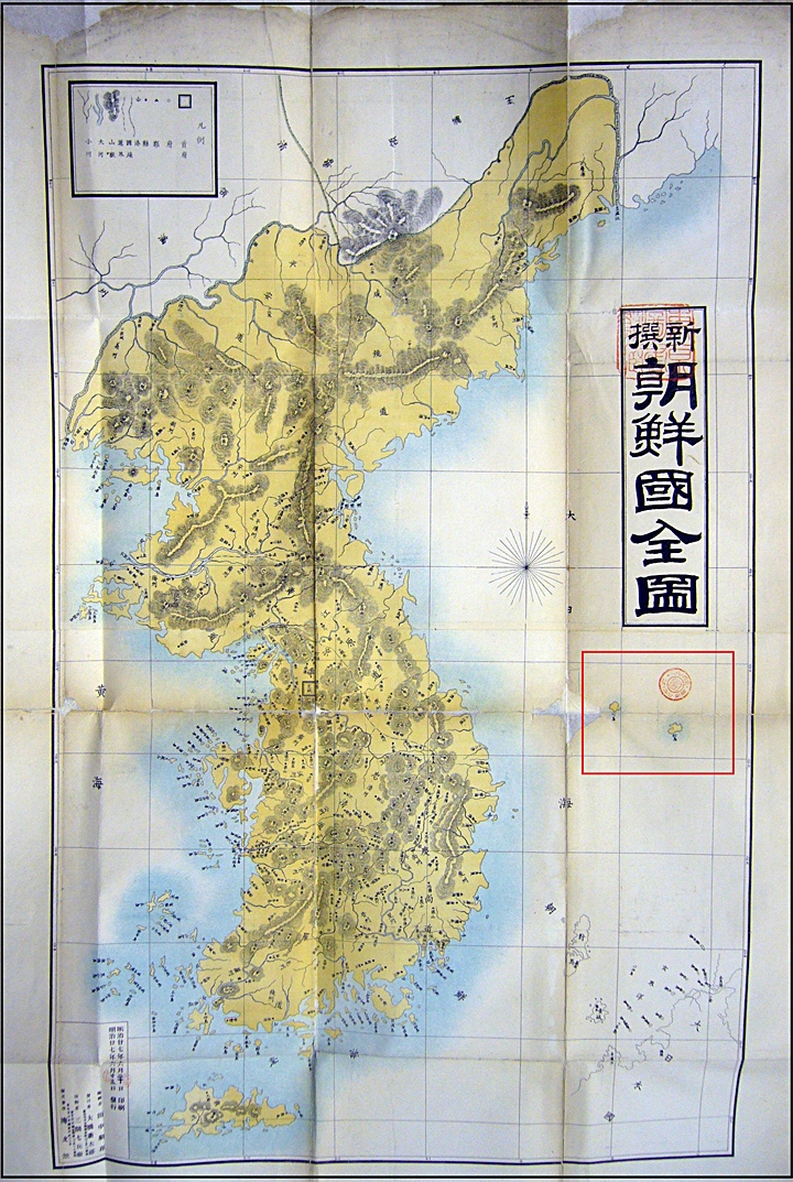
 On February 22, 2008 (Shimane Prefecture Takeshima Day) Japanese Professor Hosaka Yuji (shown right) held a press conference to unveil some newly uncovered maps of Korea from the 19th Century.
It has been long known Japanese maps consistently excluded Matsushima (Dokdo) from Japan’s territory. However, over the last few years more maps have surfaced that go a step further and show Takeshima (Ulleungdo) and Matsushima (Dokdo) as Korean territory. These maps strongly support Korea’s claim to the island.
 Professor Hosaka Yuji was born in Tokyo, Japan and graduated from Tokyo University in 1979. He moved to Seoul to research relations between South Korea and Japan in 1988. Professor Hosaka Obtained his M.A. and Ph. D. at the Department of Political Science and International Relations of Korea University.
After residing in South Korea for 15 years, he became a naturalized South Korean in 2003. Professor Hosaka received the Minister of Foreign Affairs and Trade Award in 2005. He is currently, a professor of the College of Liberal Arts at Sejong University (Japanology). He has written various papers on the history of South Korea-Japan relations, territorial rights over Dokdo, the issue of history textbooks, worshipping at the Yasukuni Shrine, the Korean wave, Japan’s rightist ideology, and other topics.
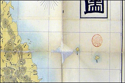
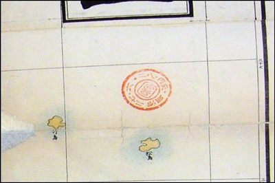
The 1894 map to the left shows accurate location of both Ulleungdo (marked Takeshima 竹島) and Dokdo (marked as Matsushima 松島) To the right, the outline of Japan’s coast and Tsushima Island for reference are outlined a little too far East. However, upon closer examination it’s clear they are colored the same yellow as the Korean peninsula and thus part of then Chosun. As with all Japanese national maps of Korea and Japan the forms of Ulleungdo and Dokdo are rough and inaccurate. The two maps below are close up images of Ulleungdo and Dokdo from the 1894 chart. (click to enlarge)


