Dokdo Island is Incorporated Into Uldo County, October 25th 1900
In 1882 the Chosun Government began filing strong protests with the Japanese Foreign Ministry against Japanese intrusion into and felling of trees on Ulleungdo Island and demanded that an immediate end be put to such illegal acts. In March 1883 the government appointed Kim Ok-kyun as the Commissioner for Development of this region and set about developing and resettling the Ulleungdo area thus abandoning the vacant island policy.
As Japanese encroachment and logging had become a serious problem in October 1897 the Korean government sent an investigation team headed by Yu Yong-jeong and he found about 70 Japanese intruders there while the head of the island could do nothing without any troops to enforce the law.
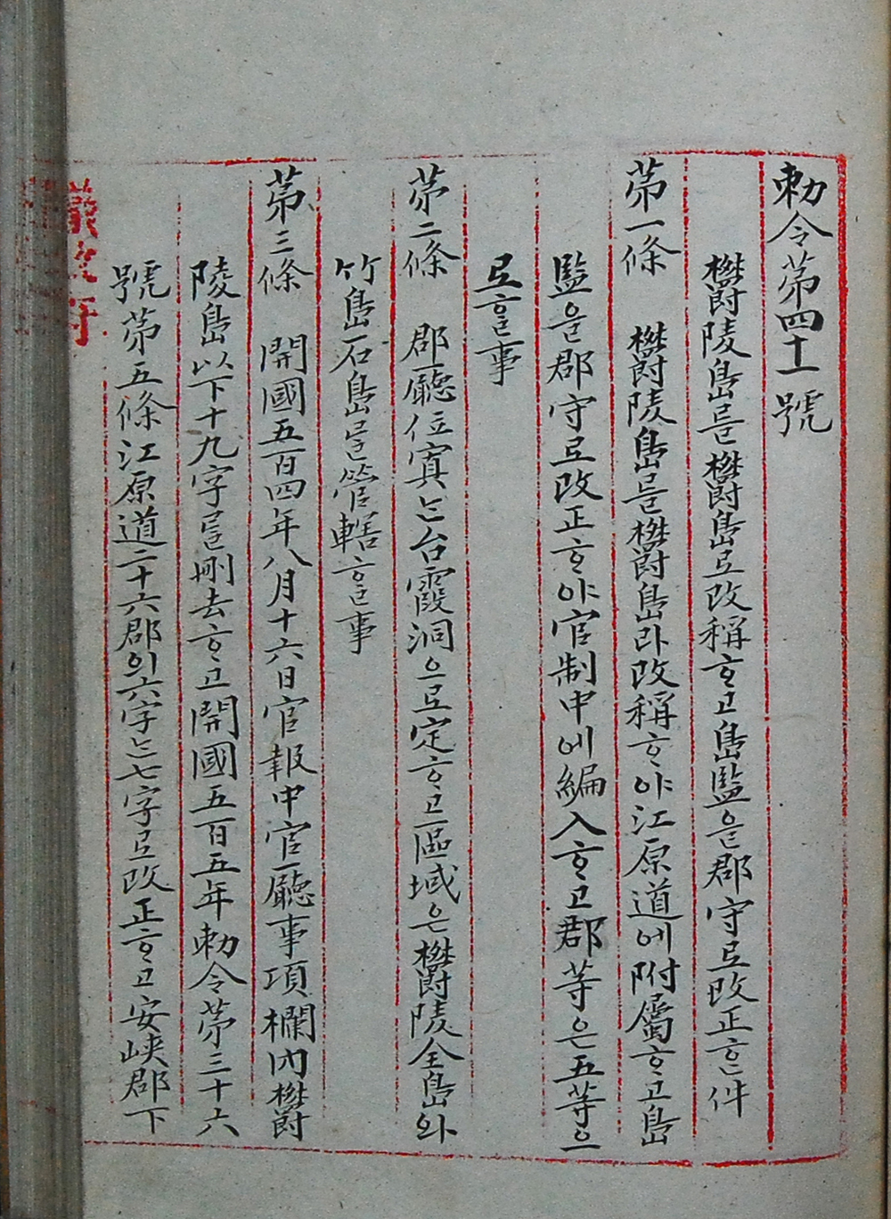
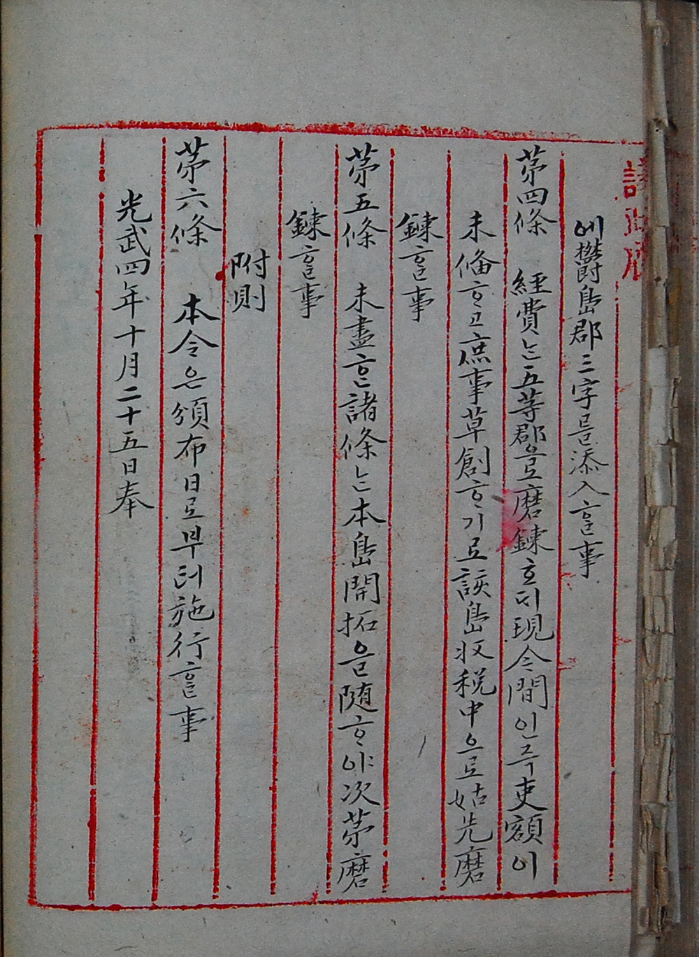
Above: Images of Chosun’s Ordinance 41 in which Dokdo (石島) was incorporated into Uldo County.
To cope with the situation, the government promulgated Imperial Ordinance No 41. on October 25 1900 which renamed Ulleungdo Uldo and upgraded the office of the head to Gunsu (county magistrate). Article II of the ordinance designated Taehadong as Gun office venue and defined the jurisdiction of the Uldo County magistrate extending over the whole of Ulleungdo, Chukdo and Sokdo. Chukdo refers to Chuksodo and rocky islet about 2.2 kms from Ulleungdo and Sokdo refers to Dokdo Island.
“How did the name Sokdo come to represent Dokdo Island..?”
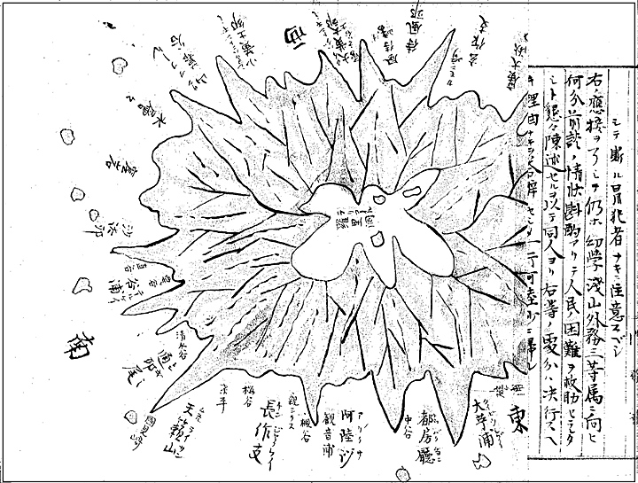
In the year 1882 King Kojong appointed a special investigator to Ulleungdo named Lee Kyuwon in preparation for development of the island. His job involved mapping the island, finding special indigenous valuable products, investigating Japanese trespassing and illegal logging and doing a detailed census of the inhabitants.
After surveying the demographics of the Ulleungdo island he found 140 of the residents were Korean. 115 of them (82%) were from various parts of Ho-nam (Chollado). 14 residents (10%) were from Kangwando, 10 of them (7%) came from Kyeongsangdo and one from Kyeonggido. The Japanese numbered 78.
In Korean the word for rock is “dol”. The Hanja character for rock (“dol”) is “石” In standard Korean this character can be pronounced as either “dol” or “seok”. As mentioned most of the residents (82%) were from Chollado. In their dialect, the word “dol” is often pronounced as “dok”. It is said the names Seokdo and Dokdo were used interchangeably by the residents of Ulleungdo. Below is a chart showing some actual examples of the character “石” being pronounced as “Dok” in some areas of Chollanamdo Korea to this very day.
Examples of the Character “石” pronounced as “Dok”
① Dok-gol 石洞 : a village in Boseong-Gun, Mundeok-Myeon, Unpo-Ri
② Dok-gol 石谷 : a village in Boseong-Gun, Mundeok-Myeon, Unpo-Ri
③ Doldokgeori 擧石里 : a village in Boseong-Gun, Nodong-Myeon, Geoseok-Ri
④ Doksalmae 石山里 : a village in Shinan-Gun, Anjoa-Myeon, Hyangmok-Ri
⑤ Doksan 石山洞 : a bridge in Shinan-Gun, Jido-Myeon, Seondo-Ri
⑥ Dokmae 石山里 : a village in Muan-Gun, Samhyang-Myeon, Wongsan-Ri
⑦ Doksalmae 石山 : a village in Shinan-Gun, Anjoa-Myeon, Daewoo-Ri
⑧ Dolgogae 石峴 : a hill in Weondo-Gun, Gogeum-Myeon, Gagyo-Ri
⑨ Dokbaegi 石峙洞 : a village in Gangjin-Gun, Doam-Myeon, Yonghwa-Ri
⑩ Dokbaegi 石田平 : a field in Boseong-Gun, Hwaecheon-Myeon, Gunpung-Ri
⑪ Dokteumi 石間洞 : a field at Gangjin-Gun Gundong-Myeon, Seokgyo-Ri
⑫ Dokdari 石橋里 : a bridge at Haenam- Gun, Munnae-Myeon, Seokgyo-Ri
⑬ Dokdarigol 石橋里 : a stone bridge at Jindo-Gun, Imhwae-Myeon, Bukgyo-Ri
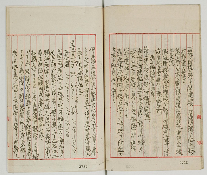
Shortly after the character 石 was no longer used to denote the sound “dok” but rather the standard Korean Hanja character “獨”. This character usage and the name Dokdo was confirmed by Japanese records such as the Niitaka’s log books in 1904 prior to the Japanese annexation of Dokdo and during Ulleungdo Governor Shim Heung Taek’s objections of the Japanese annexation of Dokdo.
The image on the right is from the southern coast of an old Korean map. As shown, the same character for rock was used to name the rocky islet off of the coast of Korea.
The map was drawn in 1682 and shows how Koreans describes this islet as a “Seok-do” or “Rock Island” Dokdo Island was often referred to as a “Rock Island” or “石島” in some records around 1900.
Dokdo Island was described as a Seok-do (岩島) or “Rock Island.”
The Diary of Nakai Yozaburo
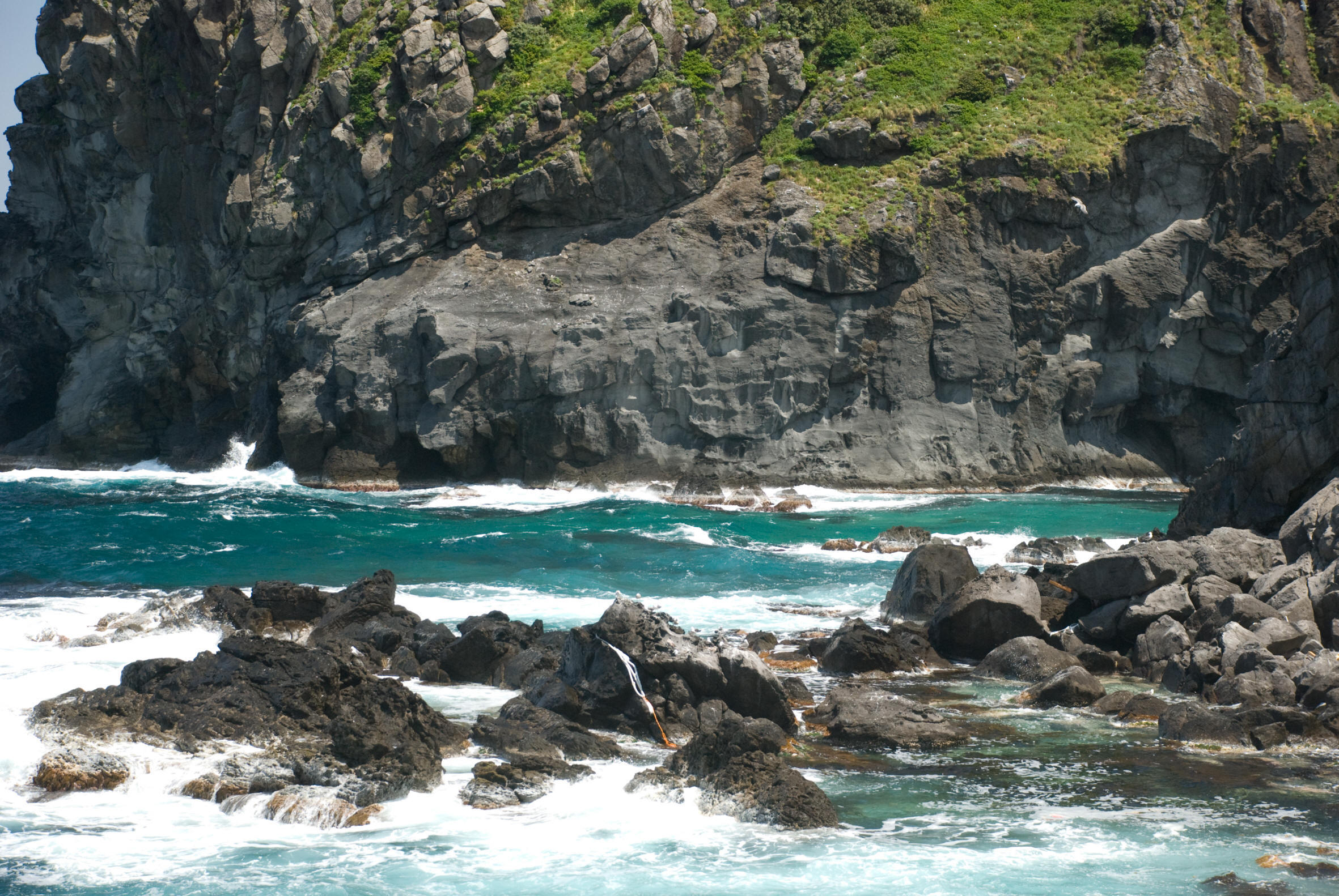
When studying related historical documents there can be found a couple of historical records that show those who lived on Ulleungdo Island described Dokdo as a “rock island” 岩島 . Note: The character 岩 is used in the same manner as 石 meaning “rock”. Both records are Japanese one from the Nakai Yozaburo’s application to lease Liancourt Rocks (Dokdo) and the other from the logbooks of the Japanese warship Niitaka.
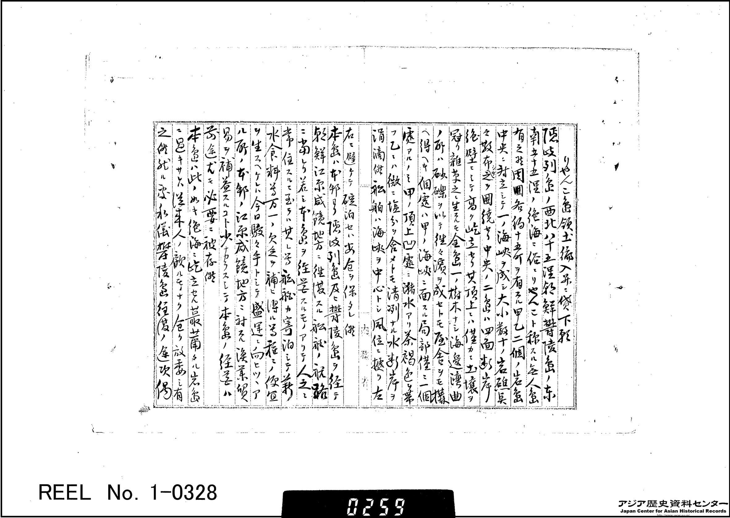
“..In the distant sea eighty-five ri to the west of Oki and fifty-five ri southeast of Joseon’s Ulleungdo is an uninhabited island called “Ryanko-to.” It is comprised of two rocky islets, Islet A and Islet B (甲乙), each with a circumference of about fifteen cho. The two islets face each other and there is a channel between them and forty to fifty reefs around them. The two central islets have steep cliffs on four sides and are rising toward the sky. There is little soil on top and only weeds. There are no trees on whole islands…”
“..This island is only a rock island rising into the sky in the distant sea, so no one pays attention to it and it has been left untouched. However, I land at the island whenever I was go to and from Ulleungdo and have seen lots of sea lions living there. I have thought that it was not good to leave it untouched, and have made various plans..”
“..The following is an account of Liancourt Rocks (Dokdo Island) from an actual observer while on Matsushima (Ulleungdo Island). Liancourt Rocks, Koreans call these rocks Dokdo while Japanese fishermen call then Riangko in short. As described in the attached paper, it consists of two rock islands. The West islet is about 400 feet in height, and too precipitous to climb..”
Above images: The two historical records of Dokdo describe the island as “岩島” or rock islets much in the same manner as Korea’s Ordinance 41 of 1900.
Could “石島” Have Been Another Island Near Ulleungdo?
Of course many Japanese dispute that the Seokdo mentioned in Ordinance 41 of 1900 is not Dokdo but rather one of the other neighboring islets surrounding Ulleungdo. There are only a few islands large enough to warrant inclusion on this document. Gwanmeundo Island (Do-hang) on Ulleungdo’s Northeast is the island some Japanese claim is the Seokdo of Oridinance 41. However, it is not possible Gwangmeundo is Dokdo for the following reasons.
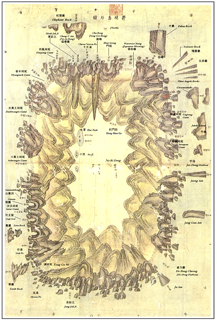
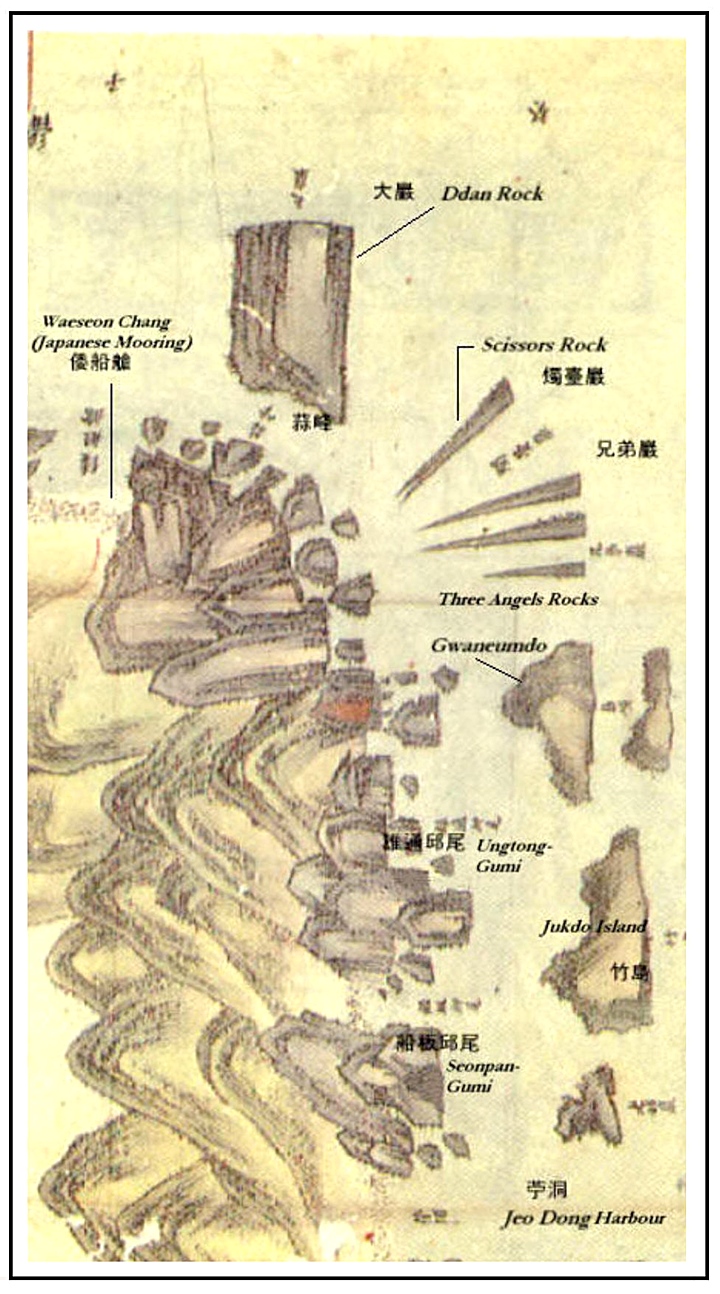
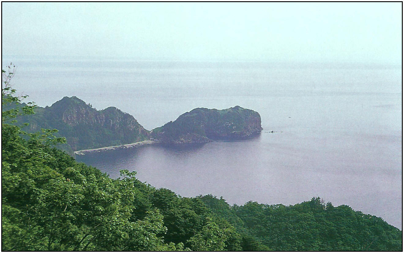
Gwaneumdo Island is more an outcropping of rock or point, than an island. In reality, there is only about 100 meters of water separating Gwaneumdo rock from Ulleungdo. Thus, this rock formation’s extremely close proximity to Ulleungdo’s shore and small size didn’t warrant Gwanmeudo being explicitly being mentioned as part of Uldo County’s territory. There are other notable islands surrounding Ulleungdo such as Hole Rock that were not mentioned on Ordinance 41 but also noteworthy. Leekyuwon’s map of Ulleungdo (below) didn’t show Gwaneumdo as any more significant as other neighbouring islands. The 1880 Japanese Warship Amagi survey map of Ulleungdo shows Gwaneumdo as not being an island at all but rather an extension of the main island.
Above: Lee Gyuwon’s survey map of Ulleungdo showed Jukdo Island marked as “竹島” and Gwaneumdo labeled as Do-Hang (島項) or island neck, not as Seokdo.
Above left: This image of Gwaneumdo shows the islet as an extension of Ulleungdo Island and not as an island at all. Above right: The narrow band of water between Ulleungdo Island and Gwaneumdo explains why the island was often considered as attached to Ulleungdo.
Above right: A Japanese map of Ulleungdo from 1883 showed Jukdo Islet also as “竹島” and Gwaneumdo labeled as Do-Hang (島項) or island neck, and also marked as Cape Gwaneum (觀音埼). There is no mention of Gwaneumdo being called “Seokdo”
The only plausible explanation remains, Seokdo of Ordinance 41 was Dokdo Island.
Historical records and maps show us the Koreans were using the name Dohang to refer to today’s Gwaneumdo around the year 1900. Earlier records from the 18th Century show Gwaneumdo was called Bang-Pae Do. The Japanese used both Dohang and Gwaneum-gi or Cape Gwaneum to refer to this area around the turn of the 20th Century. Thus it doesn’t seem likely the name Seok-do was used to refer to Gwaneumdo.
We do know that Koreans called Dokdo island by the same name because this was written in the logbooks of the Japanese Warship Niitaka in 1904. The name Dokdo was also used by Uldo Governor Shim Heung Taek when he contested the Dokdo’s annexation in 1906. (See link) Thus, Korea’s explanation that Seok-Do refers to Dokdo as a result of Chollanamdo dialect still seems to be the most plausible explanation for the name confusion. This position has been steadfastly maintained by Korea for over 70 years now.

 In 1882 the Chosun Government began filing strong protests with the Japanese Foreign Ministry against Japanese intrusion into and felling of trees on Ulleungdo Island and demanded that an immediate end be put to such illegal acts. In March 1883 the government appointed Kim Ok-kyun as the Commissioner for Development of this region and set about developing and resettling the Ulleungdo area thus abandoning the vacant island policy.
 Shortly after the character 石 was no longer used to denote the sound “dok” but rather the standard Korean Hanja character “獨”. This character usage and the name Dokdo was confirmed by Japanese records such as the Niitaka’s log books in 1904 prior to the Japanese annexation of Dokdo and during Ulleungdo Governor Shim Heung Taek’s objections of the Japanese annexation of Dokdo.