
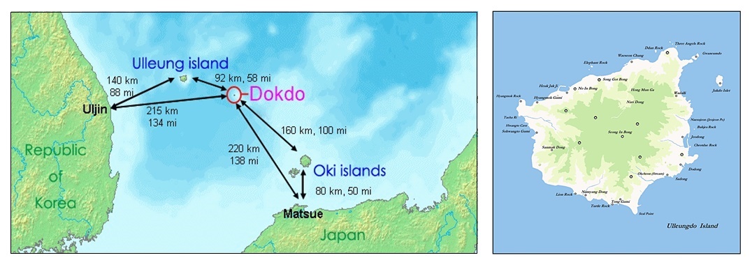
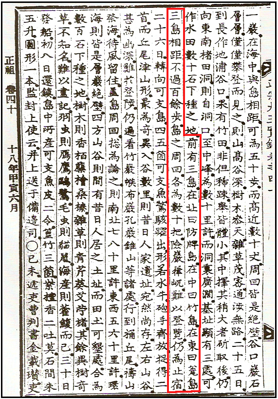
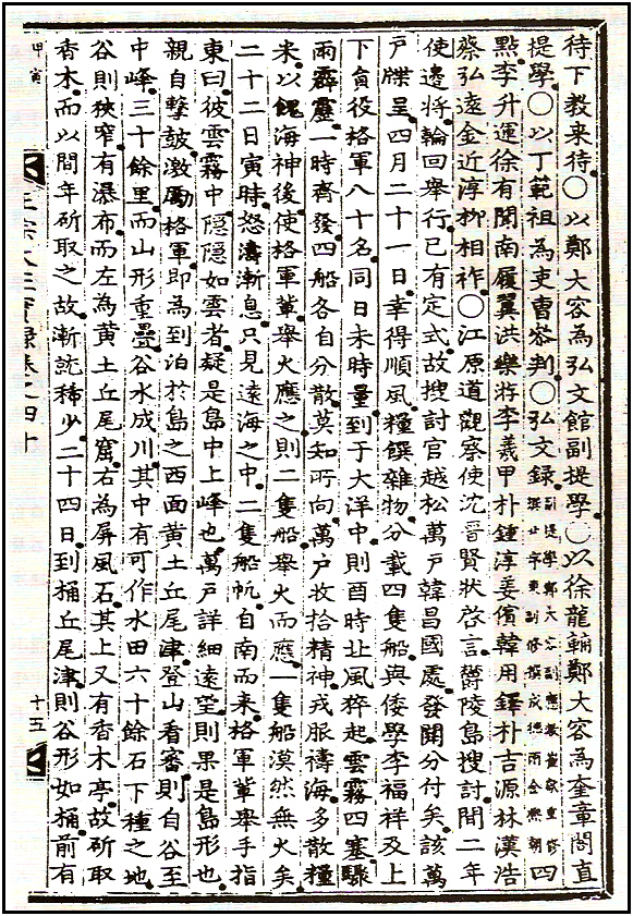
鬱陵島搜討, 間二年, 使邊將輪回擧行, 已有定式, 故搜討官越松萬戶韓昌國處, 發關分付矣。 該萬戶牒呈: “四月二十一日, 幸得順風, 糧饌雜物分, 載四隻船, 與倭學李福祥及上下員役、格軍八十名, 同日未時量, 到于大洋中, 則酉時, 北風猝起, 雲霧四塞, 驟雨霹靂, 一時齊發, 四船各自分散, 莫知所向。 萬戶收拾精神, 戎服禱海, 多散糧米, 以餽海神後, 使格軍輩, 擧火應之, 則二隻船擧火而應, 一隻船漠然無火矣。 二十二日寅時, 怒濤漸息, 只見遠海之中, 二隻船帆自南而來。 格軍輩擧手指東曰: ‘彼雲霧中隱隱如雲者, 疑是島中上峰也。’ 萬戶詳細遠望, 則果是島形也。 親自擊, 激勵格軍, 卽爲到泊於島之西面黃土丘尾津。 登山看審, 則自谷至中峰三十餘里, 而山形重疊, 谷水成川, 其中有可作水田六十餘石下種之地。 谷則狹窄, 有瀑布, 而左爲黃土丘尾窟, 右爲屛風石。 其上又有香木亭, 故斫取香木, 而以間年斫取之故, 漸就稀少。 二十四日到桶丘尾津, 則谷形如桶, 前有一巖在海中, 與島相距可爲五十步, 而高近數十丈, 周回皆是絶壁。 谷口巖石層層, 僅僅攀登而見之, 則山高谷深, 樹木參天, 雜草茂密, 通涉無路。 二十五日到長作地浦, 谷口果有竹田, 非但稀踈, 擧皆體小。 其中擇其稍大者斫取後, 仍向東南楮田洞, 則自洞口至中峰爲數十里許, 而洞裏廣闊基址, 顯有三處, 可作水田數十石下種之地。 前有三島, 在北曰防牌島, 在中曰竹島, 在東曰瓮島。 三島相距, 不過百餘步, 島之周回, 各爲數十把, 險巖嵂, 難以登覽, 仍爲止宿。 二十六日轉向可支島, 四五箇可支魚, 驚駭躍出, 形若水牛。 砲手齊放, 捉得二首, 而丘尾津山形, 最爲奇異, 入谷數里, 則昔日人家遺址, 宛然尙存。 左右山谷, 甚爲幽深, 難於登陟。 仍遍看竹巖、帿布巖、孔巖、錐山等諸處, 行到桶丘尾, 禱山祭海, 待風留住。 蓋島周回, 摠爲論之, 則南北七八十里許, 東西五六十里許。 環海則皆是層巖絶壁, 四方山谷, 則間有昔日人居之土址, 而田土可墾處, 合爲數百石下種之地。 樹木則香、栢、蘗、檜、桑、榛, 雜草則靑芹、葵、艾、苧、楮。 其餘異樹奇草, 不知名, 難以盡記。 羽蟲則雁、鷹、鷗、鷺, 毛蟲則貓、鼠, 海産則藿、鰒而已。 三十日發船, 初八日還鎭。 島中所産可支魚皮二令、篁竹三箇、紫檀香二吐莫、石間朱五升、圖形一本, 監封上使” 云。 幷上送于備邊司
 The Gangwando Inspector Shim Jih-Hyeon reports as follows:
“..According to the rule that officials declare turns taken to make biannual tour of Ulleungdo, an official letter was sent to Han Jang Guk to inform him of his duty. The following is the records of the inspection tour.
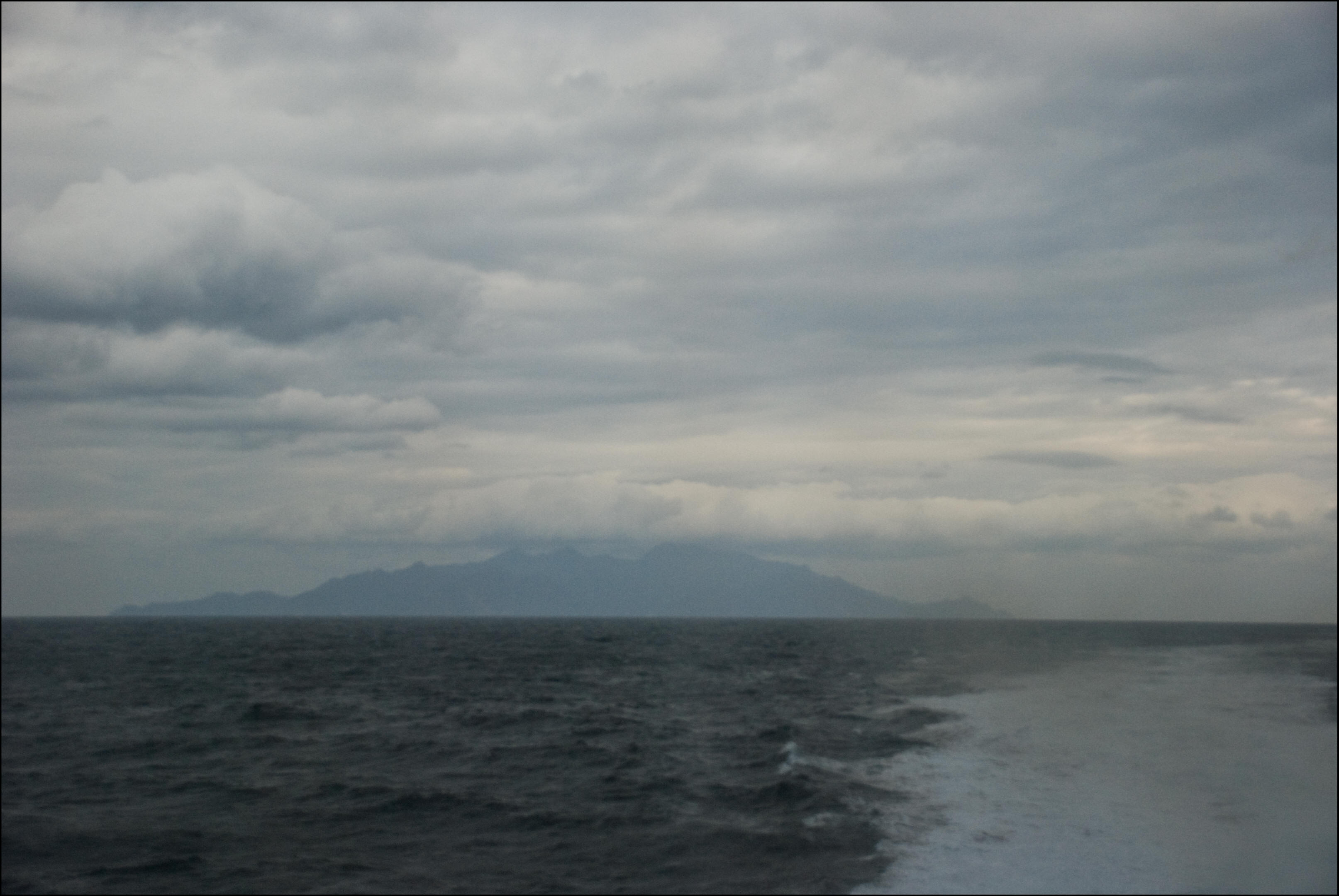
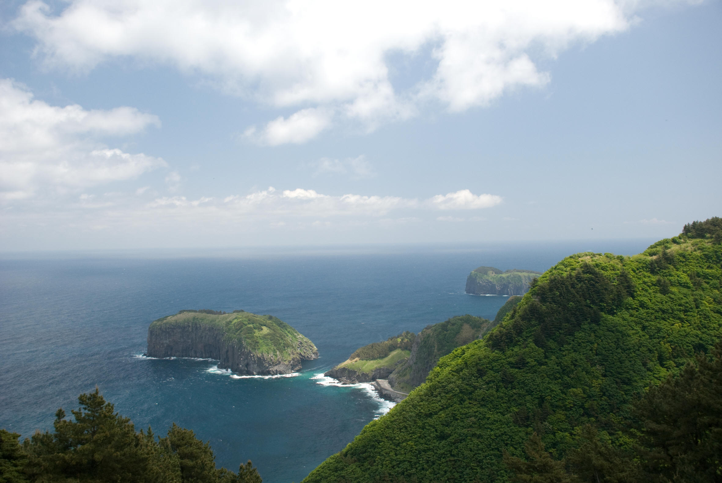
“On the early afternoon of April 21st we departed with a group of 80 people and provisions in four separate ships. In the beginning the weather was pleasant, but later by the early evening came a storm with thick fog and heavy rain. All of a sudden the four ships went in different directions from each other until we lost visual contact with each other. Amid this, (title) keeping his composure, put on his uniform to pray to the ocean before dumping a lot of food to feed the ocean god. Afterwards he told some (title) to hold up torches for a signal, and two other ships responded with their torches but the other ship’s was not to be seen. Between three and five on the morning of the 22nd as the high waves abated, far away in the South, were observed two boats with their sails up coming toward us when some (…), pointing to the East said “That thing looking like some cloud through the fog over there is probably a high peak of a mountain on an island..” (Above right: An image of Ulleungdo as Inspector Han would have seen, from 30kms – continued)
 “..Hearing this, (…) looked carefully and concluded it was a shape of an island (…) himself was beating the drum in person to encourage (..) and soon leading them to the West of this island, where the boats got moored. Checking around from the top of the mountain, there was a stream between the valley and the middle peak, about 30 ri, with its overlapping geography. And in this area were about sixty tracts of rice paddies along with the narrow gully and a waterfall.
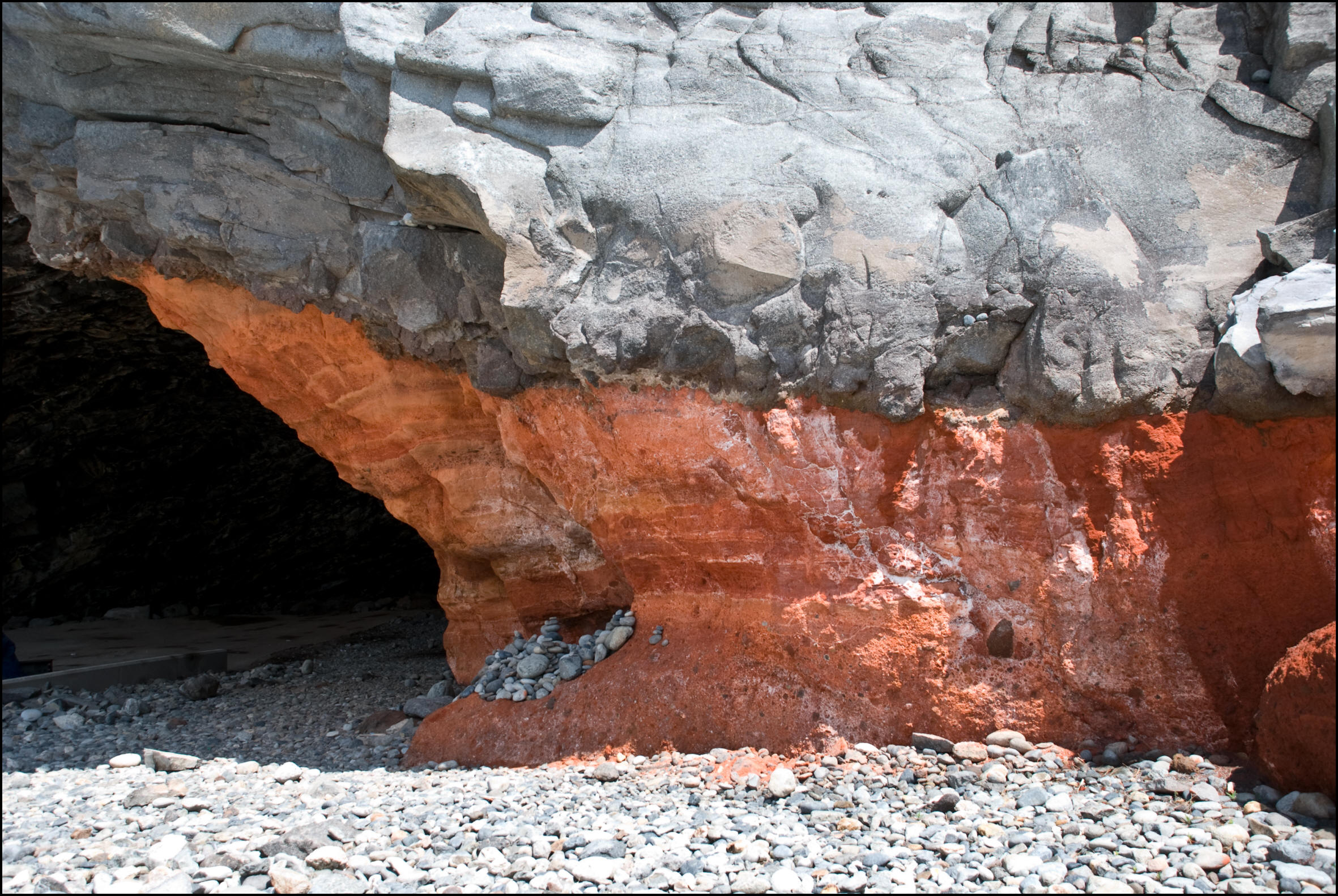
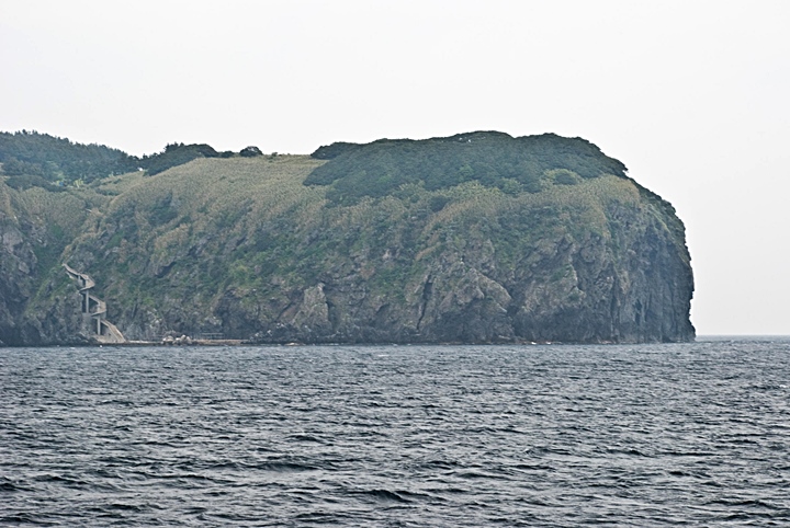
To the left was Hweong-tu-gu-mi-gol, to the right was Byeong-Pung-Seok, and to the North Hyang-Mok-Jeong, where the aromatic trees were scarce because they had been cut down every second year. On the 24th upon arriving at Tong-gu-mi-jin, the way the valley lay looked like a log, and ahead of it was a rock. From that rock in the sea to the island was about 50 paces (bo) away. The rock was very high with cliffs all around. At the entrance of the valley there were layers of rocks. We managed to climb up there to find that it was a high mountain with a deep ravine. The trees were soaring to the sky and the weeds were so thick it was hard to get through…” (Above: The red clay cave of Hwangto Gumi, where Han Chang Guk landed. -continued)

 “…On the 25th arriving at the entrance to the valley of Jang-jak-ji-po there was a bamboo field. The bamboo plants were sparsely scattered and most of them were quite short. After cutting the larger of them, we headed toward the southeast for Jeo-Jeong-Dong.
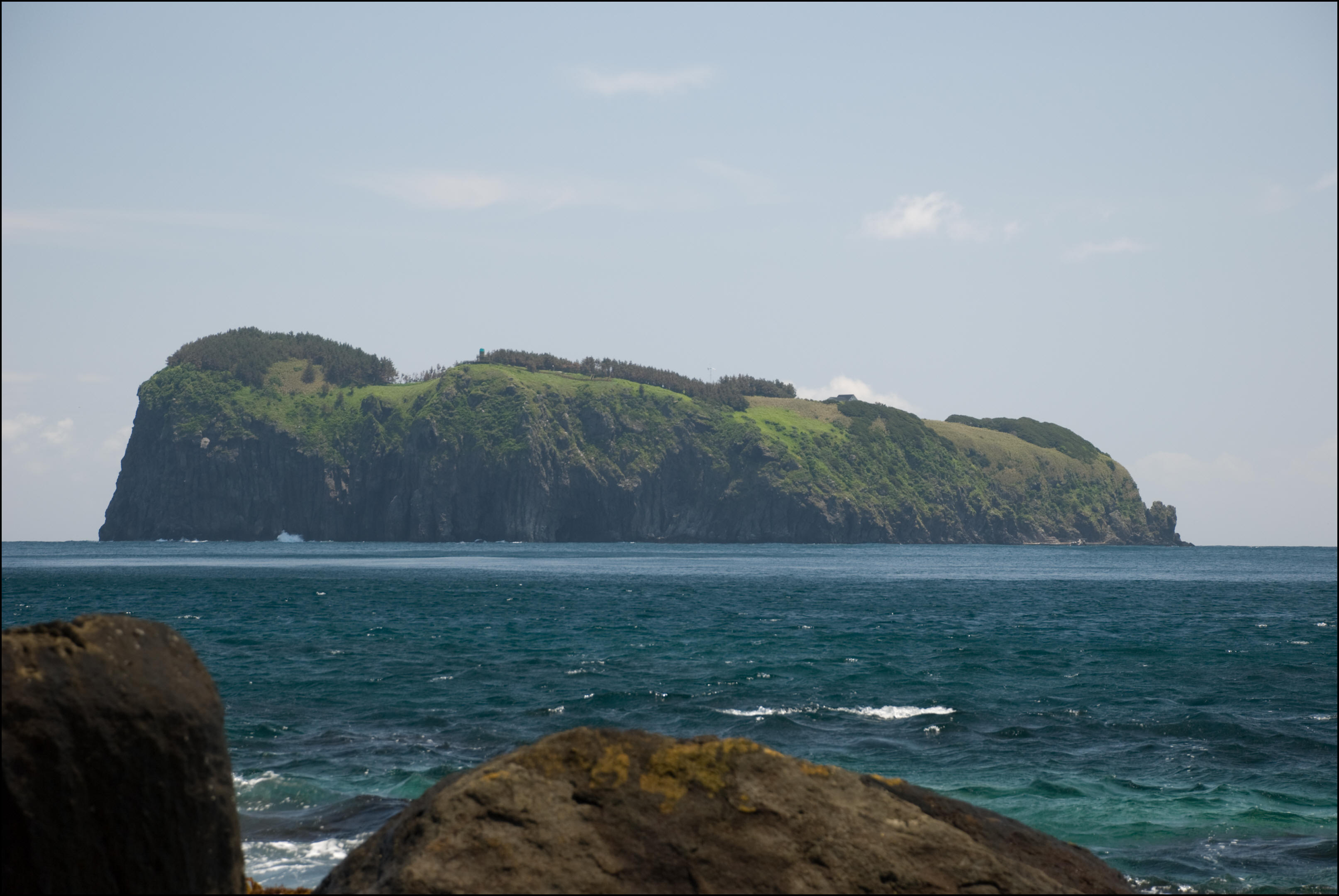
From the bottom of the valley to the middle peak, which was tens of ri, lay three spacious lots which were utilized as dozens of rice fields. And to the front are three islands, Bang-Pae Do in the North, Jukdo in the middle and Ongdo in the East. The distance between these is only 100 paces each and the circumference of them is tens of pa each. However, these rocks were jagged and steep and looked very difficult to climb…” (On the right is a picture of Jukdo Island from Ulleungdo’s Seom-mok. Han Chang Guk referred to the islet as Jukdo, not Usando – continued.)
 After spending the night there, on the following day, 26th, we went to Ga-ji-do where four or five sealions jumped out of the water in surprise. They looked like rhinos (musso) and two of them were killed by firing many shots at a time. The geographical features of Gu-mi-jin were most unusual, and about 10 ri into the valley still vividly remained the site of an old village. The mountains on both sides of the deep ravine remained were too steep to go up.
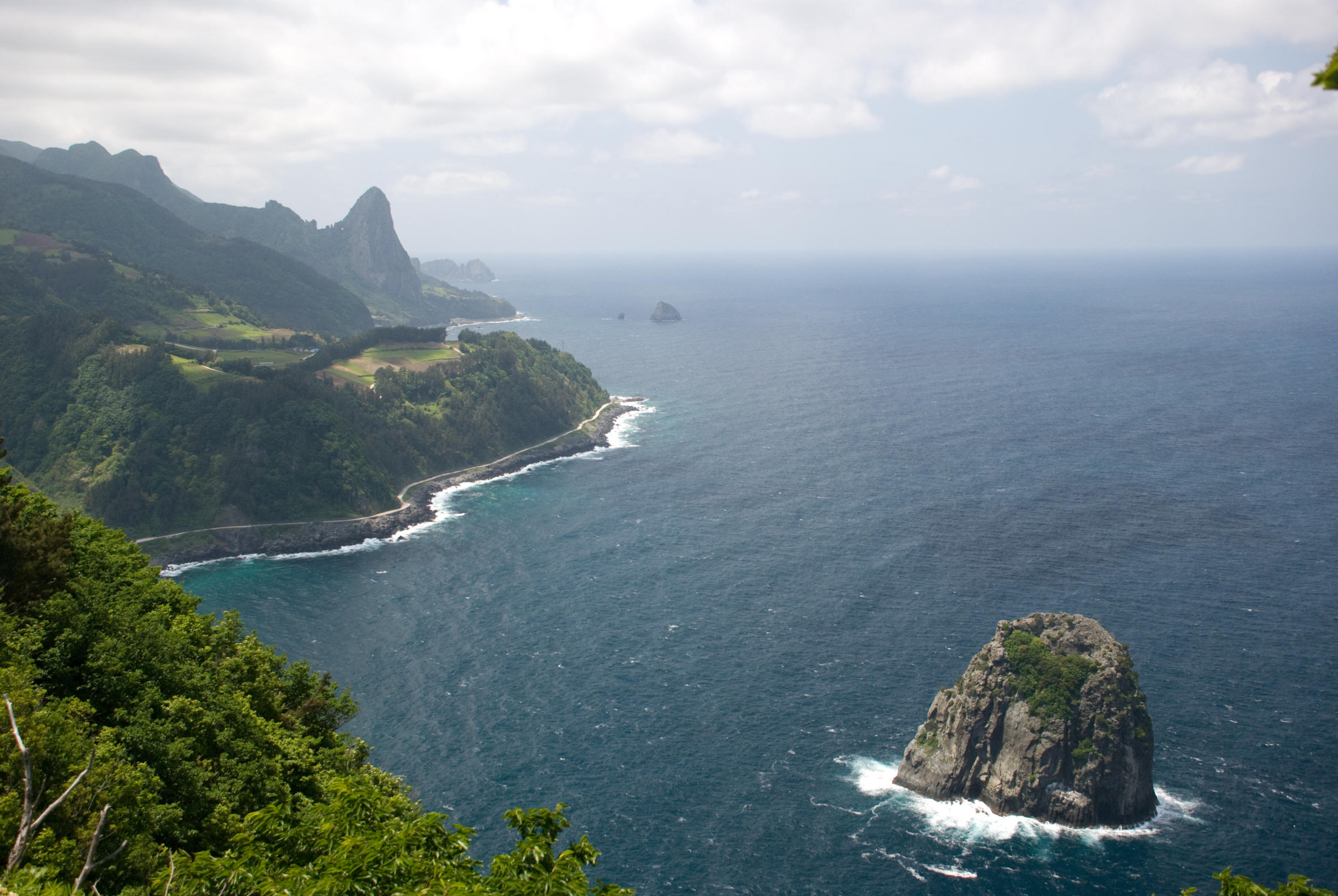
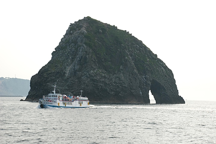
Next, me made an inspection tour of Juk-am, Hu-po-am, Kong-am, Jeuk-san etc,. and headed for Tong-Gu-mi where we waited for the winds to let up. The overall measurements around Ulleungdo Island are about 70 to 80 ri North to South, and about 50 to 60 ri East to West and all around it are piles of (layers of) precipices (steep rocky cliffs). There are old housing sites and lots that could be cultivated into that total about a couple of hundred…” (Left: A close-up picture of spectacular Hole Rock (Elephant Rock) as Inspector Han would have seen it – continued.)
Leaving on the 30th on a boat, the group returned home on the 8th of the following month, bringing back two sea-lion skins, three hweong-juks two pieces of rosewood seok-gak-ju and 5 twae and a map to the king….”
Next, this report is one of two inspections of Ulleungdo that clearly give the names of Ulleungdo’s surrounding islets. In all probability Bang-pae-do is what is called Gwaneumdo Island on the northwest corner of Ulleungdo. The island of Jukdo that some Japanese assert is Usando is simply called Jukdo Islet. This concurs with another report made by Leekyuwon in 1880 that also mapped and stated the name of this rock was Jukdo Islet and not Usando. The last island’s identity is unclear.

The last part of this document gives a brief explanation as to how they measured Ulleungdo. It seems that Korean surveyors measured around the island giving the values as a circumference. This method of measurement makes sense in that historical Korean documents describe Ulleungdo as 100ri (Sabang-baek-ri). Thus is could be that the island’s dimensions were measured as they sailed around the island in all four directions of the compass and then added up the values to arrive at Ulleundo’s area.