
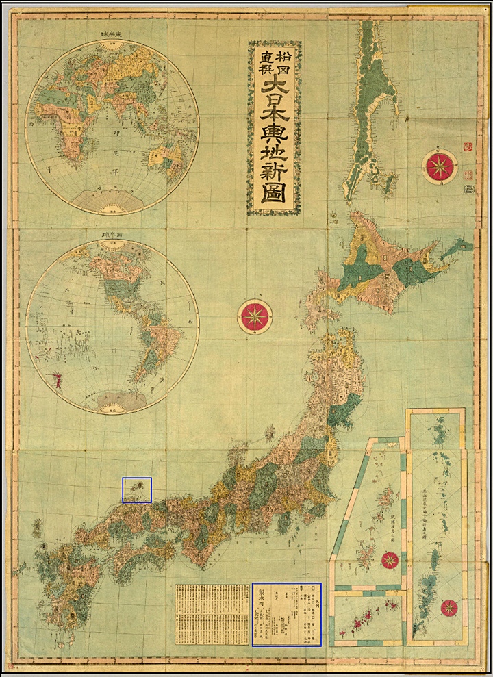
Old Japanese Maps of Korea, the East Sea and Japan Show Japan’s Historical Territorial Limits
“If Dokdo was an inherent part of the nation of Japan as her MOFA insists, why do historical Japanese maps consistently exclude Dokdo Island..?”
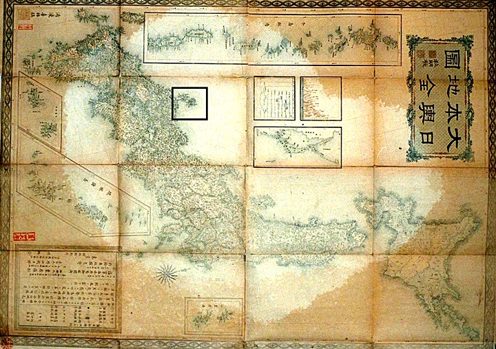
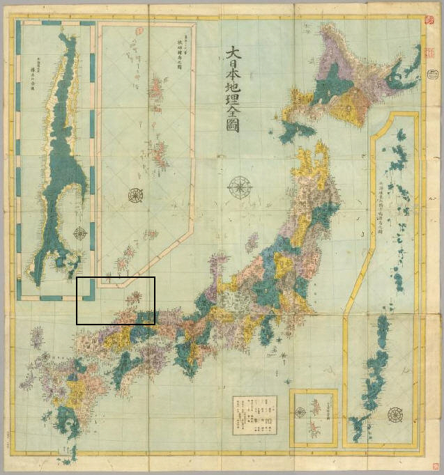
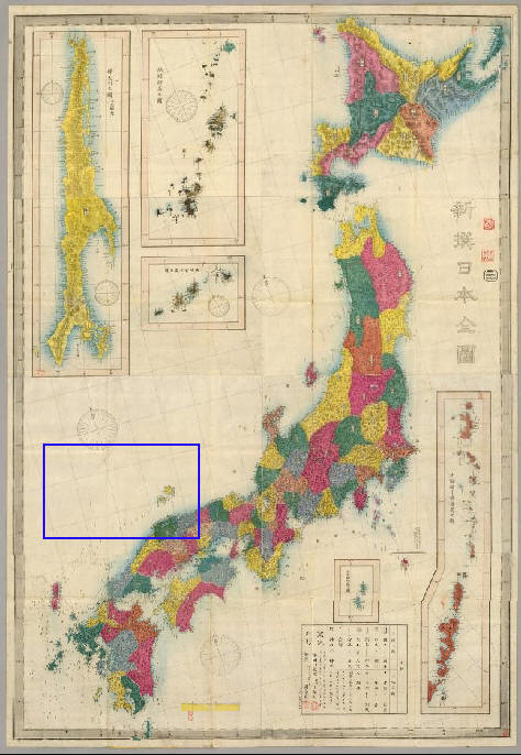
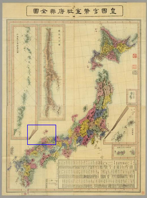
The following maps were gathered from various sources with the intent of making one point. Throughout the ages Japanese national maps prove Dokdo -Takeshima (sometimes called Liancourt Rocks) was not considered an inherent part of Japan as their Foreign Ministry now boldly claims. For reference, Oki Island has been boxed and a modern map at the top gives a geographical reference point for the viewer. From these maps, it’s a logical conclusion that for centuries before the annexation of Dokdo in 1905 the Japanese considered Oki Island (隱岐) as the Northwestern boundary of Japan. For higher magnification, each map is clickable.
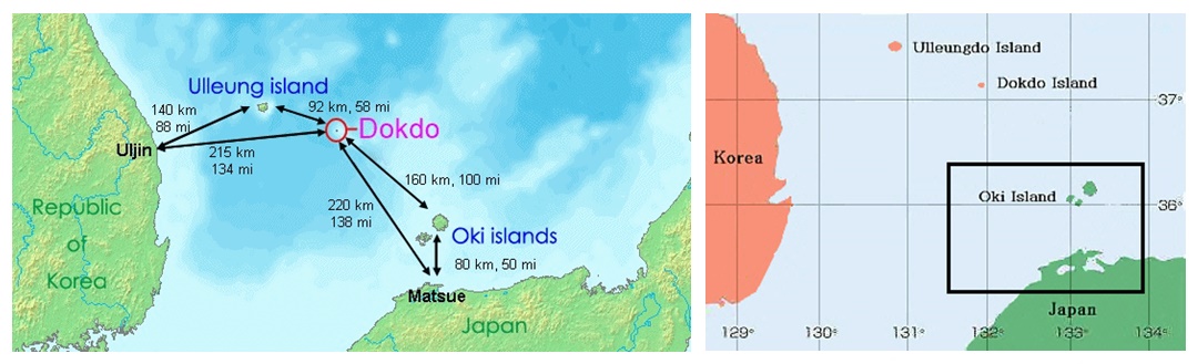
Above Left: A map showing distances to Dokdo from Korean and Japanese nearest islands and landfalls. Above Right: A map showing Japan’s Oki Islands boxed in black. Historically, Japanese considered the Oki Islands as Japan’s Northwestern limit.
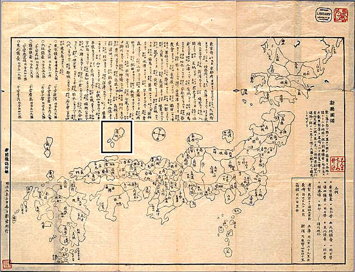
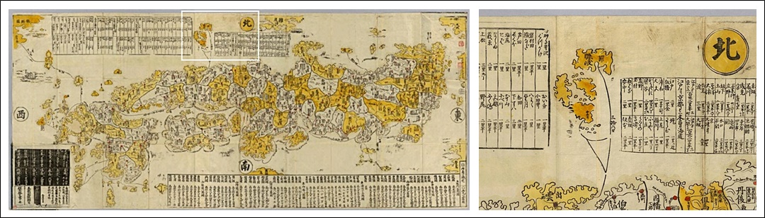
Above left: An 1872 map entitled Nisshindo Shinken Zufu shows nothing West of Oki. Above right: An 1853 color-coded map shows Ulleungdo and presumably Dokdo Island to the South as the same color as Chosun and thus Korean territory. (click images)


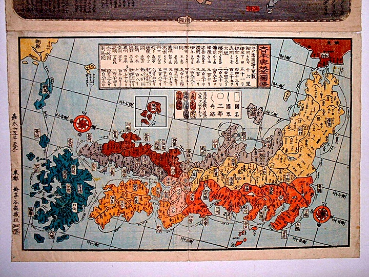
Above left: A map of the 1870’s shows no islands West of Oki. Above right: A map dated from around 1800 with Oki Islands boxed (click images)
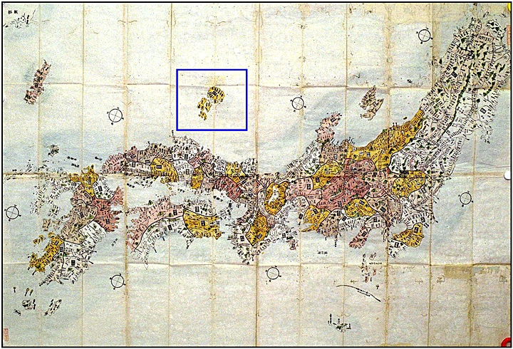
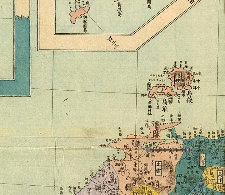
Top left: An 1870’s Japanese map excluding Ulleungdo and Dokdo with Oki Islands boxed in blue. Above right: Although damaged, this map is clear enough to determine Dokdo Island was not part of Japan. (click images)
Additional Historical Japanese Maps of Japan
“The Oki Islands (隱岐) Are Consistently Shown As Japan’s Northwestern Limits On Japanese Maps.”
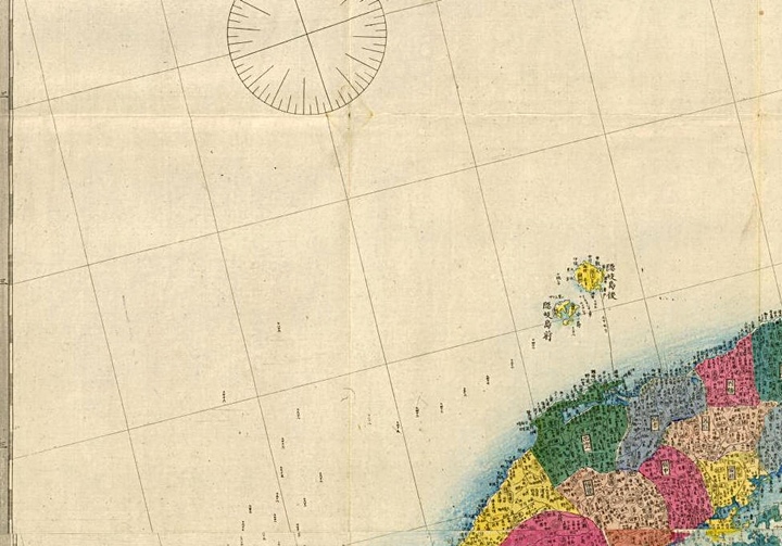
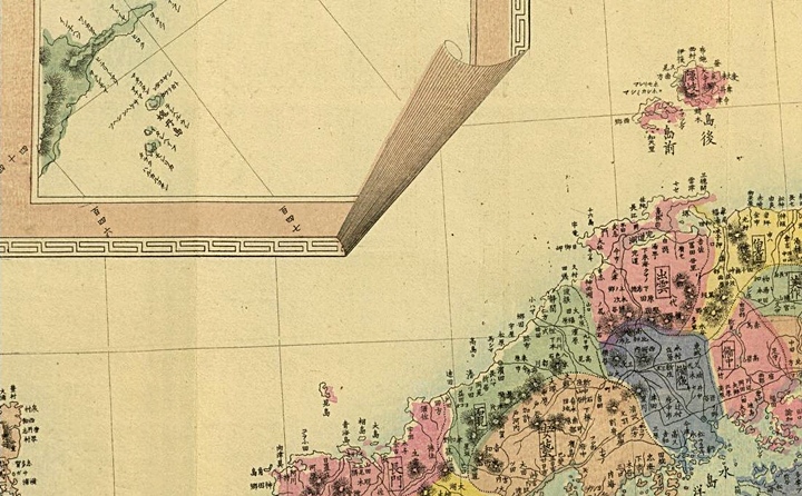
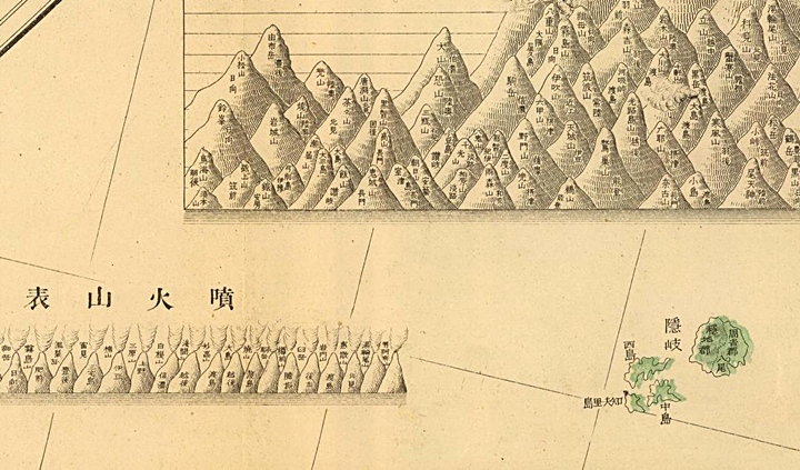
The following charts are Japanese historical maps with first an overview, then a close-up of the Oki Island (隱岐) region showing these islands to be Japan’s territorial limit throughout the ages. The two images of each group are clickable for higher detail.
The Honcho Zukan Komoku, Dated 1630
Above left: The overall view of this map shows the definition of Japan as of 1630. Above right: This shows Oki Islands (隱岐) as the Northwestern boundary of Japanese territory. Japan’s MOFA claims Dokdo was part of Japan throughout the 17th Century. (click images)
The Shinhan Nihonkoku Oezu, Dated 1685
Above left: The overall view of the Shinhan Nihonkoku Oezu shows the definition of Japan as of 1685. Above right: This map also shows Oki Islands (隱岐) as the Northwestern boundary of Japanese territory. Japan’s MOFA claims Dokdo was part of Japan throughout the 17th Century. (click images)
An Anonymous Map of Japan, Dated 1730
Above left: The overall view of this anonymously drawn chart shows the definition of Japan as of 1730. Above right: This close up portion of the map also shows Oki Islands (隱岐) as the Northwestern boundary of Japanese territory. Japan’s MOFA claims Dokdo was part of Japan throughout and beyond the 17th Century. (click images)
The Dai Nihon Yochi Benran, Dated 1834
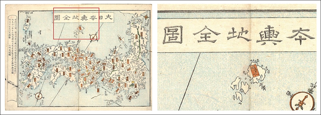
Above left: The entire map created in 1834 prior to the Meiji Era excluded Dokdo and Ulleungdo Islands. A few years later Japan would formally declare both islands as Korean, after a trespassing incident on Ulleungdo. Above right: A close-up image of the Oki Islands, Japan’s limit.
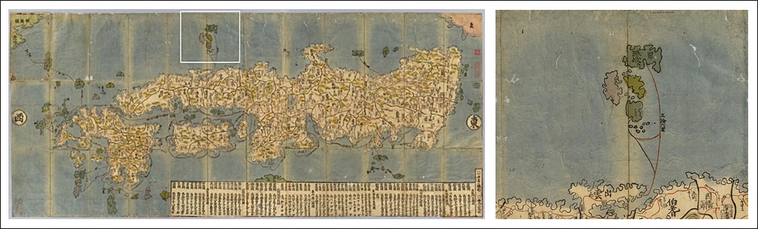
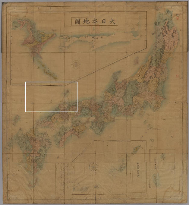
An 1886 National Map of Japan – Suganum Akira
Above left: The overall map of Suganuma Akiro about 20 years before Japan forcibly annexed Dokdo omitted the islets. Above right: An close-up of the Oki Islands (隱岐) group illustrates these islets were the limit of Japan. (click maps for higher detail)
An 1877 Chart of Japan, Takeuchi Sozaburo
Above left: The overall map, drawn in 1877. Note appended maps showing distant outlying islands that were part of Japan. This map also included sea routes, however none extended to Dokdo Island. Above right: The boundary of the map of Japan was altered to include Oki Islands but then stopped. Note the dotted line indicating boat voyage routes that ended at Oki Islands (隱岐) click images.
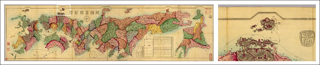
A Map of Japan, Kataoka Kenzo – 1892
Above left: This chart drawn in 1892 by Kataoka Kenzo included outlying islands with appended maps and excluded Dokdo. Voyage routes ended at the Oki Islands group.
A Map of Japan, 1874 – Ide Inosuke
Drawn in 1876, this map was careful to include islands such as Hokkaido, the Kuriles, Sakhalin and the Ryukyus with appended maps. However, Dokdo Island’s location was covered by these charts and thus not part of Japan.
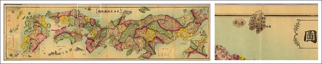
A Map of Japan, 1876 – Matsuda Tadashi
Above maps. The chart above drawn in 1876 went a step further by not including any islands in the East Sea (Sea of Japan) West of the Oki Islands.
A National Map of Japan 1875 – Urabe Seiichi
Above maps: In much the same manner as Matsuda Tadashi’s 1876 chart, the map above did not include any islands in the East Sea (Sea of Japan) West of the Oki Islands group at all. Thus, Dokdo Island could not have been considered part of Japan at this time.
A National Map of Japan 1875 – Makita Aikyo
Above maps: This chart shows Japan’s territory also with the use of appended maps. The location of Dokdo Island is covered by two maps, one of Sakhalin Island and the other of the Ryukyu Island group. Also included, were very distant Japanese outlying islands such as the Ogasawaras, however Dokdo Island was not shown and therefore separate from Japanese territory. (click maps)
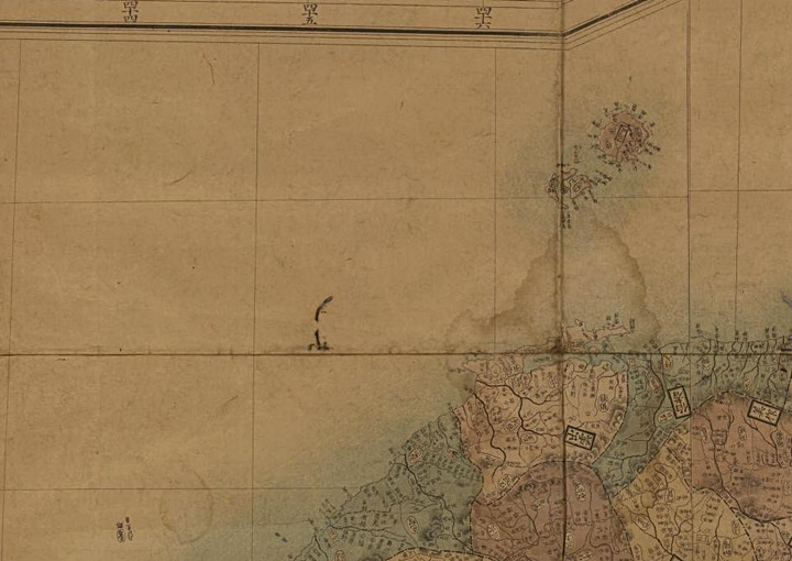
A Map of Japan 1888 – Yamamoto Meino
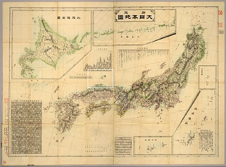
As with the subsequent charts, Yamamoto Meino’s map incorporated the use of appended maps to include Japanese outlying minor islands. The map above was careful to show Japanese distant islands such as the Ryukyus, Hokkaido, Kuriles and the Ogasawaras. However, Dokdo Island’s location was buried under a chart listing Japanese mountains. Thus, it is a safe conclusion Dokdo was not thought to be part of Japan at this time. (click images)
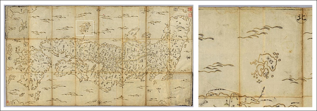
A National Map of Japan 1871 – Kawakami Kan
Though in poor condition the map above is clear enough to observe no islands were drawn West of Japan’s Oki Islands. Dokdo Island’s location was placed under an appended map of Hokkaido and the Kurile Islands. From this we know Japan excluded the waters West of Oki from her territory.
Japanese Ancient Maps Excluded Dokdo – Takeshima Part III – The Only Possible Conclusion
“Japan’s MOFA’s claims are false. Dokdo was never an inherent part of Japan…”
When studying historical maps to determine past territorial perceptions, one must first collect as many charts as possible of the region in question made by the nation that created them. From there, these maps must be examined and compared to find a dominant trend. With this in mind, there can be no other conclusion that Japan excluded Dokdo Island from her land throughout history. Simply put, Dokdo Island was never part of Japan.
This page is just the third of a series. If the reader continues to read and observe the dozens of charts found here and on the following, pages it’s possible to conclude the following: Not only did Japan exclude Dokdo from her territory, she frequently labeled and drew the islets as Korean. Thus Japan’s MOFA claims of historical title to Dokdo are simply wrong. Dokdo island is not, and was not an inherent part of Japan.