
Though both sides have argued with Japanese~Korean historical maps and documents, a basic study of Dokdo region’s geography has been given little consideration. What did the Japanese and Koreans see hundreds of years ago when they sailed these waters? When we look through the eyes of those who frequented the East Sea we can begin to understand what areas they considered to be their land.
This page has been created to give the reader an in-depth introduction to the Dokdo~Ulleungdo region through actual images from different locations around Korea. These images will be referenced with Korean and Japanese historical documents and maps.
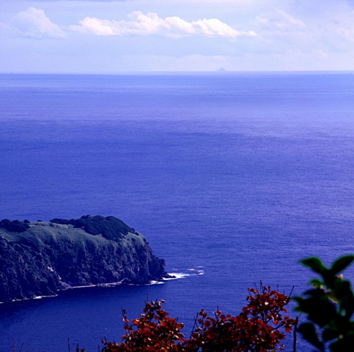
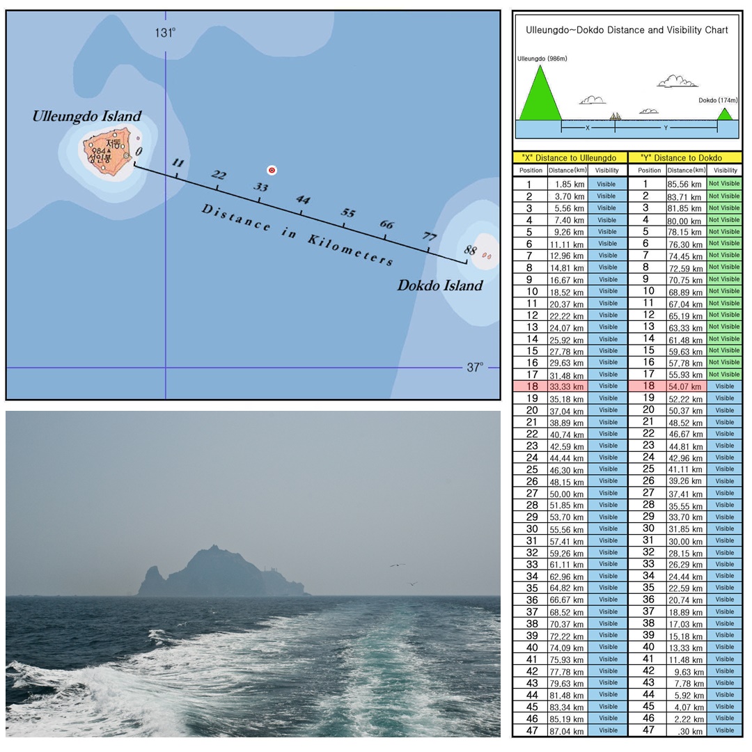
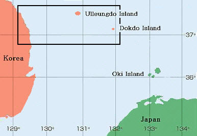 The image to the right of this text is an overview of the East coast of Korea and Japan’s western shore. Right away it is apparent how much closer Korea’s easternmost island Ulleugdo is to Dokdo than Japan’s Oki Island. Ulleungdo is about 87kms from Dokdo, and Oki Island almost double the distance at around 156kms. When conditions are ideal, Dokdo is visible from Ulleungdo’s peaks, on the other hand, Dokdo is never visible from Japan’s Okinoshimas.
Historically Dokdo was about one day’s sailing from Ulleungdo Island in the direction of both prevailing winds and currents. However, to reach Dokdo Japanese had to battle these elements to reach the island and it was recorded to take about two days and one night for Japanese to sail to Dokdo en route to Ulleungdo. (See Saito Hosen’s report below) However, the only official Japanese voyages originated from Yonago of Tottori (today’s Shimane Prefecture) and would have taken around three days also en route to plunder Korea’s Ulleungdo Island.

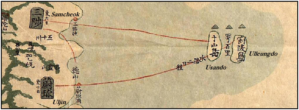
Below is a Korean chart from the 18th Century. This map shows both Ulleungdo and Usando (Dokdo). Usando was drawn on the West side rather than its correct eastern location. Note the red line extending from Ulleungdo Island to Uljin. This line is marked “Two days sea route” and shows Koreans were frequenting Ulleungdo. In fact, Korean records of voyaging to Ulleungdo date back to the year 512 A.D. Thus, it can be confirmed Koreans were living within visual proximity of Dokdo a millennium before the first Japanese records of the region by the Murakawa family of Shimane dated around 1618.
 Historical Records of Ulleungdo’s Visibility from Korea
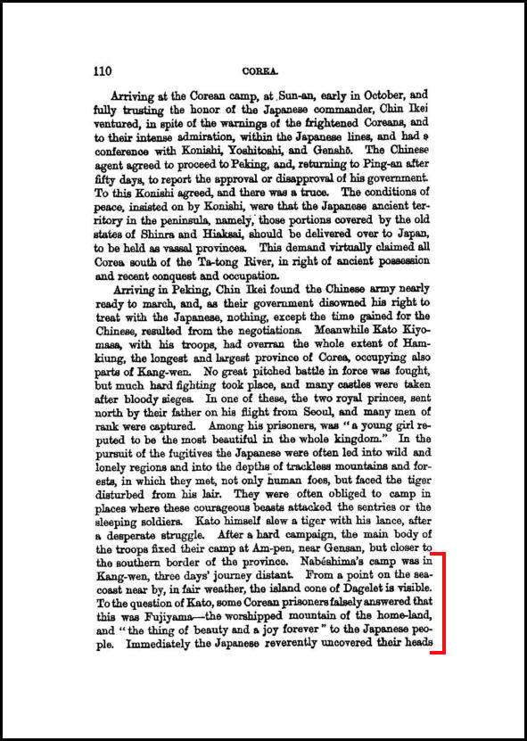
In the year 1882 William Elliot Griffiths published a book called “Corea, The Hermit Kingdom” on pages 110~111 can be found a small description about Ulleundo’s visibility from Kangwan Province on Korea’s East coast it reads as follows
“…Nabashi’s camp was in Kangwan, three days journey distant. From a point on the sea coast near by, in fair weather, the island cone of Dagelet (Ulleungdo) is visible. To the question of Kato, some Korean prisoners falsely answered that it was Fujiyama – the worshipped island of the homeland and “the thing of beauty and joy forever” to the Japanese people. Immediately the Japanese reverently uncovered their heads and, kneeling to the strand, gazed long and lovingly with homesick hearts – a scene often portrayed in Japanese decorative work…”
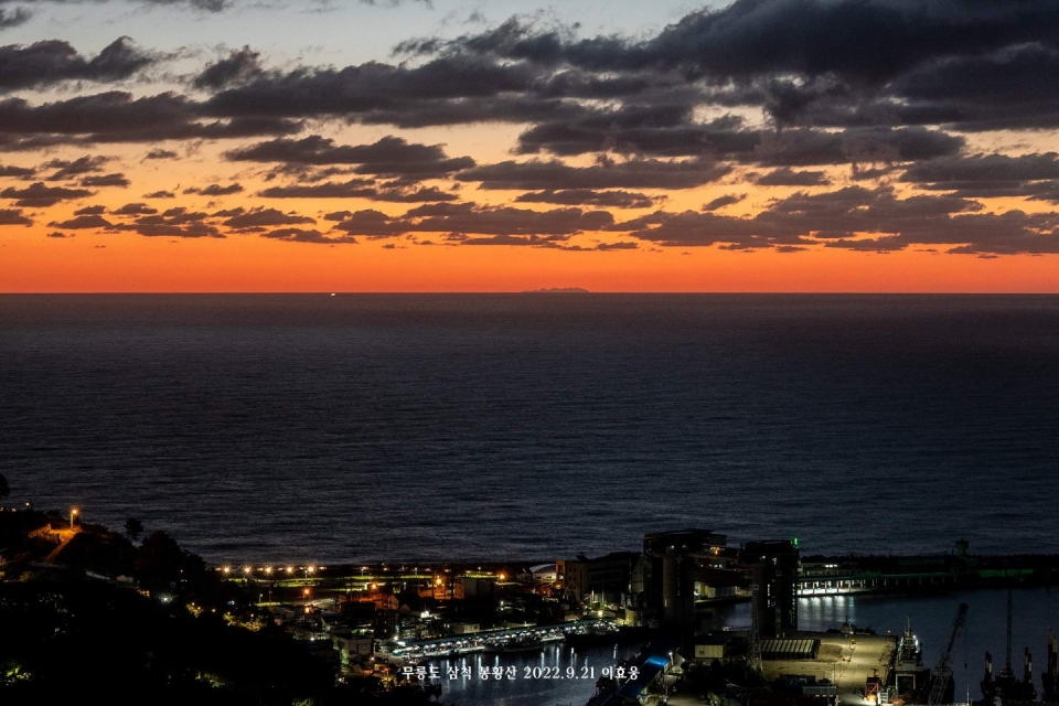
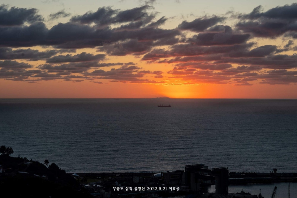
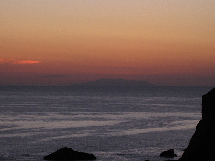
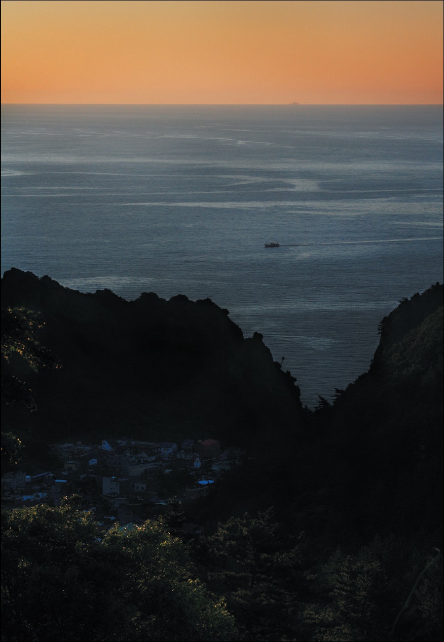
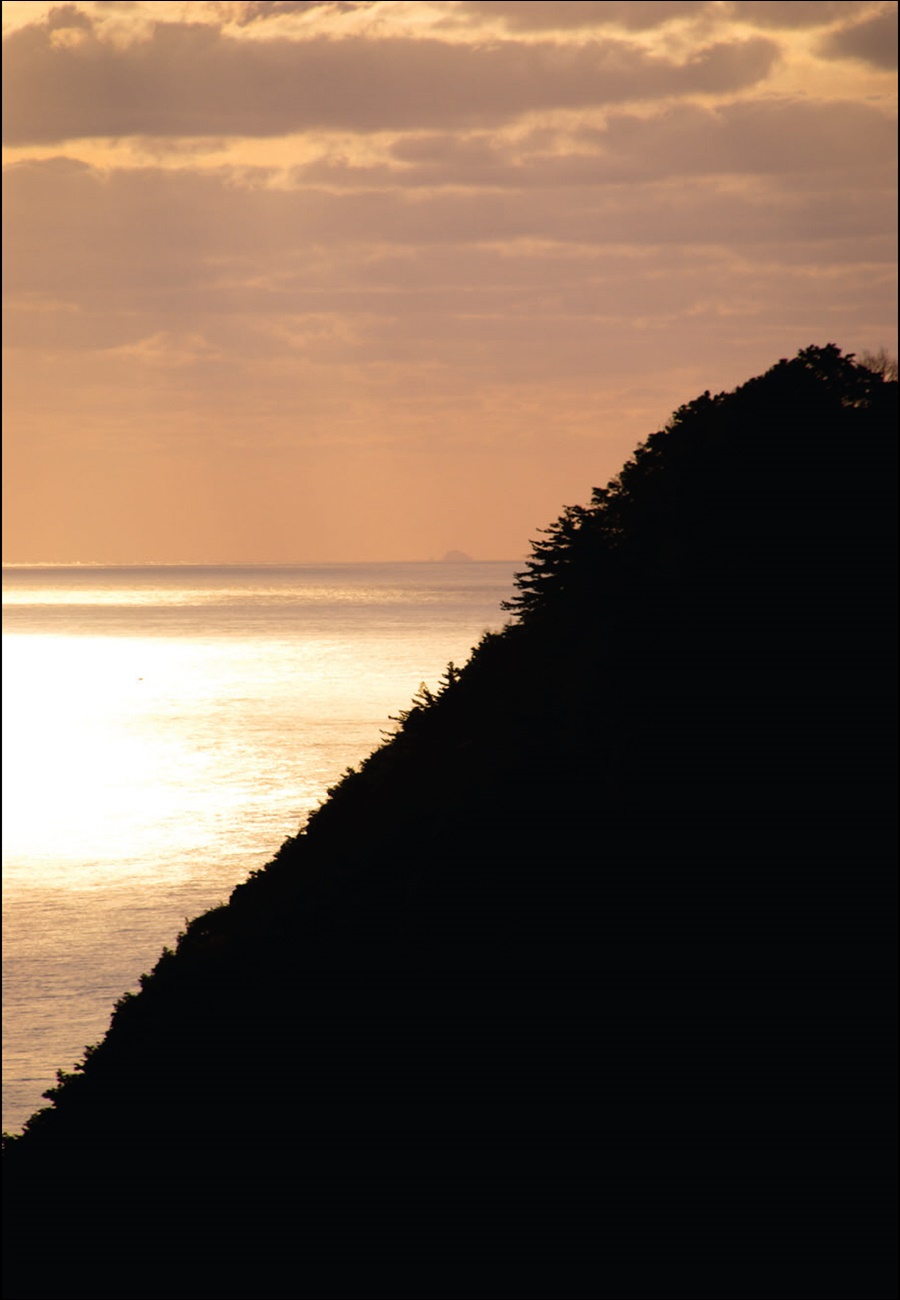
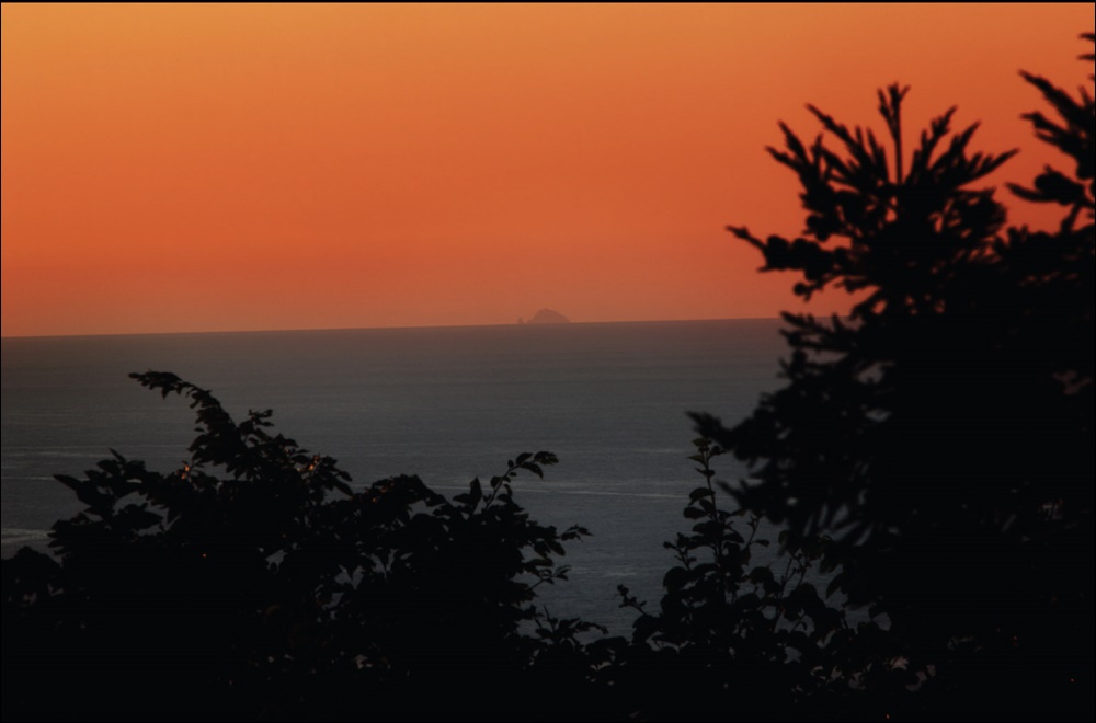
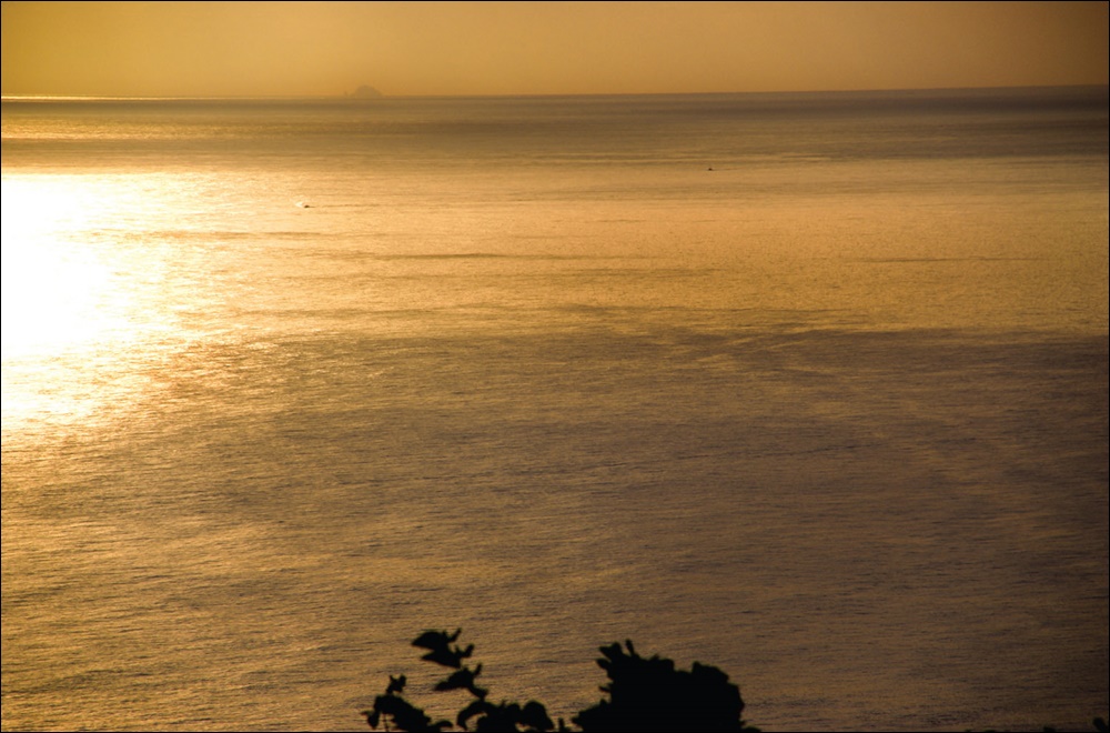
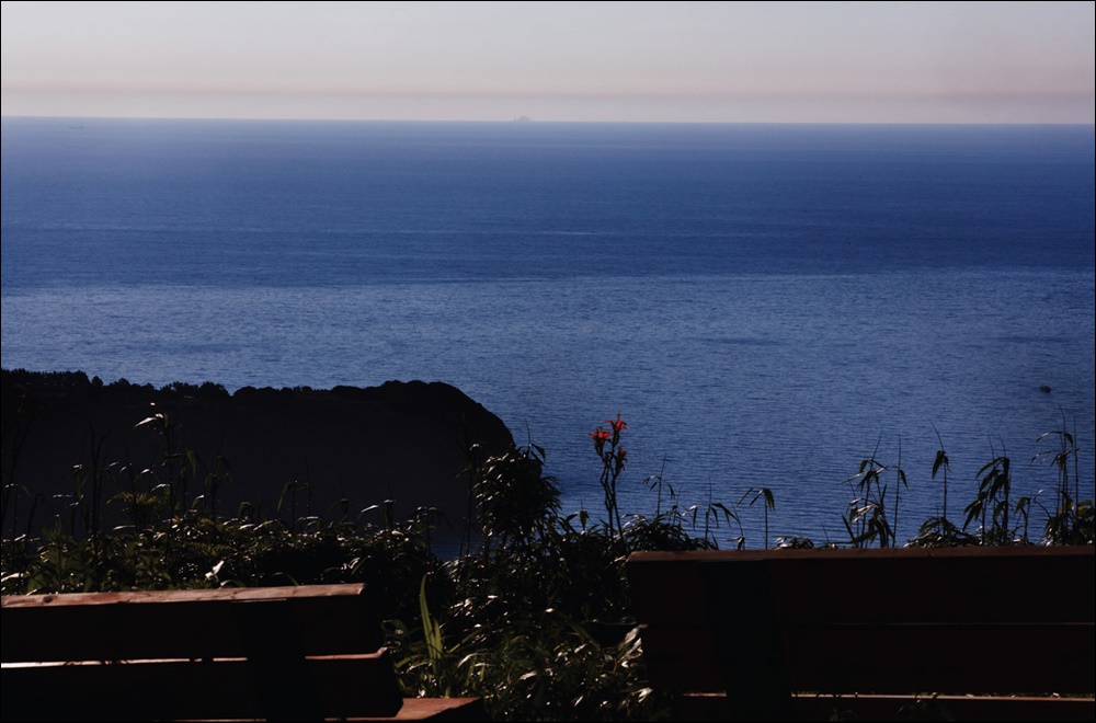
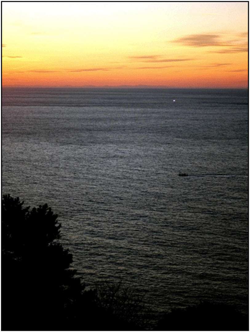 Both Chosun and Japanese ancient historical documents that recorded Korea was visible from the Ulleungdo and Dokdo vicinity have recently been confirmed by pictures taken from Ulleungdo. For example the image on the right is a photograph of Korea’s East coast taken from Ulleungdo’s West side in the evening. The outline of Korea’s Taebaek mountain range is clearly visible against the setting sun in this photo. The image can be clicked twice for a large image.
This photo, and some others on this page were taken by a Korean photographer named Kim Cheol Hwan. He has devoted a great deal of time and effort in capturing images of the Dokdo region to verify what was is recorded in ancient Korean and Japanese documents.
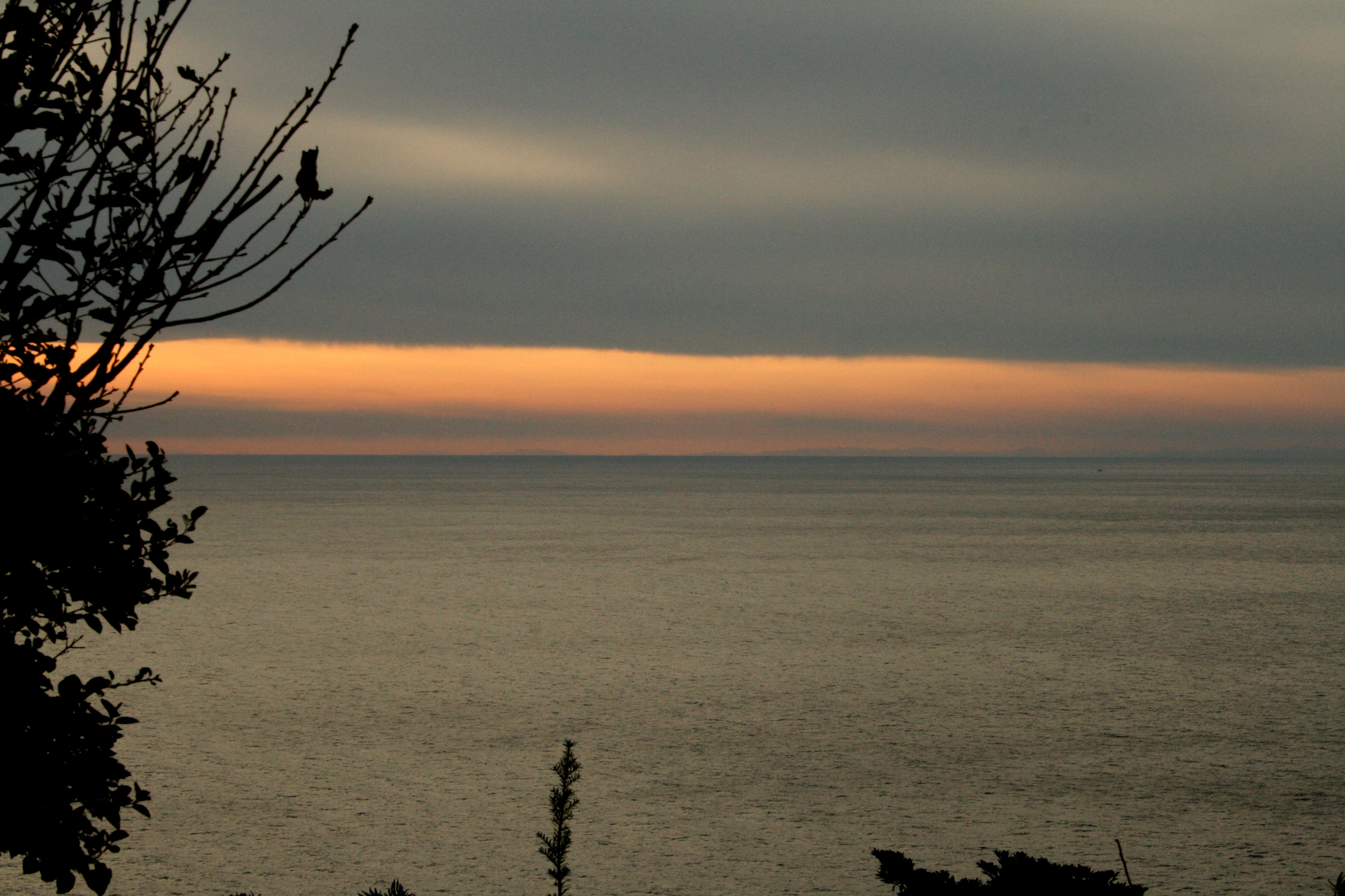
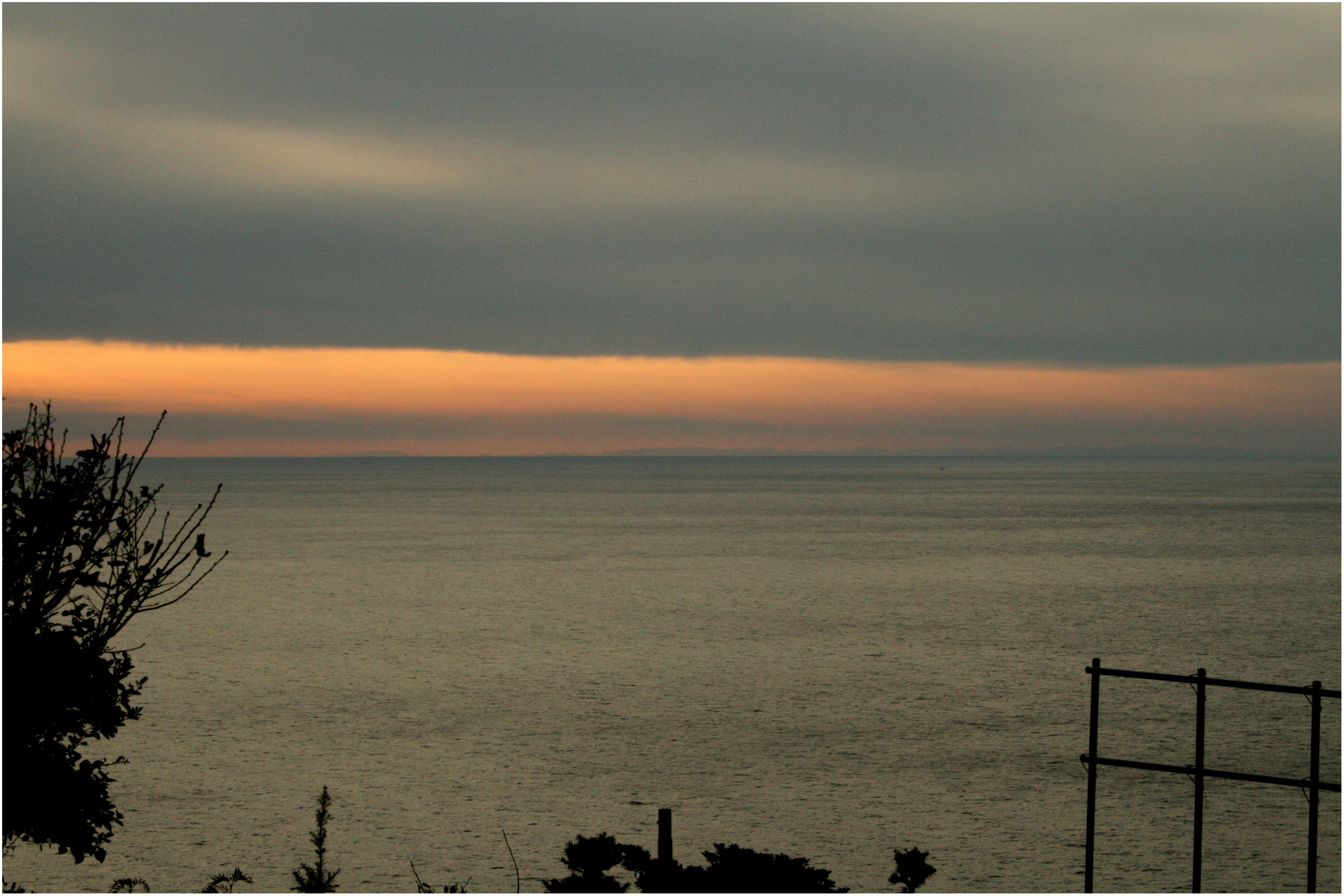
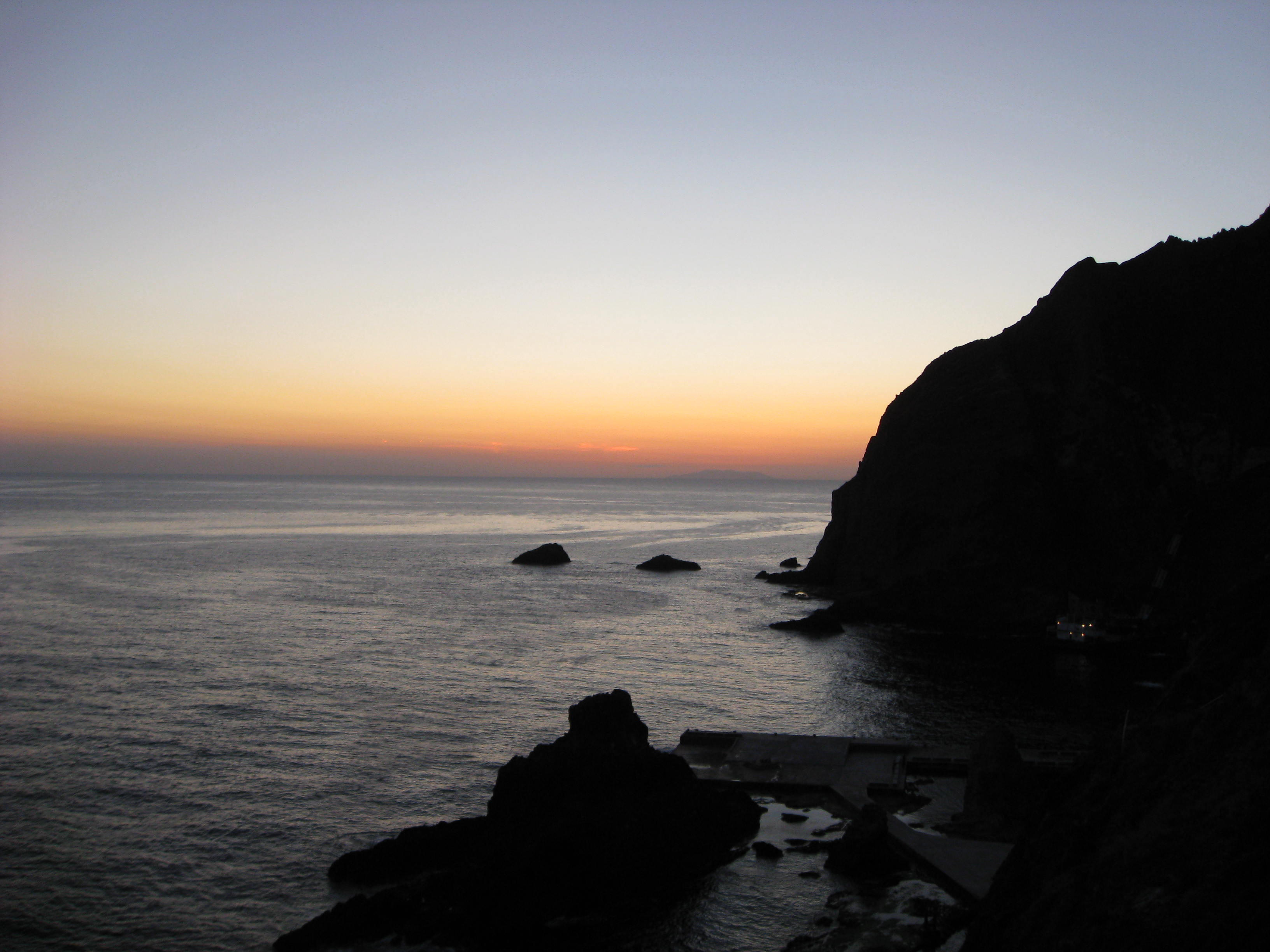
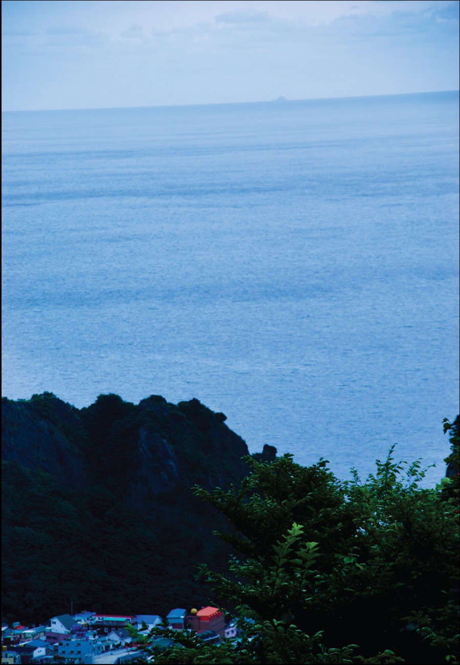
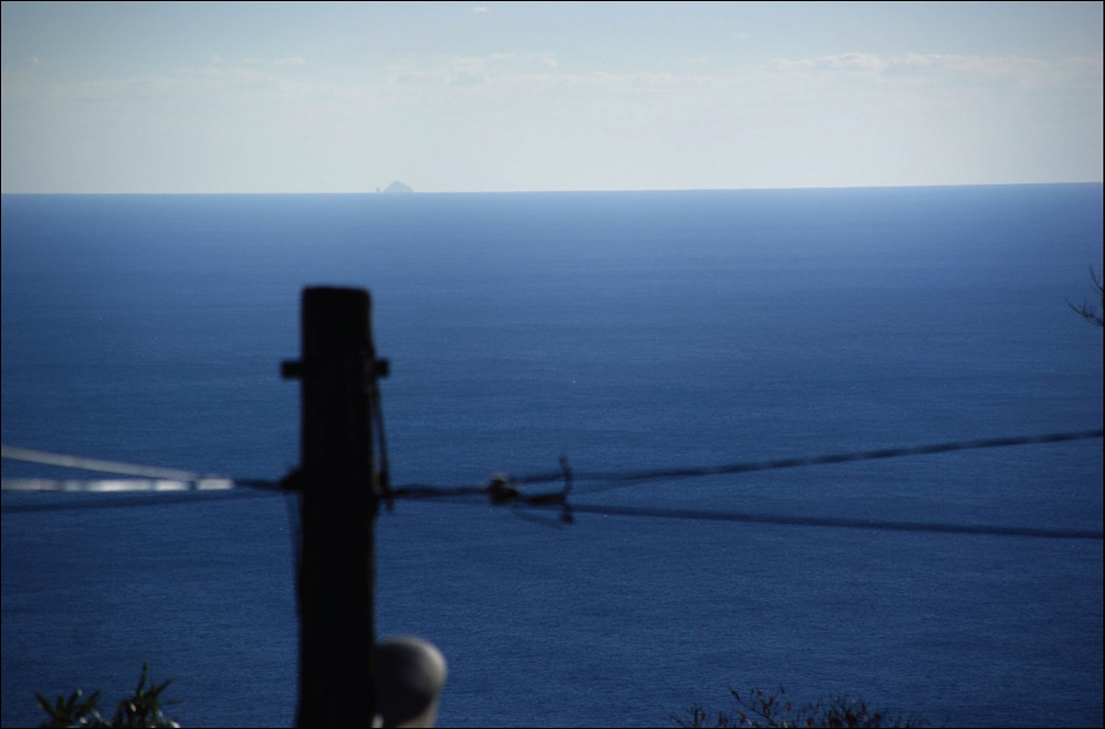
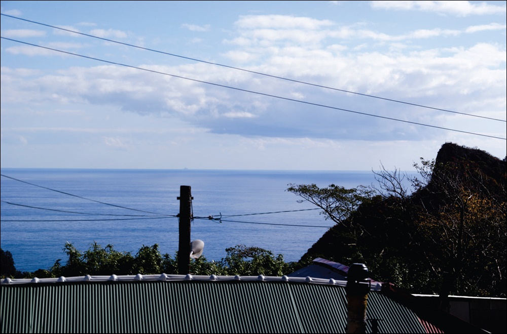
The two photographs were taken in the evening from Ulleungdo’s West side on the hills of Taeha Village by Ulleungdo resident Kim Nam Hee in the fall of 2008. Korea’s mountains are easily visible against the backdrop of the setting sun. In 1696, a Korean inspector named Jang Han Sang also mentioned seeing Korea’s mountains from Chosun’s Ulleungdo Island. Jang Han Sang’s 1694 Inspection of Ulleungdo – Korea’s Ulleungdo Sa-Jeok (蔚陵島事蹟)


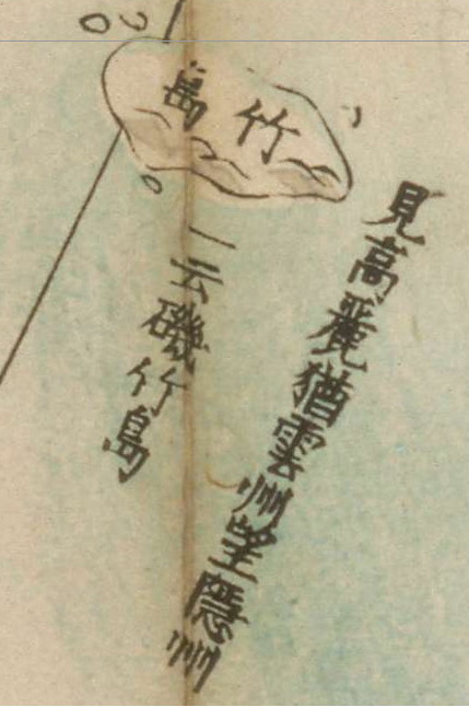 The three closeup images of Ulleungdo (Takeshima) and Dokdo (Matsushima) were taken from Japanese historical maps from different eras. We can see Kanji characters that read “見高如麗雲州望隱州”. This means “Viewing Korea (from here) is the same as viewing Oki Island from Unshu (雲州)..” Notice how the text spans both Ulleungdo and Dokdo islands as one. The map to the left was taken from a Japanese map of Korea and Japan dated 1849.
Thus, almost two hundred years after Saito Hosen defined Japan’s Westernmost limit as Oki Island, Japanese mapmakers continued to remind thier countrymen of the strong visual – territorial bond between Ulleungdo/Dokdo and the Korean peninsula.
A handful of Japanese (politically motivated) “historians” still maintain the narrow-minded view Saito Hosen’s quote is evidence of Japan’s sovereignty over Dokdo (marked as 松島-Matsushima). These assertions can be easily dismissed as Saito Hosens’s quote continued to be written adjacent to Ulleungdo Island and Dokdo over a century after Japan’s Shogunate declared the islands outside of Japan (in 1696) and part of Chosun (in 1836).
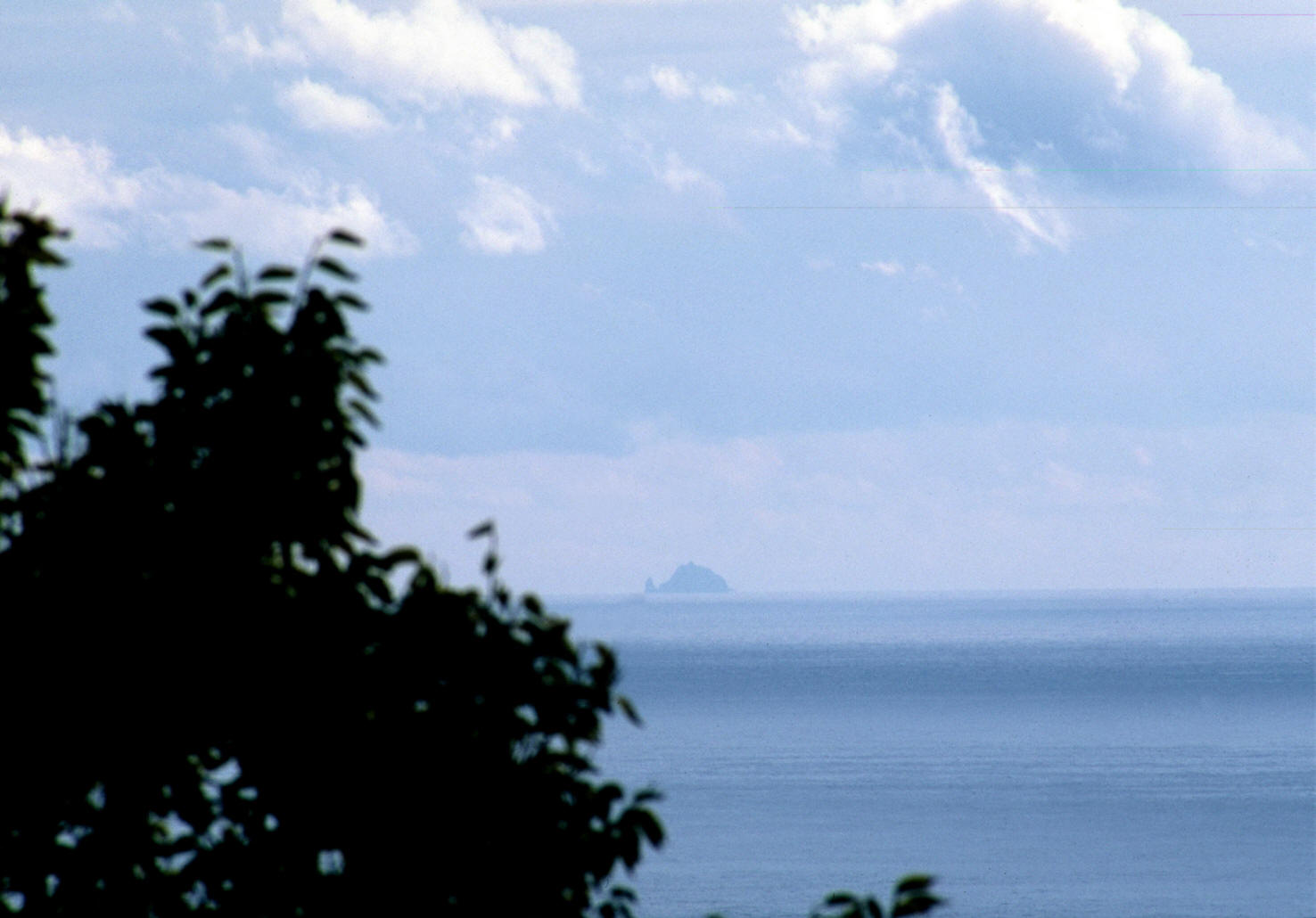
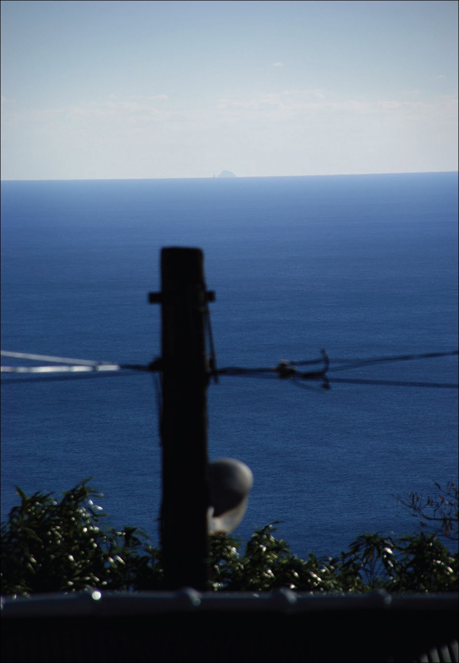
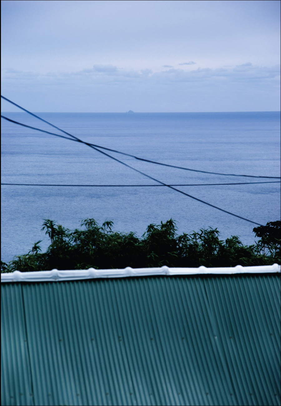
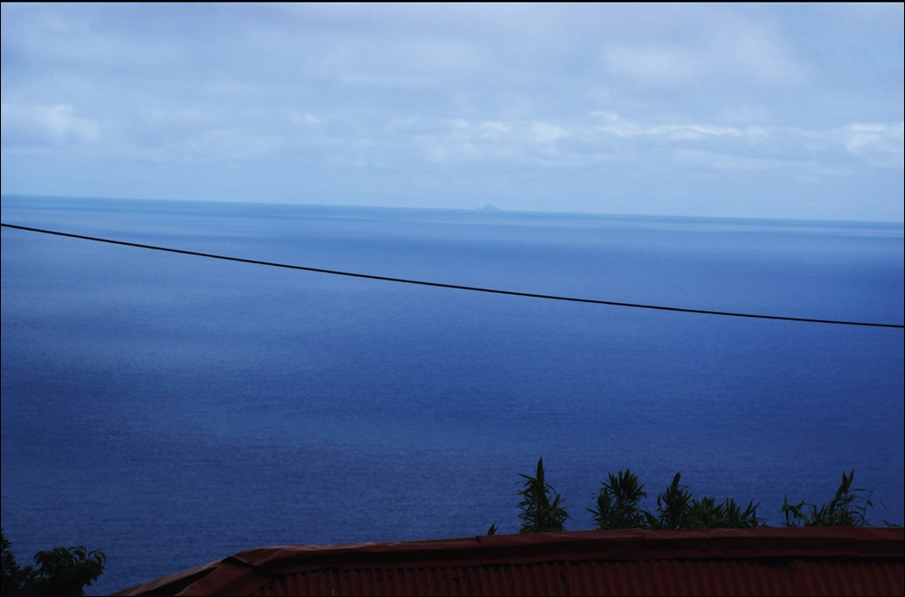
However, what has been overlooked in this territorial dispute is Ulleungdo’s visibility from Dokdo island.The images below are pictures of Ulleungdo Island from Dokdo Island. We can see Ulleungdo is highly visible from Dokdo. As mentioned above, Seonginbong Mountain on Ulleungdo towers almost a kilometer above sea level.
Below are some other random photos of Ulleungdo from Dokdo Island. They were taken by various tourists and some were from the Dokdo museum and the Northeast Asian History Foundation’s Dokdo Research Center.(click images twice)


 The picture shown to the right is again Korea’s Ulleungdo Island as seen from Dokdo. Dokdo Island’s West Islet is in the foreground and behind is the southern tip of Ulleungdo. The outline of the rocks can be identified as Ulleungdo’s Seal Point.
This photo must have been taken from the top of the East Islet. It also must have used a fair degree of magnification and was taken in the evening judging by the setting sun in the West. The most probable location of the photographer must have been from the East Islet’s lighthouse, watchtower or helicopter pad. Perhaps it was also taken by Korea’s Dokdo Guard Police.
Because Youtube’s resolution is poor, this video is best viewed at least 720p HD. Simply click on the bottom right 480p default and adjust the setting. Hopefully, in the future we can stream the video directly through our website. The video can also be viewed directly at youtube here ( link )
 The image shown to the left, is one of the first images of Dokdo from Ulleungdo to be made publicly available via the internet. Many Japanese on the internet doubted the authenticity of this photo and scrutinized every aspect of it. Some wrongfully stated the picture was photoshopped and claimed the shadows on the person in the foreground were inconsistent with Dokdo’s location relative to Ulleungdo.
Fake or not, with other images and historical records having surfaced over the years, the skeptical Japanese lobbyists who doubted Dokdo’s visibility, have been silenced.

Dokdo-takeshima.com suggested to bolster Korea’s argument, the pictures should be unmagnified and taken with a lens with a focal length of around 50mm or less. Korean netizens and governmental groups came through. Later on, authentic, unmagnified pictures of Dokdo from Ulleungdo became more commonplace on the internet.


 In 1901 and 1903 the Shimane Prefecture-based fishing organization ‘The Black Dragon Society’ printed the book 韓海通漁指針 or Chosun (Korean) Ocean Fishing Manual. The Black Dragons were an ultranationalist organization whose views were considered extremely right-wing during Japan’s expansionist era. This publication was printed in 1901 and 1903 with both editions mentioning the visibility of Dokdo from Ulleungdo.
The relevent text is as follows “…About 30-ri south-east of Ulleungdo, and almost the same distance north-west from Japan’s Oki county, there is an uninhabited island. One can see it from the highest point of 山峯 (mountain) in Ulleungdo when the weather is fine. Korean and Japanese fishermen call it “Yanko” (Liancourt Rocks – Dokdo)…”
It is also noteworthy to mention the Black Dragon Fishing Manuals listed Dokdo Island under its Korean waters edition and also marked it down as part of Korea’s Gangwan Province. This shows the territorial perceptions of Japanese who had intimate knowledge of the waters surrounding Ulleungdo and Dokdo. Note the Hanja characters (江原道) for Gangwan Province on the left margin
 Around the turn of the 18th Century two important Korean documents record Dokdo’s visibility from Ulleungdo. The first record was from the Ulleugdo Sa-Jeok written in September 1694 by Inspector Jang Han Sang. After surveying Ulleungdo because it was heard the Japanese had attacked or invaded Ulleungdo, Jang Han Sang recorded what he saw.
This record reads as follows. “…Looking toward the east, there was one island far off to the southeast. The size was only about one-third the size Ulleungdo. It was only about 300 ri [120 kilometers] away…”
Jang Han Sang saw Dokdo far off and overestimated the distance. Because of this he also thought Dokdo to be much larger. Even so the Ulleungdo Sa-Jeok disproves Japanese historians’ incorrect assertions Dokdo cannot be seen from Ulleungdo’s shores.
Besides the visibility factor, this record gives and important clue as to Chosun’s territorial perceptions. In this report Jang Han Sang mentioned he saw Dokdo Island and later states he did not see Japan. Thus, is safe to conclude Korea considered Dokdo outside of Japan, yet within Korea’s sphere of influence.
 In the year 1714 there was growing concern among Chosun residents a Japanese invasion may occur. King Sukjong’s July 22nd entry records Korea’s concerns and while doing so, mentions Dokdo Island.
Gangwan Provincial emmisary Jo Seok Myeong, discussed the neglected coastal defenses in the Yeongdong region and reported the following.
“…I listened carefully to the people in the ports (浦人) who said “..Pyeonghae (平海) and Uljin (蔚珍) are the closest to Ulleungdo and there are obstructions along the sea route. Visible to the East of Ulleung is and island that is adjacent to the limits of Japan…” In 1708 and 1712 strange looking ships drifted to the borders of Gosoeng (杆城), so we know that Japanese ships frequently come and go…”
This document tells us that Koreans of the coastal region were cognizant of Dokdo Island long before the Japanese annexed the islets in 1905. Additionally Dokdo Island’s visibility from the shores of her nearest island (Korea’s Ulleungdo) is once again confirmed by this record. Lastly, the 1714 record makes it clear 18th Century Koreans excluded Dokdo from Japanese territory. Korean Emissary Cho Seok Myeong stated the island to the East of Ulleungdo was “adjacent to” or “bordering on” the limits of Japan and not part of Japan.
Twenty years later, yet another Korean historical document records Dokdo’s visibility from Chosun’s Ulleungdo Island. This record is from the year 1714.
The section on the chart marked in light red shows the distance at which Dokdo becomes visible from Ulleungdo’s shore. We can read, weather permitting, Dokdo can be seen from about 54km away from sea level.
This Russian drawing shows Dokdo was highly visible from 26kms away even when viewed from the direction of Dokdo’s smallest profile at sea level. The largest top left rendering is Dokdo’s profile drawn being viewed from the West to East (similar to being viewed from Ulleungdo). All images are as seen with the naked eye. Dokdo’s West islet is named Olivutsa and the East is called Menelai.

Korea’s inferior maps and records often force them to rely on Japan’s more advanced 19th Century western cartography skills or military records to support their claim. These records show Koreans were both cognizant and involved on Dokdo prior to Japan’s 1905 Shimane Prefecture Inclusion of Dokdo.
Common sense tells us Koreans who had lived within visual proximity of Dokdo for a thousand years before the Japanese arrival on Ulleungdo must have been cognizant of Dokdo Island. As the above maps and records show Koreans had the ability to sail two days to Ulleungdo from the Korean mainland at will. To think these people who relied on marine products to survive couldn’t or didn’t travel the extra few hours East of Ulleungdo to see Dokdo simply doesn’t make sense.