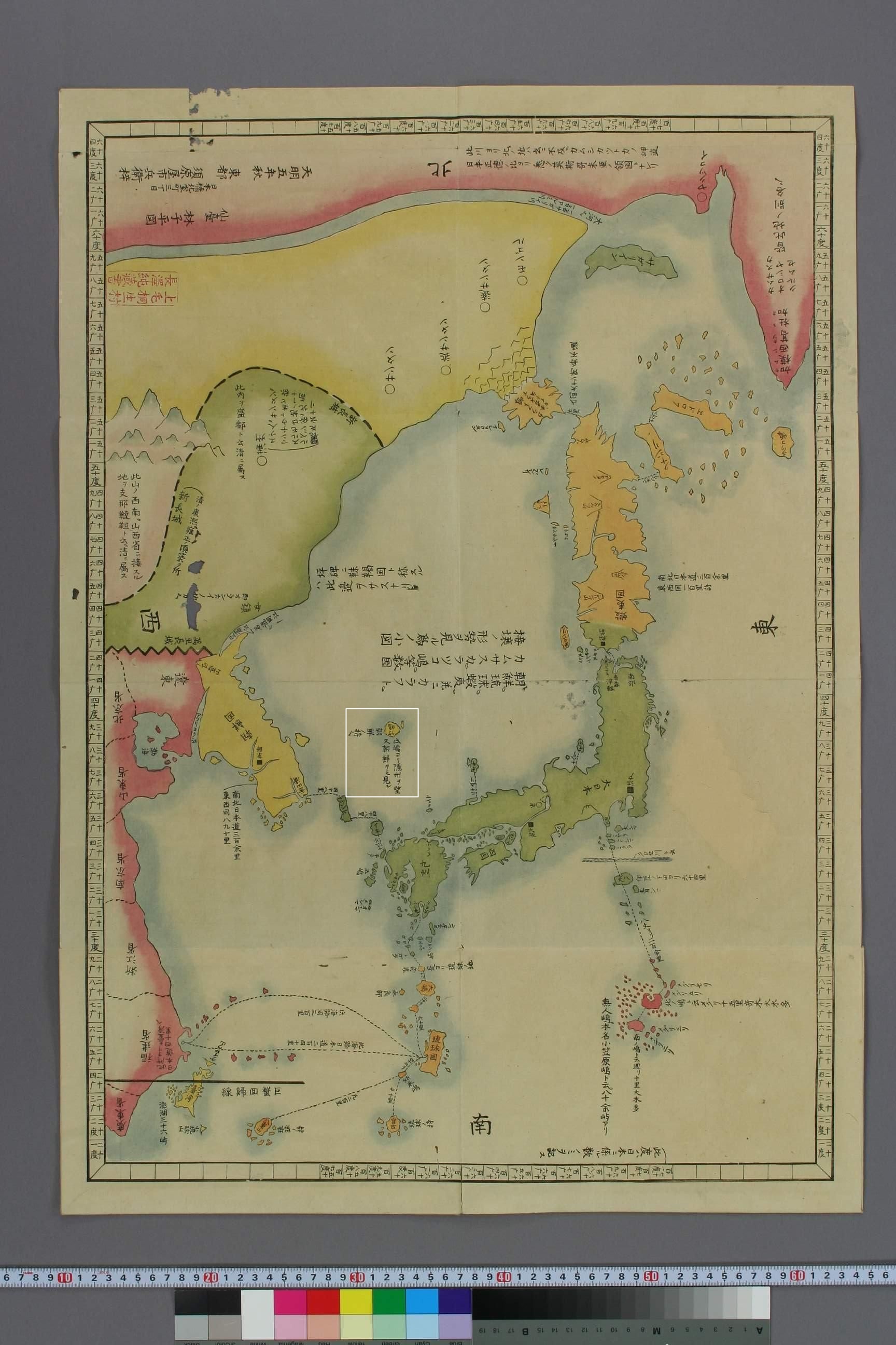
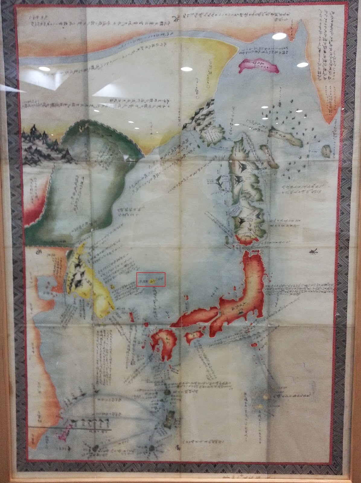
In 1785 Hayashi Shihei made the Illustrated General Survey of the Three Countries. This book was translated into French by Heinrich Klaproth in 1832 and then it became widely used in Europe as a guide to Northeast Asia. The Illustrated General Survey of the Three Countries was used to show how close the Japanese were from her potential enemies.
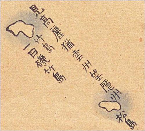
We can notice Hayashi drew Ulleungdo(竹島) and a small island next to Ulleungdo and marked them as part of Chosun (Korea) 朝鮮ノ持之. On two of the five maps attached to the book there appear Ulluengdo and the small island next but unnamed apparently, Dokdo. Some Japanese assert the island next to Ulleungdo is the small rock called Jukdo Islet next to Ulleungdo. However it is not plausible Hayashi Shihei omitted Dokdo and included an insignificant rock on a map of Northeast Asia because it lacks such scale and detail.
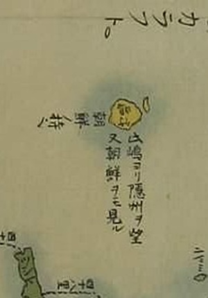
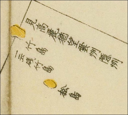
Above left: The overall map drawn by Hayashi Shihei in 1785 shows Korea’s Ulleungdo and presumably Dokdo Island coloured yellow. No other islands are shown West of Oki. Above right: A close-up of Ulleungdo and Dokdo. Note the abbreviated Kanji “見高如麗雲州望隱州” frequently drawn next to Ulleungdo and Dokdo on Japanese maps.
A More Detailed Study of Hayashi Shihei’s Map and Japan’s Flawed Interpretation.
Hayshi Shihei’s 1785 map is quite crude to be sure but we can glean a few important facts from it. The island drawn as Ulleungdo (Takeshima – 竹島) is colored yellow, and clearly Chosun territory. To the East, is another small island also shown as Korean in yellow.
To some Japanese involved in the historical debate surrounding Dokdo this island is Ulleungdo’s Jukdo Islet. (shown below) However, would a map of such large area and scale draw a rock located 2kms from Korea’s Ulleungdo? Historical evidence shows the Japanese government wasn’t even aware of Jukdo Islet’s existence until the Meiji Era’s Japanese Warship Amagi formally surveyed Ulleungdo in 1880.
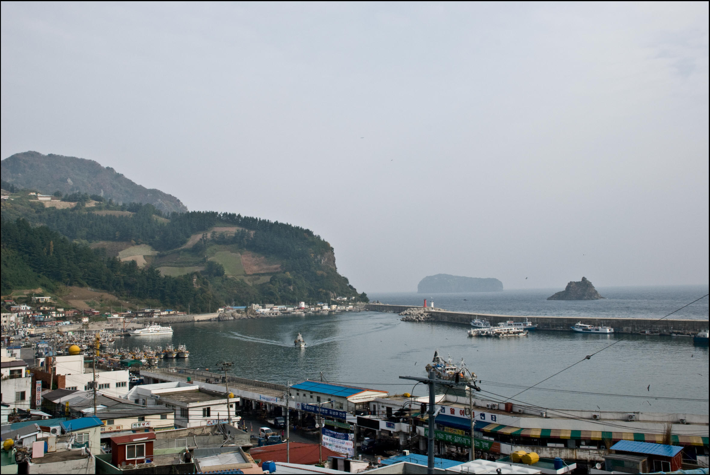
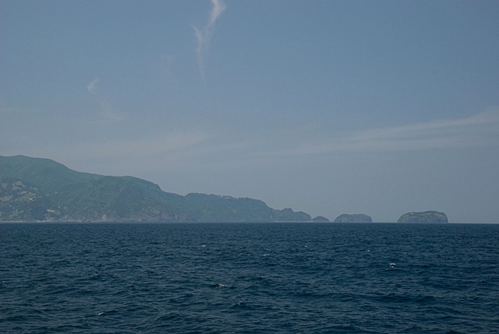
Above: Both pictures above show Jukdo Islet located 2kms from Korea’s Ulleungdo Island. The left image shows Jukdo in the far background and the right image has Jukdo on the right side next to Gwaneum Island. Some Japanese insist Hayashi Shihei’s 1785 map omitted Dokdo Island and instead included this rock though records show Japan’s government wasn’t aware of Jukdo until 1880.
“..So what would the small islet to the East of Ulleungdo be on this map..?”
Japanese historical maps can be a mosaic of information and sometimes errors. But as a rule Japanese cartographers followed a few basic principles. The first rule would be “..Oki Islands were the northwest limits of Japan..” This is proven by scores of Japanese historical maps on this website. Another basic principle was “two islands existed in the East Sea (Sea of Japan), (Ulleungdo and Dokdo) both of these islands were consistently colored the same and it’s an indisputable fact Ulleungdo was Chosun land since the 6th Century.
Another hint to the tiny yellow island East of Ulleungdo’s identity is the glaring absence of other islands between Japan’s Oki Islands and Ulleungdo itself. Additionally another large yellow island is drawn off of Korea’s East coast. On this one point alone, Hayashi Shihei excluded Dokdo from Japan.
As with many Japanese maps of this era, an abbreviated form of Saito Hosen’s 1667 Report on Oki “見高如麗雲州望隱州” can be seen next to Ulleungdo and the smaller island where cartographers routinely drew it between Ulleungdo and Dokdo. This fact supports the interpretation the Eastern island is Dokdo Island.
Above left and center: These two Japanese historical maps show Saito Hosen’s 1667 quote “見高如麗雲州望隱州” Korea is visible from the Ulleungdo-Dokdo region. Likewise Hayashi’s 1785 map had an abbreviated version next to Ulleungdo and “Dokdo”.
Update! A new map proves that the neighboring island on Hayashi’s map is Dokdo (Takeshima).
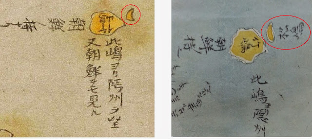
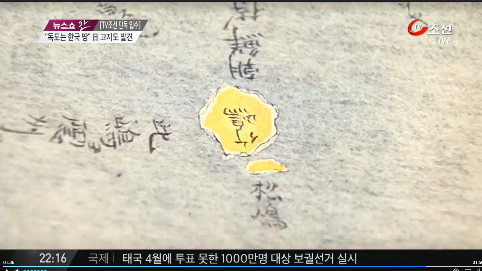
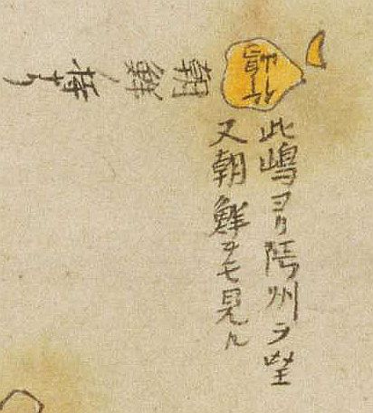
In 2014, a revised map of Hayashi’s “Map of the Three Adjacent Countries,” created in 1802, was discovered. The map was discovered in Germany by a Korean professor named Lee Jin-myung of the University of Lyon.
The 1802 map, like Hayashi’s map, shows Saito Hosen’s “見高如麗雲州望隠州” as shortened to “此島ヨリ州隠ヲ望/朝鮮ヲ見る”. This means looking at Korea from here (Ulleungdo and Dokdo) is the same as looking at Oki Island from Honshu.
Also, as Hayashi’s map shows, Ulleungdo’s neighboring island is marked as ‘Matsushima’ (Dokdo) and we can see a passage called ‘Chosun Possessions’, belonging to Korea. (朝鮮ノ持之)This means Chosun’s (Korea’s) territory.
The above images show a comparison between Hayashi’s 1785 map and the revised version from 1802. We can see the island next to Ulleungdo (竹島) is labeled Dokdo (松島).
The images above are close-ups of Korean territories Ulleungdo (竹島) and Dokdo (松島) on a newly discovered 1802 map of Japan. This news was broadcast on Korean television in 2014.
“The Only Logical Conclusion From This Map..”
From this map it’s clear that Oki Island is the Northwest limit of Japan. Hayashi writes under Ulleungdo and the neighbouring island “Korea’s Possessions…” From the above data, the most plausible explanation is Hayashi Shihei drew tiny Dokdo Island next to Ulleungdo and coloured it as Korean territory. Thus, Hayashi’s chart above is yet another Japanese piece of evidence proving Korean ownership of Dokdo Island.

 In 2014, a revised map of Hayashi’s “Map of the Three Adjacent Countries,” created in 1802, was discovered. The map was discovered in Germany by a Korean professor named Lee Jin-myung of the University of Lyon.