As Japanese naval technicians from the Imperial Warship Niitaka worked feverishly to install watchtowers and telegraph defense systems on Ulleungdo and mainland Korea, it was reported Liancourt Rocks were suitable for building military structures. (link) At the same time a Japanese fisherman named Nakai Yozaburo who was sealing on Liancourt Rocks via Korea’s Ulleungdo Island applied to lease the island. Nakai, like others involved in the region believed Liancourt Rocks was attached to Ulleungdo (see link) so he was about to inquire to the Korean government. The Home Ministry rejected his application. However, after talking to other Japanese officials he became convinced the island was ownerless. They suggested he process his application through the Foreign Ministry.

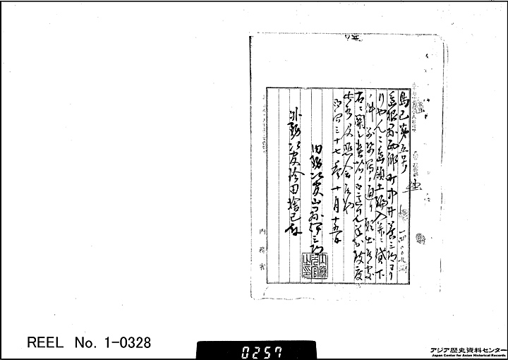
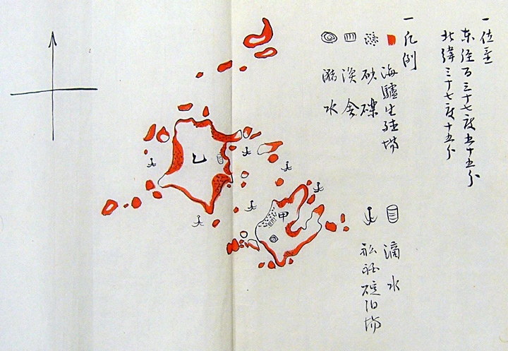
On the shore at the curvature of the islet there is gravel that looks like a beach, but there is only one place where one can build a house on Islet A, facing the channel. In the middle of the Islet A there is a water pond, which looks brownish. On Islet B, there is slightly salty water dripping down from the cliff. Ships can be safe if they drop anchor in the channel, shifting toward the left or right to avoid winds. This island is located on the route that ships take going back and forth between the Japanese mainland, through Oki islands and Ulleungdo, to Joseon’s Gangwon (江原) and Kamkyeong (咸鏡). provinces.
It would be convenient if there is someone who lived on the island and manage it. For example, he can offer firewood, water, and food to ships who lack them. It would benefit Japan’s fishery and trade with the Gangwon and Kamgyeong districts, which is now on the increase. Therefore, the management of this island will be most necessary.
This island is only a rock island rising into the sky in the distant sea, so no one pays attention to it and it has been left untouched. However, I land at the island whenever I was go to and from Ulleungdo and have seen lots of sea lions living there. I have thought that it was not good to leave it untouched, and have made various plans.
In the 36th year of Meiji (1903), I decided to invest and built a fishery house there, moved workers there, prepared fishing gear, and started hunting sea lions. At that time, people laughed at me saying it’s reckless. Of course, if somebody starts a new business on an uninhibited island, they risk failure, lose of equipment, and other things, and I didn’t know how to hunt sea lions, and was unsure of their use and marketability. I wasted lots of money, but after much effort, I developed a hunting method, product manufacturing techniques, and other inventions this year, so I began to market them.
Their skin, after preserving it in salt, will be used as a substitution for cowhide, which is used in many ways. The oil from their fresh grease is equal to whale oil in quality and price. I confirmed that its well-squeezed dregs can be used for glue, and its meat will be made into powder and mingled with bone to make fertilizer. That means hunting sea lions at this island is promising. However, there will be no business on this island other than sea lion hunting.
I haven’t researched it, so I am not sure of fishing in the area, but since it is in the middle of the Sea of Japan, there should be various fish around the island. If sea lion hunting continues, and if I am given a chance to research it, I think there will be a chance to start other new promising businesses in the future. In short, if someone has enough capital and equipment and started hunting sea lions, the management of this island will be very promising. However, the ownership of this island undetermined.
The other day I met a foreign ship in trouble. Such unexpected events can occur, but without firm protection, investment of lots of money in this island will be very dangerous. The sea lions on the island do not always live there. Every year in reproductive months, April and May, they come there and then leave in July or August after reproducing. So the hunting will be conducted during that season. Therefore, if hunting is not limited and reproduction not properly protected, the sea lions will soon vanish. However, limiting hunting and protecting reproduction cannot be managed if there is competition.
People gather around beneficial things like ants gather around sweets. If they know sea lion hunting is beneficial, people, including the ones who first laughed at me, will come and compete. They will exhaust all the sea lions by overhunting. In the end, collapse of all the hunters is inevitable. As I have said, I have tried various things and now prospects are good for hunting sea lions at this island. I want to increase capital and put various production machinery there and have fishery equipment for fishing. I want to limit the size and count of my catch, protect the sea lions, especially females and infants, and make preserves somewhere on the island. I want to expel the killer whales and sharks that hurt the animals, but as I have already said, I cannot because of the mentioned risk. This would be not only disadvantageous not only to me, but also to the nation.
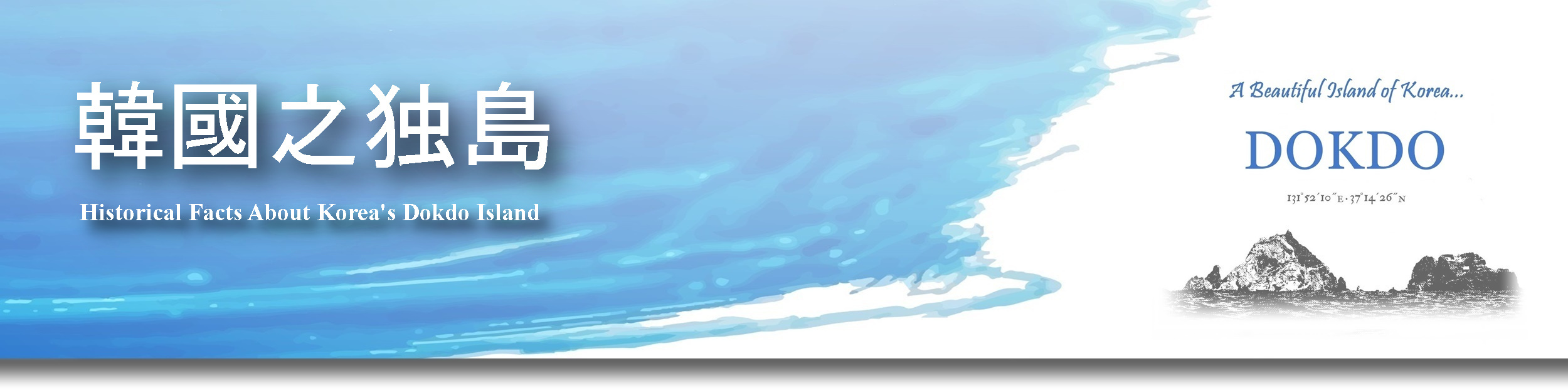
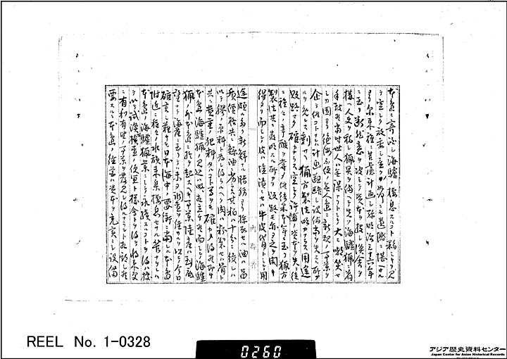
Therefore, in order to assure the safety of the business and to complete the management of the island, please swiftly incorporate this island into Japan’s territory and simultaneously lease it to me for the next 10 years.
I am enclosing a drawing.
29th of September, the 37th year of Meiji (1904)
Shimane prefecture, 周吉gun, Saigo cho, Nishimachi
Yozaburo Nakai
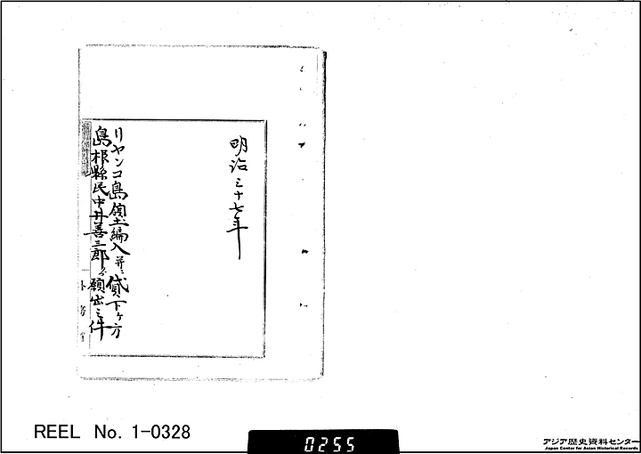
Submitted To:
The Minister of Home Affairs Akimasa Yoshikawa,
The Minister of Foreign Affairs, Baron Sir Jutaro Komura,
The Minister of Agricluture and Commerce, Baron Sir Keigo Kiyoura…”
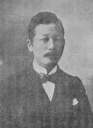 Who was Yamaza Enjiro?
A diplomat born in Fukuoka, he was the son of an ashigaru (a samurai of the lowest rank) for the Kuroda Clan. In 1892, he graduated from the Law College of the Imperial University. He then entered the Foreign Ministry and served as resident staff in Pusan, Shanghai, Incheon, London, and Korea. In 1901, he became the director of the Political Affairs Bureau. Under the foreign minister Jutaro Komura, he was involved in forging the Anglo-Japanese Alliance, negotiations with Russia, and diplomacy concerning the war against Russia. He also attended the Portsmouth Peace Conference as one of the staff in attendance, thus playing a central role in the Komura Diplomacy.
Director Yamaza Enjiro was known to have been under the influence of the nationalist, rightist organization of the Genyosha. The Genyosha was a terrorist organization, recruited disaffected ex-samurai, it also attracted figures involved in organized crime to assist in its campaigns of violence and assassination against foreigners and liberal politicians. Being the son of a samurai it’s not surprising Yamaza Enjiro was affiliated with the radical, right-wing Genyosha.
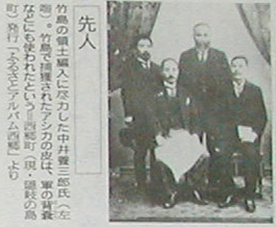
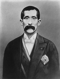
 A quick glance at Nakai Yozaburo’s application to lease Liancourt Rocks shows his request was forwarded to the Minister of Agriculture and Commerce Count Kiyoura Keigo. (shown to the left) Below is a brief summary of his political affiliations.
A government official, statesman Kiyoura Keigo was born in Kumamoto, the son of a Buddhist priest. He went to Tokyo and started working for Saitama Prefecture. In 1876, he entered the Justice Ministry. In 1884, under the then home minister Aritomo Yamagata, he became Police Security Department director in the Home Ministry and focused on such matters as the enactment of the Peace Preservation Law.
As a powerful official in the faction of Yamagata, Count Kiyoura Keigo exerted influence over the political community. In 1891, he was selected as a member of the House of Peers by Imperial nomination. Kiyoura accepted a second imperial order in 1924 and become 23rd Prime Minister of Japan. However, his cabinet was formed at a time when non-partisan, aristocratic cabinets were falling out of favor.
 As mentioned, Kiyoura Keigo was a powerful member of the Japanese Government’s Yamagata Faction. What was the nature of this political group? Aritomo Yamagata is considered one of the architects of the military and political foundations of early modern Japan. Yamagata Aritomo was the father of Japanese militarism.
Yamagata in 1877 led the newly modernized Imperial Army against the Satsuma Rebellion led by his former comrade in revolution, Saigō Takamori of Satsuma. At the end of the war, when Saigo’s severed head was brought to Yamagata, he ordered it washed, and held the head in his arms as he pronounced a meditation on the fallen hero
From 1900 to 1909, Yamagata opposed moderates like Ito Hirobumi, leader of the civilian party, and exercised influence through his protege Katsura Taro. Yamagata was an advocate of a strong foreign policy, based on the need to extend Japan’s defense perimeter to Korea and the Asian mainland. Kiyoura Keigo being a staunch supporter of Aritomo Yamagata’s military expansionist policy, obviously would have forced through the annexation of Liancourt Rocks regardless of Korea’s territorial limits.
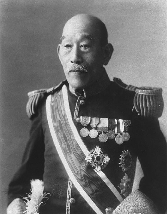
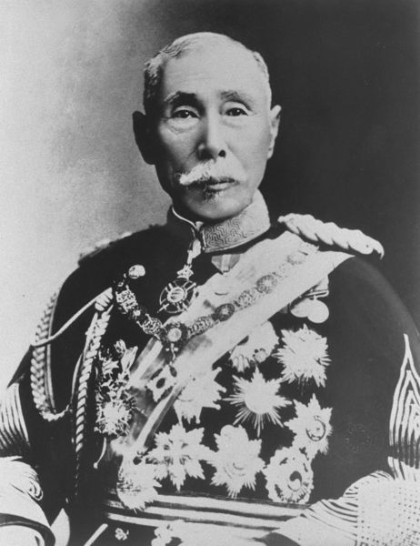
 As Nakai Yozaburo’s application above shows, Nakai Yozaburo’s application to lease Liancourt Rocks was forwarded for approval to Japan’s Minister of Foreign Affairs Komura Jutaro. (shown left) A brief outline of this man’s history gives us insight into Japan’s reasons for annexing Liancourt Rocks.
Komura, like Yamaza Enjiro, was the son of a samurai. He was born to a humble family in the Obi clan at Nichinan, Hyuga province (present-day Miyazaki prefecture). He attended the Daigaku Nanko (predecessor of Tokyo Imperial University). In 1875, he was selected by the Ministry of Education as one of the first students to study abroad under a government scholarship, and later graduated with remarkable English ability from Harvard University’s Law School in 1878. In 1880 he joined the Ministry of Justice and after serving as a judge of the Supreme Court, in 1884 transferred to the Translation Bureau in the Ministry of Foreign Affairs.
Komura was deeply involved with Japanese interests in Korea and the Asian mainland well before the incorporation of Takeshima. In 1895 He helped draft the Shimonseki Treaty after the Japanese defeated the Chinese in the Sino-Japanese war. This treaty helped give Japan a “free hand” in Korea and force China to cede the Pescadores, Formosa (Taiwan) and Liandong Peninsula (Dalian, Shenyang)
In 1902 Komura was given the task of negotiating the Anglo Japanese Treaty. This agreement allowed Japan a free hand in both China and Korea and assured Great Britain would assist Korea if a third party threatened Japanese interests there. After the Russo~Japanese war of 1904~1905 Komura Jutaro took part in the negotiation of the Treaty of Portsmouth that stated Russia would not interfere with Japanese interests in Korea both political and military.
In Korea during August 1904 a Pro-Japanese American, Durham Stevens, a diplomatic advisor, was installed by Japan in accordance with the First Korea-Japan Agreement of August 1904. Documents found, show secret instructions given by the Japanese Foreign Minister, Komura Jutaro, to Stevens clearly demonstrate that he, being employed by the Korean government as recommended by Japan, was charged with bringing all important diplomatic activities of Korea in line with Japan’s strategy toward Korea and, if deemed necessary, to consult with the Japanese Consulate stationed in Seoul.
 Komura’s memorandum instructed Stevens that he must a) refer to the Japanese government in all important details, b)Japanese policy vis-a-vis Korea will from time to time be confidentially be made known to him and he must not diverge from this policy. C) in all matters of high importance he must promptly and frankly communicate with a Japanese representative. Against this backdrop, one can reasonably infer that any protest by the Korean Empire, even if it had been aware of Japan’s 1905 incorporation measure, would have been virtually blocked.
Five years after the Japanese would seize Dokdo, Komuro Jutaro would play a central role in the colonization of Korea under the Katsura government. Before Korea’s annexation both Katsura and Komuro worked in extreme secrecy and devoted themselves to these administrative tasks waiting only for the appropriate moment to take over Korea.
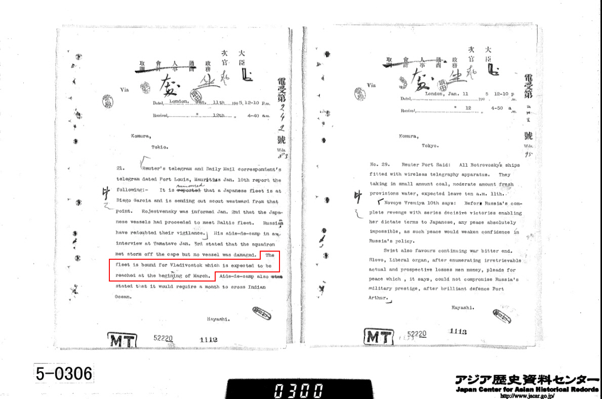
Records from Japan’s Russo~Japanese War (1904~1905) archives (above right) detail how Komura Jutaro received telegrams on an almost daily basis reporting the location of Russia’s approaching Baltic Fleet. A mere two weeks before annexing Dokdo, Komura Jutaro was sent a message confirming Russia’s Navy would be sailing through Dokdo’s adjacent waters en-route to Vladivostok (see details). To help posture for the battle Komura Jutaro with the help of Admiral Kimotsuki ( see below) surveyed Dokdo, annexed the island and then installed watchtowers there.
Foreign policy in the annexation of Liancourt Rocks would be guided by Kumuro Jutaro. His years of experience working in foreign affairs and international law would determine how Japan would handle legal issues such as how public the Shimane Prefecture Inclusion would be, and if other countries would be notified. Japan’s so-called “public announcement” is a reflection of how cautious the Japanese were to keep their annexation of Liancourt Rocks somewhat “legal” but still manage to keep it by and large a secret measure.
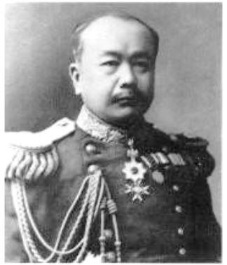 Kimotsuki Kaneyuki, a director of Hydrography Department, and a mayor of Osaka, was born in Kagoshima(鹿児島) in1853. He is a nephew of Komatsu Tatewaki Kiyokado (小松 清廉(帯刀) ). The lieutenant of naval forces(海軍中尉), is known as the first Japanese who observed latitude by the Talcott Method, and obtained the value of 35 degrees 39 minutes 17 seconds 492 of north latitude in the Tokyo Azabu naval forces marine meteorological observatory in 1876.
During the Russo~Japanese War of 1904~1905 the Hydrographic Department became utilized for strategic purposes. In early September of 1904 the Japanese warship Niitaka reported Russian warships were seen near Dokdo Island. (see link ) The Japanese navy then ordered a survey of Dokdo in November and submitted a feasibility report for the construction of naval watchtowers and telegraph station on Dokdo to Kimotsuki Kaneyuki on January 5th 1905. ( see link ) Dokdo Island was annexed immediately after it was realized it could be used for these purposes. These instructions reveal Japan’s military agenda for Dokdo Island and thus the incorporation was not peaceful or natural.
Kimotsuki Kenko examined a map of the Dokdo Takeshima region and determined Liancourt Rocks were closer to Japan’s mainland than Korea. From this simple baseline distance comparison Japan unilaterally decided they should annex the islets. Absolutely no consideration was given to Dokdo’s most proximate island, Chosun’s Ulleungdo. From this we know Japan’s geographic basis for annexing the island is out of line with today’s modern maritime law which allows for EEZs to extend beyond large inhabitable islands.
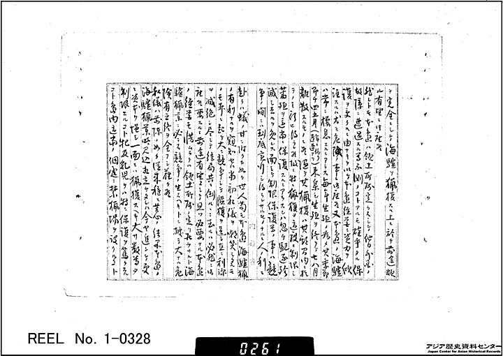
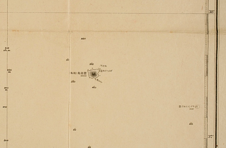
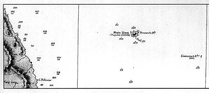
“We have examined the matter about the uninhabited island which the Secretary of the State for Home Affairs applied as seen on another document, and we didn’t find any traces of occupation by any other countries of the uninhabited island at latitude 37°9’30” N,longitude 131°55′ E, which is located at 85 sea-miles northwest of Oki island.
A Japanese citizen named Nakai Yozaburo began sea lion hunting at the island two years ago in the 36th year (of Meiji, 1903) after he built a hut for fishery, transferred laborers and got proper fishing gear. As he petitioned to incorporate the island and to lend it to him, (the officials) came to need to clarify the belonging to which prefecture and the name of the island – so they named it as Takeshima and asked to make it control under the jurisdiction of the local government of Oki island of Shimane prefecture from now on.
So we examined the matter and found that there is a fact of occupation under the international law as it is clear from related documents that Nakai Yozaburo moved to the island since the 36thyear of Meiji (1903) and has engaged in fishery there. So we think that we may make it belong to Japan and put it under the jurisdiction of the local government of Oki island of Shimane prefecture. So the decision was made by a Cabinet meeting to approve the petition…”
Nakai was not living on Liancourt Rocks at this time. These barren rocks could not sustain human life as there is no potable water to found on the islets. Liancourt Rocks could offer no shelter during the harsh weather that frequents the East Sea (Sea of Japan). Nakai also stated he had built a fishery house and moved workers there. Is this true?
The real situation on Liancourt Rocks at this time (not surprisingly) was recorded by the Japanese warships Niitaka and Tsushima in the fall of 1904 just months before the above announcement. On September 25th the logbook recorded that those who hunted seals on Liancourt Rocks used Ulleungdo Island from which to conduct their activities, (link) only visiting Liancourt for about 10 days at time and only during fair weather in June or July. It’s not clear if these fishermen were both Korean and Japanese or just the latter. Nakai also states on his application he noticed Liancourt Rocks while en route to Ulleungdo.
The “house” Nakai Yozaburo refers to on his application was little more than a temporary shack. In fact, the logbooks of the Japanese Warship’s November 20th (link) survey describe this “house” it states “..On the East islet stands a little hut, which is used by fishermen to catch sealions in the summer. Now only the ruins of it lie after its sudden destruction. Judging by what is left of it, one can only imagine how powerful the winds and waves must have been when the damage was done. …”
Shimane Prefecture’s announcement states they found no trace of occupation by Koreans on Liancourt Rocks. However there is no historical data to show us how they arrived at this conclusion. Korea, the most proximate country and within visual distance from Liancourt Rocks was never contacted, nor was there any announcement at a central government level.
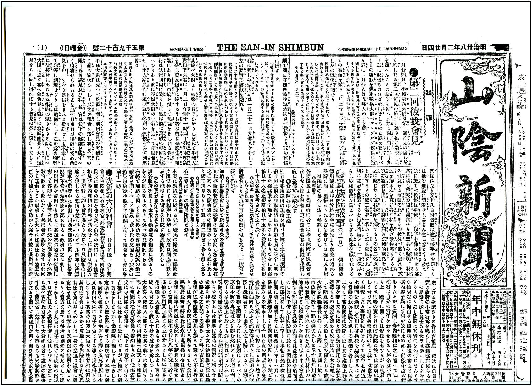
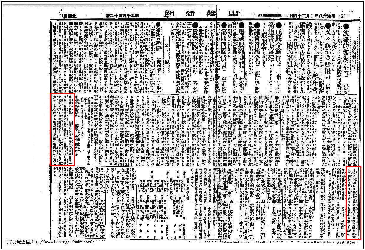
When we read the above article it’s immediately apparent there is no mention of Liancourt Rocks in Shimane’s “announcement”. In documents and maps both European and Japanese of this era Dokdo / Takeshima was almost exclusively referred to as “Liancourt Rocks”. The announcement is on the second page, without headlines, broken in half and little larger than a classified ad in the personals section. It’s not clear how many people actually read the San-in Shimbum in 1905. It’s highly unlikely the above ad was seen by many Japanese people, and was certainly not read by citizens of other concerned nations.
This explains why Koreans were not aware of Japan’s annexation of Dokdo until Uldo County’s Governor Shim Heung Ta was told in person in 1906. It also explains why the Japanese themselves failed to include Takeshima on so many of their own maps of Japan and Shimane Prefecture after the island was annexed. It seems many Japanese themselves weren’t aware. This was how Japan announced extending her international boundary 160kms westward, within visual proximity of Chosun’s Ulleungdo Island.

From a political standpoint Japan was very worried if she appeared to use a heavy-handed approach in Korea this may cause European nations to intervene in Japanese affairs there. Komura Jutaro who helped process Nakai’s Liancourt Rocks application would have remembered the Triple Intervention of 1895 when the terms of the Shimonseki Treaty he helped draft was scrapped by the Germans, Russians and French. At this point in time Japan’s interests in Korea were only supported by the Anglo~Japanese Alliance. Japan wouldn’t receive American support until the secret Taft~Katsura Agreement later that year. Germany still supported Russian interests during this time by helping the Baltic Fleet coal their ships as they steamed to assist the Russian Fleet in Port Arthur. Thus Japan was very cautious in her foreign policy toward Chosun.
From a military or strategic standpoint, it would be a foolish measure to publicly announce the annexation of Liancourt Rocks and then station naval personnel there. We must remember Japan was at war with Russia at this time and the East Sea (Sea of Japan) was a major battleground. Japan would lose the advantage of stealth surveillance by an open declaration of Liancourt’s incorporation. Those who would be stationed on Liancourt Rocks would be isolated and vulnerable to attack from the Vladivostok Fleet to the North. Japan still needed time to install proper communication and surveillance facilities on Liancourt Rocks. The islands rough topography made construction possible only during the summer’s calm weather.
In the case of the Bonin (Ogasawara) Islands in 1876, for instance, the Meiji government provided notifications to consular offices in Tokyo, such as those of the United States, France and Germany. Afterwards, the Meiji government decided to incorporate the islands and instructed a relevant local government agency to do so. Likewise, the standard procedure the Meiji government followed seems to have been to verify whether the territory concerned belonged to any other sovereign by means of notification in advance of referring it for a final Cabinet decision. As far as Dokdo is concerned, however, these notification and verification procedures were conspicuously omitted despite the Meiji government’s strong presumption of Korea’s territoriality over Dokdo.
Such factors as the geographical proximity of Dokdo to Ulleungdo as well as Japan’s express affirmation of Korea’s sovereignty over Ulleungdo makes the Dokdo case distinguishable from other international precedents. Above all, given Japan’s prevailing perception that Dokdo belonged to Korea, (link) or at least its doubts regarding the ownership of Dokdo, the Japanese government should have formally solicited an opinion from the Korean side. In other words, Korea should have been given an opportunity to raise an adverse claim.