
In this three page series however, original historical records from three of Japan’s battle cruisers the Niitaka, the Tsushima and the Hashidate help to remove the veil of secrecy that once concealed the motivation behind Japan’s claim to Dokdo. The ships’ records are arranged chronologically to show how the Japanese Imperial Navy systematically surveyed, mapped and zoned Dokdo Island before the island was finally integrated into Japan’s war plan against the Russian Navy during the Russo~Japanese War of 1904~1905.
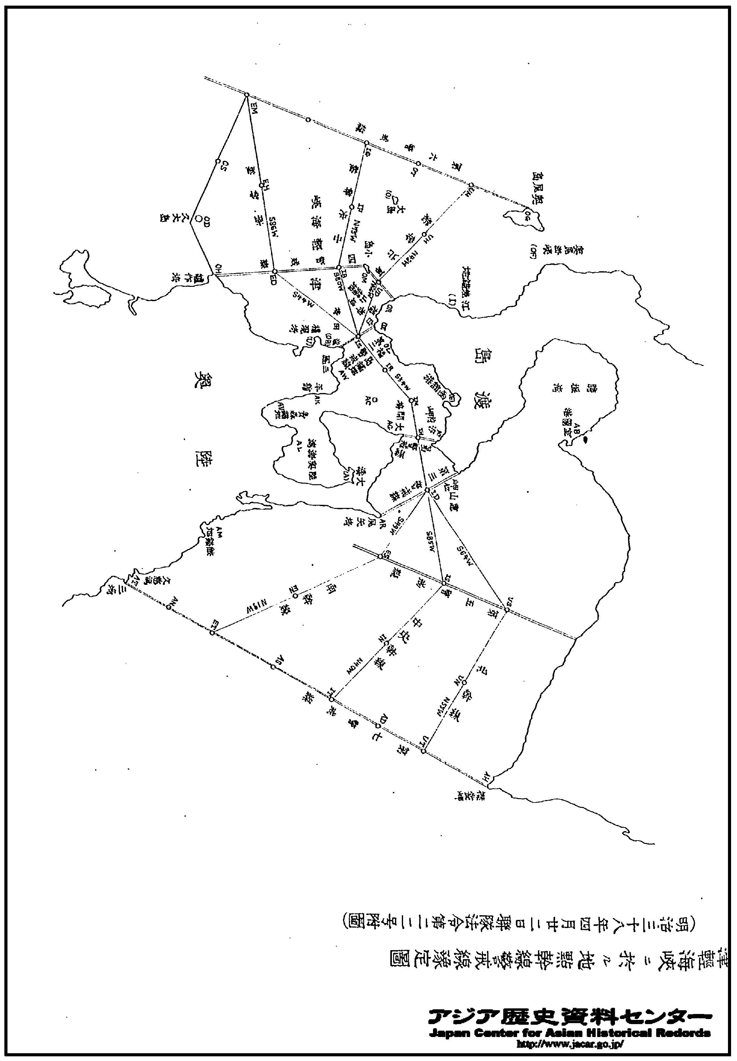
To aid their Pacific Fleet the Russian navy dispatched the Baltic Fleet which would have to sail 18,000 miles to assist the besieged port. However, before the Baltic Fleet could arrive Port Arthur fell to the Japanese. Original Japanese historical navy maps below shows the path of the Russian Baltic Fleet it is highlighted in green. (by author)
The Battle of Tsushima that would follow would go down as one of the most decisive naval conflicts in history. It was also dubbed the “Tsushima Massacre”
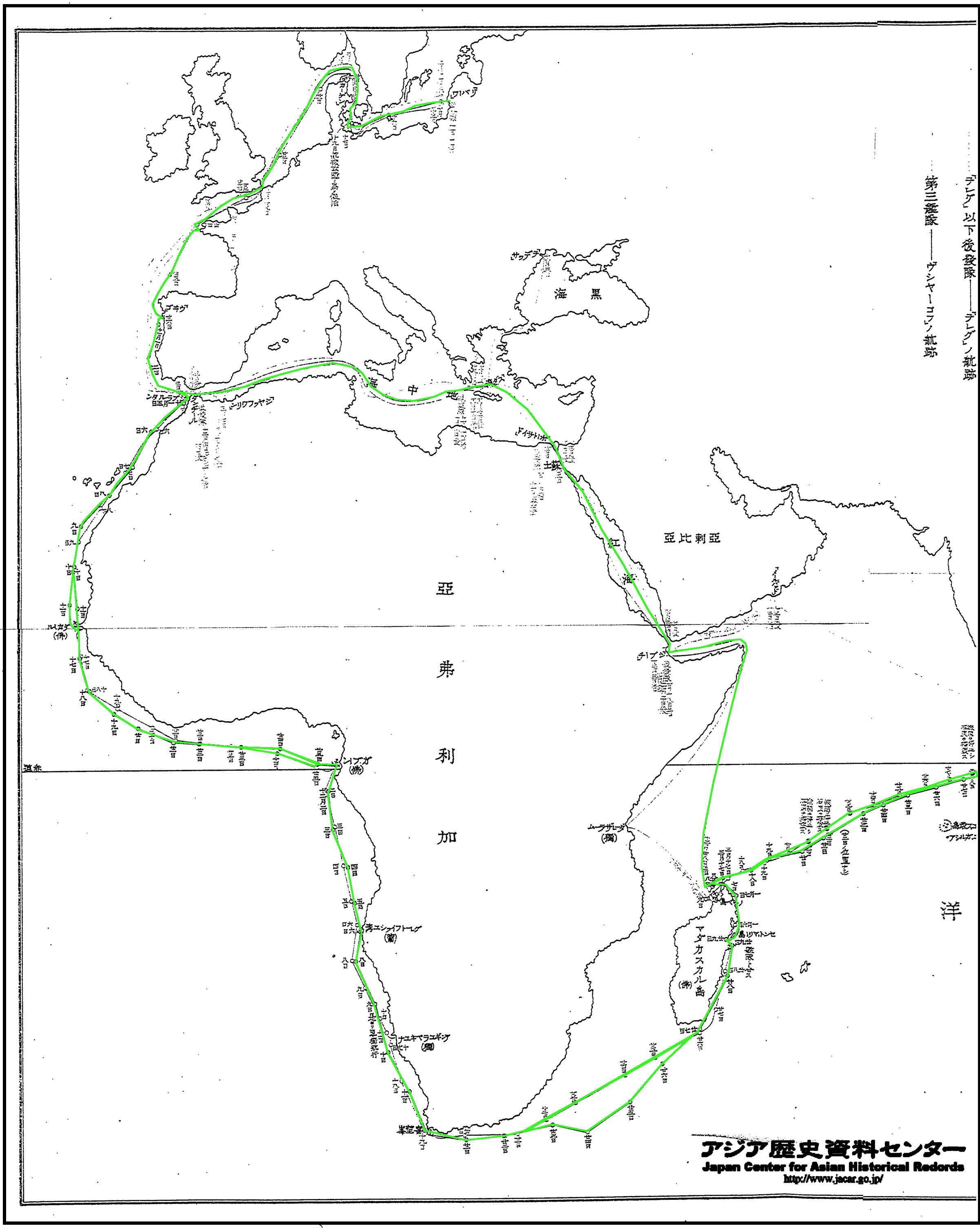
There were three routes the Russian Baltic Fleet could take to reach Vladivostok.
1. They could steam through the Chosun Straits to the West of Tsushima Island.
2. They could sail through the Tsushima Straits to the East of Tsushima Island.
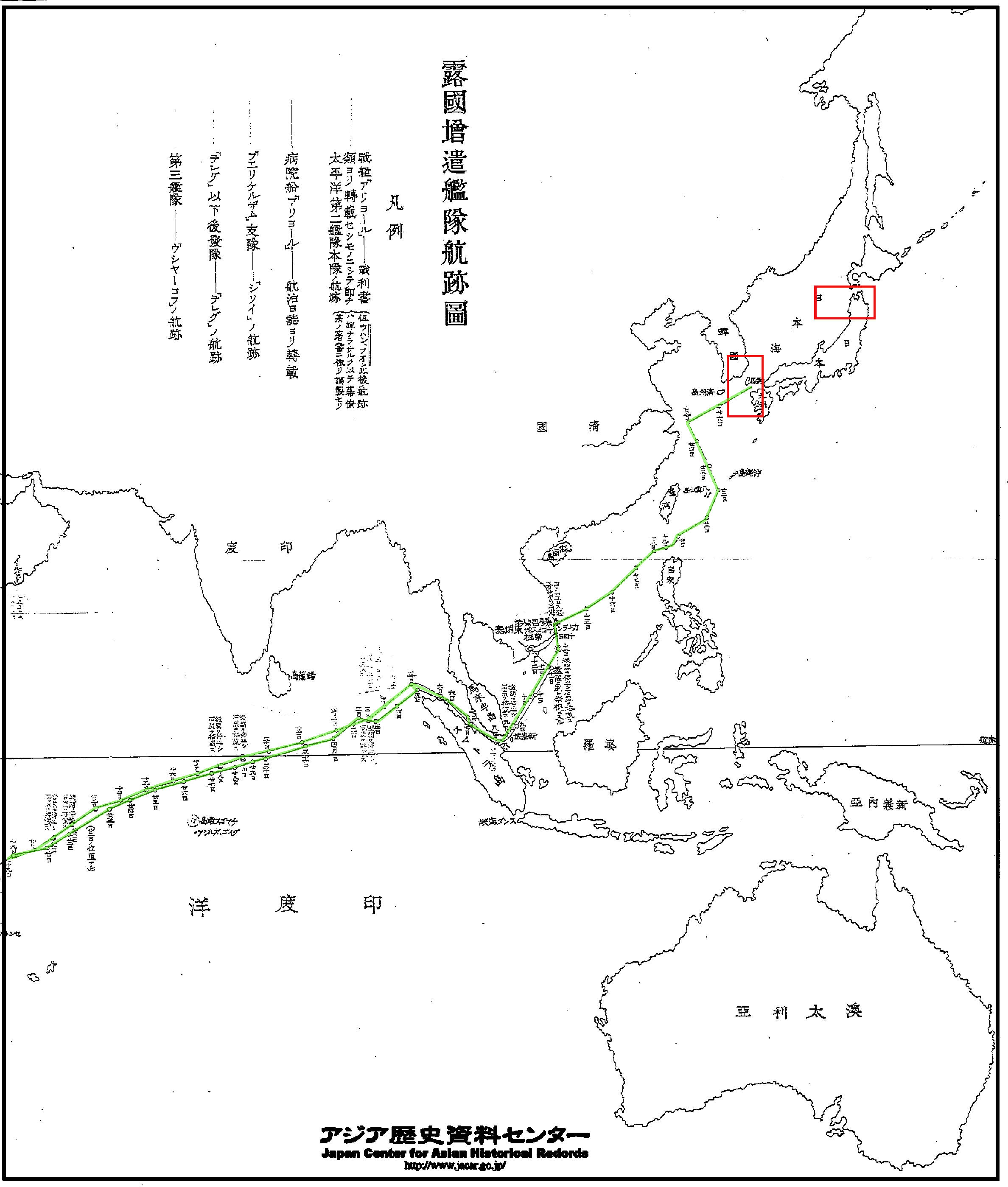
3. They could travel all of the way around Japan’s East Coast and then through the waters between Hokkaido and the Japanese main island of Honshu. This would require extra coaling at sea which was very dangerous. This route was highly unlikely. Nonetheless, as the maps below show, Japan devised a plan should this happen.
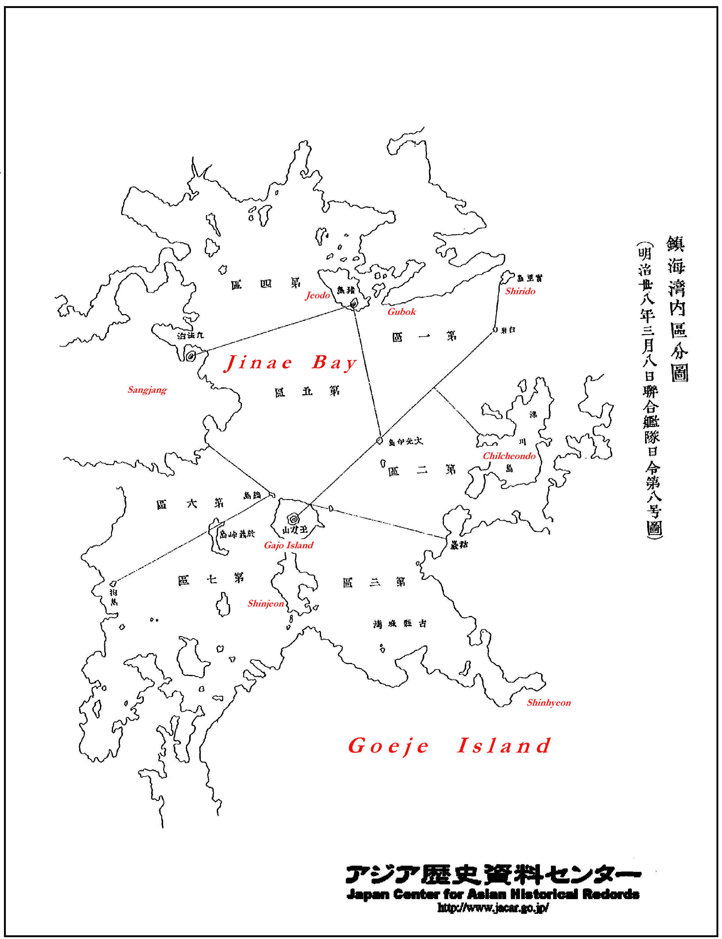
As the Japanese prepared a war plan for the advance of the Russians, the map above shows how the Imperial Navy mapped, zoned and then assigned certain naval regiments to each area that lie en route to Vladivostok Harbor in Russia. It is not plausible such an complex war plan was drafted overnight. Thus, well before Shimane Prefecture Incorporated Liancourt Rocks, (Dokdo/Takeshima) was already integrated into the Japanese Imperial Navy’s war strategy. Dokdo (marked in blue above) can be found within the boundaries of the region marked as the central regimental area. The most disturbing aspect of this map is that some of the areas zoned as under Japanese naval control were not part of Japanese territory.
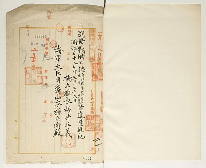
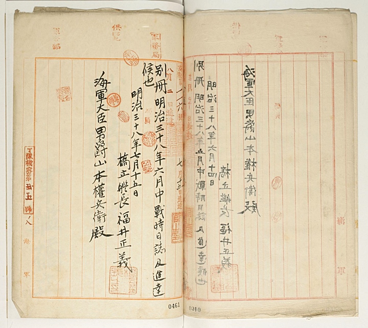
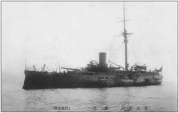 The IJN Hashidate (橋立) was a protected cruiser of the Imperial Japanese Navy, designed by Emile Bertin, and built by the Yokosuka naval shipyards in Japan. The Hashidate (right) was the 3rd and last ship in the Matsushima class, and was the only one constructed in Japan. During the Russo-Japanese War, the hopelessly obsolete Hashidate and her sister ships were assigned to the 5th squadron of the reserve 3rd Fleet.
The Hashidate’s survey of Dokdo took place immediately after the Battle of Tsushima on May 28th 1905. As shown Japan had already noted the strategic importance of Dokdo almost a year before. As the seas around Ullungdo and Takeshima/Dokdo became the main sea battleground, the island’s military value came to be highly valued.
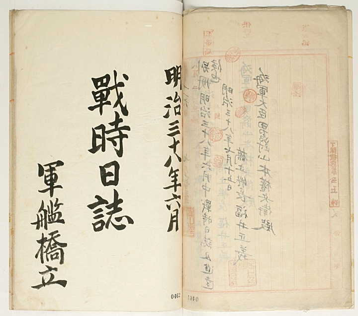
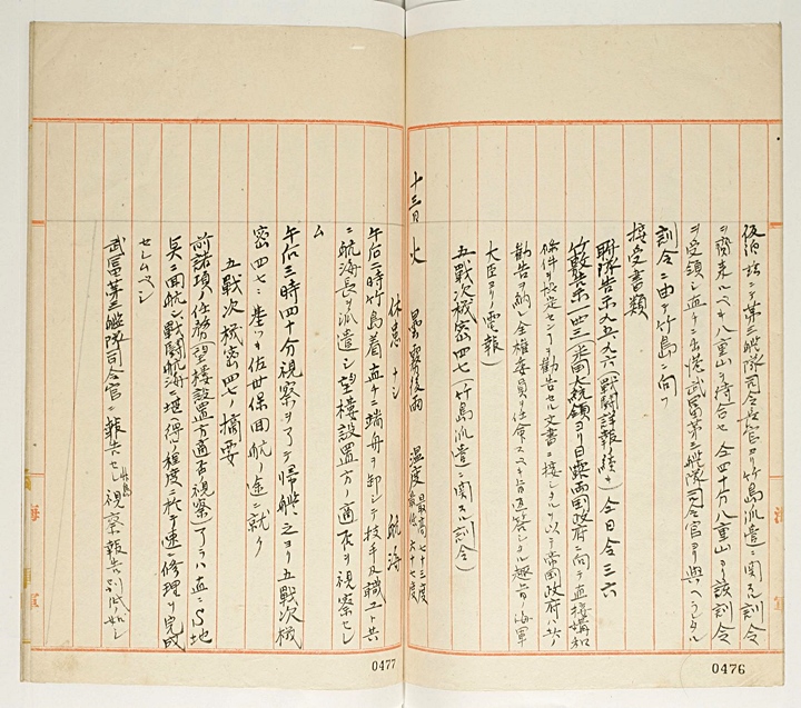


June 1905
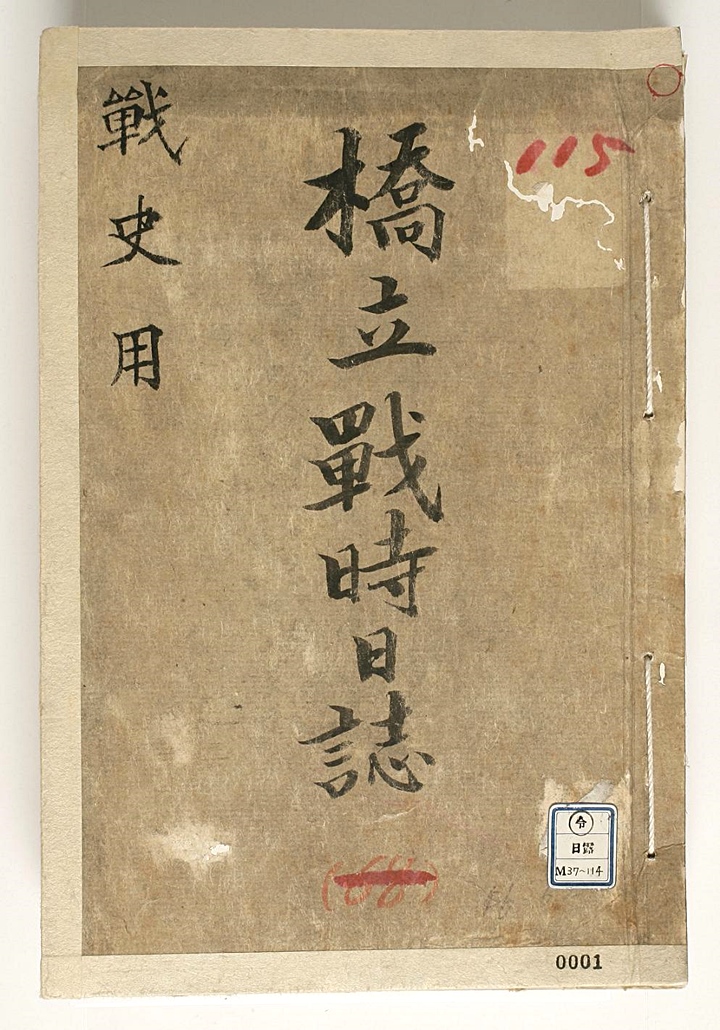
Wartime Log of the Warship Hashidate
Page 4
No. 34, 35
“..One Petty Officer Second-Class boarded
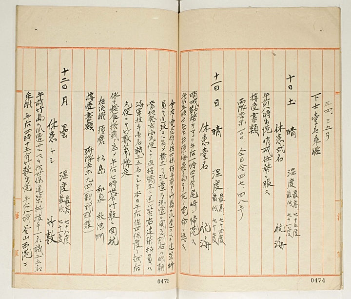
Saturday, June 10th Clear Temperatures: HIgh 75 F Low 71F
Number of sick personnel: 2
Departed at 8:00 A.M. Watched for any signs of attack. We received notification #100. Orders #47 and #48.
Sunday, June 11th Clear Temperatures: High 74 F Low 70 F
Number of sick personnel: 1
After serving watch duty, we returned to Ojaki at 1:40 P.M. At 5:25 P.M. we received telegraphic order as below from Eup Island in Jinhae…”
“..Headquarters in Sasaebo dispatched some personnel of the construction department, who are to be sent over to Takeshima (Dokdo) on the Hashidate. Instructions of the dispatch are to be delivered directly to the Hashidate via the Kenkai Maru (ship name) which departs from here tomorrow morning. One navy engineer and five other workers of the construction personnel mentioned above are to arrive at Takeshiki this afternoon via the Haechiko Maru in Sasaebo (naval base, Nagasaki).
At 7:35 P.M. we thus went to Takeshiki to load up with provisions.
Ships at anchor, the Su-ah, the Matsushima, the Izuma and the Akijushima.
Received papers: Regimental notification 94 (report of war details)
Monday June 12th Cloudy Temperatures: High 78 F Low 71 F
Number of sick personnel: none
In the morning one engineer and five other workers from Sasaebo’s Construction Dept. boarded to be sent to Takeshima (Dokdo) At 4:15 P.M. we departed from Takeshiki. At 8:00 P.M. we temporarily moored at the West harbour of Busan…”
Page 6
“…While anchored, we waited to receive another directive to dispatch onto Takeshima (Dokdo) from the 3rd Fleet Commander at Ya-ae Mountains, and then departed immediately. Following the order from Taketomi, the 3rd Fleet Commander sailed for Takeshima (Dokdo)
Takeshiki Notification #143 (A letter direct from the American President came to be known advising a peace treaty between Japan and Russia. the Japanese government will reply saying it will accept that suggestion and appoint a plenipotentiary. The above was a telegraph from the navy)
Confidential information #47 (directive on dispatch to Takeshima (Dokdo)
Tuesday June 13th Cloudy, Rained after fog Temperatures High 73 F Low 67 F…”
“…Number of sick personnel: none
At 2:00 P.M. we arrived at Takeshima (Dokdo), and without delay lowered a small boat down with the engineer and workers as well as a navigating officer on board. then they were dispatched to investigate the suitability for watch tower installations
At 3:40 P.M. they returned after finishing their investigation. From then on, according to the 5 Jeoncha confidential information #47 set off toward Sasaebo.
Summary of the 5 Jeoncha confidential information #47:
After accomplishing those special missions above (investigating the suitability of watchtower installations), return to the locations, and complete repairing promptly to prepare for battle navigation without any obstacles. We reported to Taketomi, the 3rd Fleet Commander. The report of Takeshima investigation is as to the appendix…”
Page 8
“..The Report of Takeshima (Dokdo) Investigation
According to the order we departed from Takeshiki on June 12, 1905, arriving about 1 ri at the East side of the East Islet on Takeshima at 2:00 the next afternoon. While floating on location, we lowered a small landing craft to dispatch the investigating officer Lieutenant Okuura and Lieutenant Second-Class Okida as an assistant to investigate the suitability of watch tower installations. The engineer and other workers from the Sasaebo headquarters were included in the dispatched group.
The Report of the Investigation by the officers above is as follows.
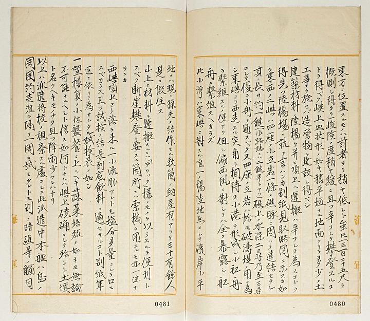
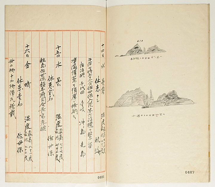
1. Takeshima consists of two rocks standing next to each other. The West Islet, very rocky and barren, stands high (410 feet in altitude), but all around are precipitous cliffs, which make climbing very difficult. There are no flat areas on top of this islet and no place for installing watch towers because of its steep, erect, peak…”
Page 9
“…The East Islet stands less high than the other one (estimated to be 325 feet in altitude) and not so steep as to make climbing possible even though it could be challenging. On the top of this islet is a relatively flat, dish shaped area, and it will be possible to erect structures by dumping landfill.
1. It will be challenging to unload construction materials onto land and carry them to the top. As far as landing locations, after some trials, they are shown in the attached map. All around the East and West Islets are a row of single-formed reefs connected to each other, which is about one ryeon (600 feet) recorded as two and a half ryeon in the document of sealanes) long and two or three shim deep (about 16~24 feet) around to the top of the reefs. A small boat can easily make it through, and reefs all around are laid out like dykes. To the West of the East islet are pointed rocks joined together which forms something like a miniature harbour. And this offers convenience for small boats to be moored although it can’t last long because of the strong winds blowing from the West. This little harbour, compared to the East Islet, is the only way to make it to land, and in some small flat areas on the seashore…”
Page 10
“…are currently a few little huts built by fishermen, where about 30 people are temporarily staying. To transport materials to the top of the mountain, a machine like a derrick would be useful, and to climb up the steep cliffs another machine (bulldozer?) could be considered as an option. From the top of the West islet runs down a little stream but the water contains too much salt to drink. A test result shows the water is not suitable for drinking.
1. It is not possible to plant vegetables as well to provide watch tower personnel with food because the top of the island is too infertile to be called soil and there is not enough precipitation.
The above so far is the survey by a dispatched officer, and during this inspection the ship circumnavigated the island keeping a distance of one ri (4kms) away and didn’t observe any particular reefs. ..”
Page 11
“…To the northwest of the East Islet, however, lies a line of a reef, which is estimated to be two ryeon (1,200 feet) long.
Now is the hunting season for seals on this island, and about 35~36 fishermen from Oki Island are catching a large number of seals with rifles and nets. What has been learnt through a talk with these fishermen during the survey was thought to be useful and therefore recorded below.
The island has an abundance of sea lions, and from mid-April till mid-July by lunar calendar fishermen stay here to engage in seal hunting. What can be obtained from those seals is their skin and oil, which are sent to Osaka and produce 4,000~5,000 yen of income yearly. Currently a man named Nakai Yozaburo from Okino is in charge of these fishermen. He says that if there are applicants for the winter this year,…”
Page 12
“…he’s willing to spend his winter on the island. Other than sea lions, a small amount of abalone is also caught. In terms of weather, in the summer it gets very hot during the midday and quite cool in the morning and the evening. The worst hot spell comes in June by the lunar calendar. The island gets thick fog and a very small amount of rainfall compared to Japan. The nearby currents, like the ones in the northeast, are not slow, and the difference between high and low tides is about four feet. According to this report, it is believed to far exceed four feet , but this figure is considered doubtful according to local fishermen. Because there are no trees and water on the island, they go to Okino and come back once or twice a month to be provided with food, wood, and other things.
This report is recorded as above…”
June 15th, 1905
Page 13
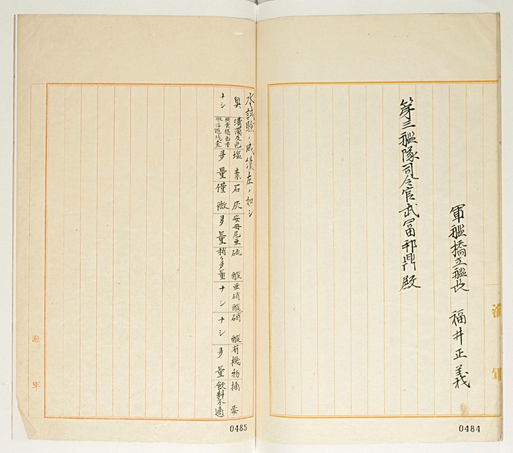
“…From Hukui Masayushi, Captain of the Warship Hashidate to Taketomi Kunikanae, Commander of the 3rd Fleet…”
Page 14
“..Results of the water test (Takeshima/Dokdo) are as follows:
Odor: Odorless
Clarity and colour: Light brown, microscopic floating particles.
Chlorine: A large quantity.
Coal: A small quantity.
Ammonia: Large quantity.
Lactic Acid: Slightly large quantity.
Nitrous Acid: None.
Nitric Acid: None.
Organic Matter: Great quantity.
Conclusion: This water is not suitable as drinking water…”
“…Wednesday, June 14th Weather: Cloudy and Foggy. Temperatures High 74 F Low 70 F
Number of sick personnel: none
At 7:52 P.M. we arrived at Sasaebo. Moored to No.6 Bouy. Other anchored ships included the Chiyoda, the Iki, the Okinoshima, and the Mishima. We stored the prepared ammunition in the warehouse.
Thursday, June 15th, Weather: Cloudy. Temperatures High 77 F Low 72 F
Number of sick personnel: Two Sasaebo.
Samaejima, Commander of Sasaebo Naval Base gave an inspection.
Friday, June 16th, Weather: Clear Temperatures High 81 F Low 72 F
Number of sick personnel: One Sasaebo
Mounted 32cm, 12 cm ammunition…”
It seems those who lobby to have Takeshima returned to Japan are of two minds. Those whose opinions are extremely right wing and don’t care, or those who haven’t studied the historical facts of Japan’s only documented claim to Takeshima in 1905.
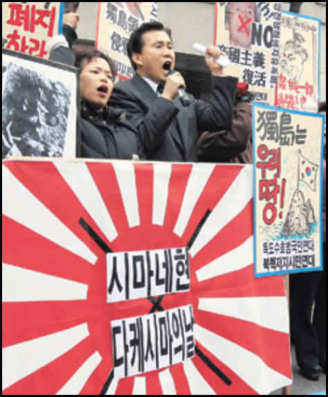 The purpose of pointing out Japan’s military activities of the past isn’t to vilify the Japanese but rather to give historical context to the Shimane Prefecture Inclusion. Also, these pages are intended to show that Korea’s outrage and disappointment over Japan’s repeated attempts to re-establish sovereignty over Dokdo are not based on blind nationalism.
Japan’s own primary military maps and documents are proof positive that the 1905 annexation of Dokdo was little more than a stepping-stone to control Korea and the overall plan to colonize her. After all, Japan annexed Dokdo for the purpose of defeating Russia in war fought over the exclusive rights to control Korea and the Liandong Peninsula (Port Arthur-Dalian)
With Japan having no historical claim to Dokdo prior to 1905 what the Japanese are demanding is lands acquired during the height of her colonial-expansionist era be returned to her. Thus, it should come as no surprise that Koreans see Japan’s demands to return Takeshima, as a re-invasion of Chosun territory.
 From a another perspective, Japanese Military involvement on Dokdo during the incorporation process raises legal questions. Japan’s terms of surrender in WWII stipulate Japan must be expelled from all territories seized by greed of violence. Japan having seized Dokdo during the largest war of the day (Russo~Japanese War 1904~1905) leaves little doubt as to the intentions of her annexation.
Secondly territorial acquisitions must be part of a natural and peaceful process as ICJ Judge Max Huber once ruled. Dokdo’s annexation was undertaken while Japan was appropriating Korean territory all across the peninsula. Most notably areas of strategic locations such as Chosun’s outlying islands (Geomundo, Chejudo, Ulleungdo, Uldo) and coastal cities.
 This website has at least eight pages of data from Japan’s own historical archives demonstrating the clear inseparability of Japan’s annexation of Dokdo from her military ambitions. However, Japanese websites lobbying for the return of Takeshima make no mention of these records at all. It’s clear the Japanese government has tried to sanitize her claim into a territorial – historical dispute when in fact the problem stems from Japan’s expansionist-colonial era a century ago.
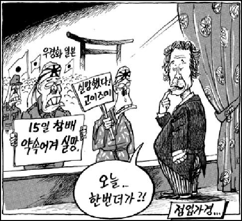
The Korean newspaper comic to the right criticizes Japan’s denial of her war past. The tormented ghosts of Japanese war dead grieve over Koizimi’s visit to the Yasukuni Shrine which honors some war criminals.
Japanese Professor Hideki Kajimura’s comments in his 1997 article “The Question of Dokdo – Takeshima brilliantly summarize the nature of the Dokdo problem. He is one of a growing number of Japanese who have the integrity to confront Japan’s past expansionist aggression toward Korea.
Basically, I think that a territorial issue exists solely in an individual form. There is no other way but to solve problems one by one, by straightening up the dispute in the actual state of things and without avoiding the trouble of ascertaining the facts. Only when that undertaking has been completed, can we be free from an obsession of national boundary. It would be useless to heighten the territorial consciousness or national consciousness by relying on an abstract concept. Contrary to the judgment of the Japanese government, I think that the Korean side has considerably reasonable grounds on the Takeshima/Tokdo issue….”