
A Study of Old Maps to Determine Japan’s Historical Territory.
“If Takeshima is Japanese territory, surely her maps would include the islands…”
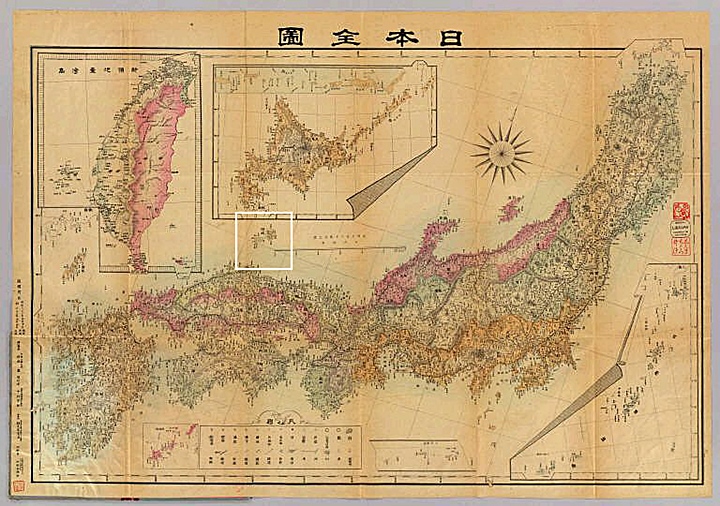
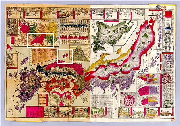
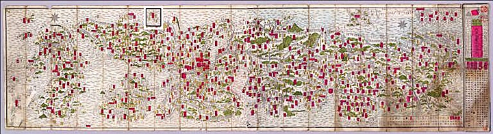
The following maps were gathered from various sources with the intent of making one point. Throughout the ages Japanese national maps prove Dokdo (sometimes Liancourt Rocks) was not considered an inherent part of Japan as their Foreign Ministry now boldly claims. For reference, Oki Island has been boxed and a modern map at the top gives a geographical reference point for the viewer. From these maps, it’s a logical conclusion that for centuries before the annexation of Dokdo in 1905 the Japanese considered Oki Island (隱岐) as the Northwestern boundary of Japan. For higher magnification, each map is clickable.
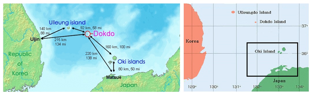
Above Left: A map showing distances to Dokdo from Korean and Japanese nearest islands and landfalls. Above Right: A map showing Japan’s Oki Islands boxed in black. Historically, Japanese considered the Oki Islands as Japan’s Northwestern limit.
Assorted Japanese Historical Maps of Japan Without Dokdo – Takeshima.
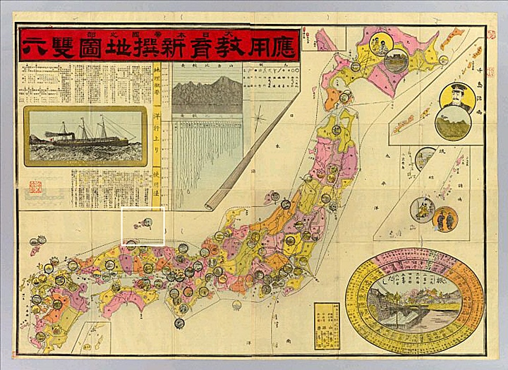
Above left: Yamamoto Homeji 1894 doesn’t show Dokdo as part of Japan. Above right: This 1876 color-coded map of Japan, excludes Dokdo.
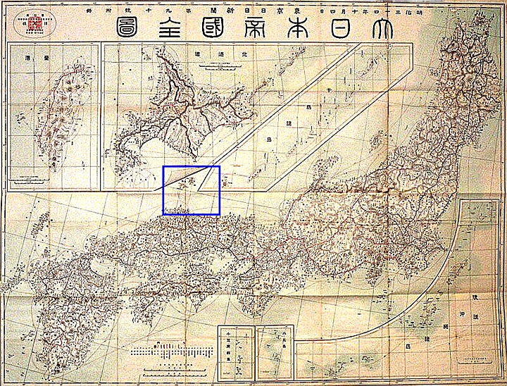
Above left: Only 4 years before Japan annexed Dokdo, this 1901 Japanese map still failed to show Dokdo Island. Above right: 1899 Nogiwa Kaoru placed Dokdo”s location under appended maps of Hokkaido and newly “acquired” Taiwan.

Above left: An 1873 Japanese map without Dokdo and Oki Islands boxed in white. Above right: Oki is cleary Japan’s boundary on this very old, crude map of Japan.

Above left: 1876 Miyazaki Ryujo’s map is oriented upside down and shows no islands West of Oki. Above right: Hikida Toryu’s 1874 map marks Oki as the boundary of Japan.
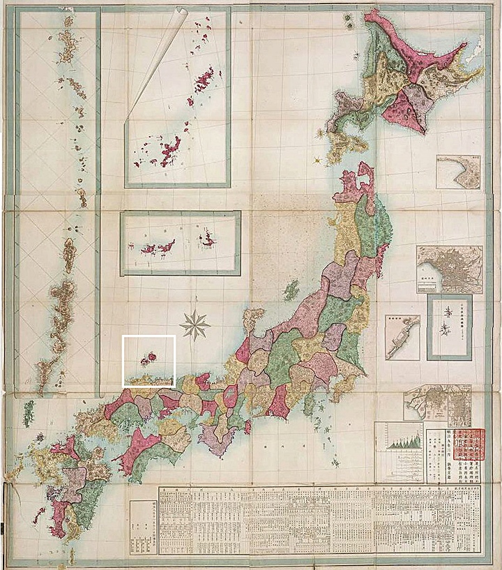
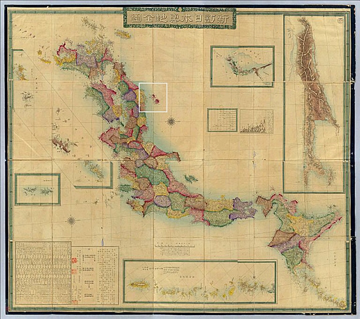
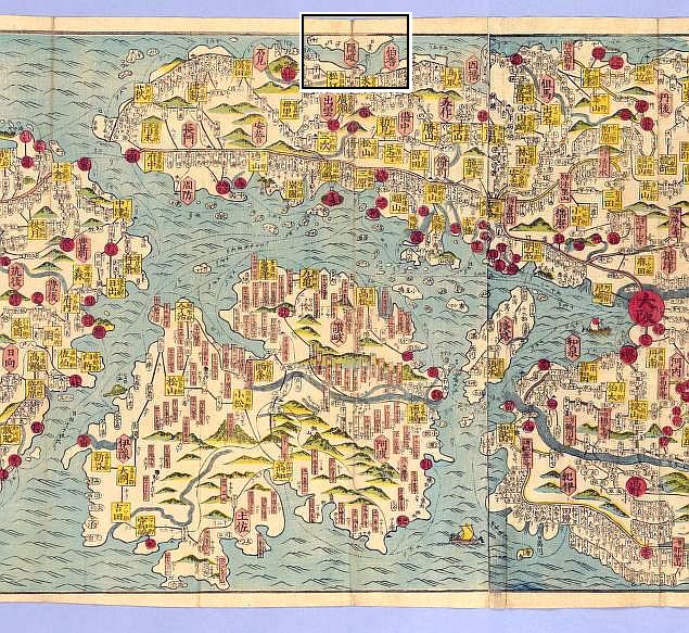
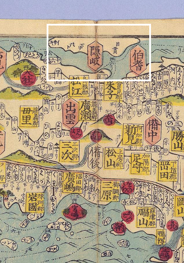
Above left: Mise Teikan’s map of 1877 showed Oki twice with no islands West (click for a close up of Oki region) Above right: An 1886 map of Japan showed no islands West of Oki, Ulleungdo was drawn on the appended map of Korea in the upper right.
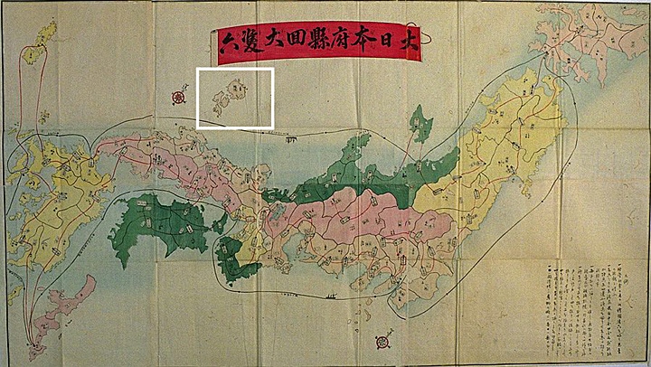
Addtional Miscellaneous Japanese Historical Maps of Japan.
“…The Oki Islands Are Consistently Shown As Japan’s Northwestern Limits On Japanese Maps…”
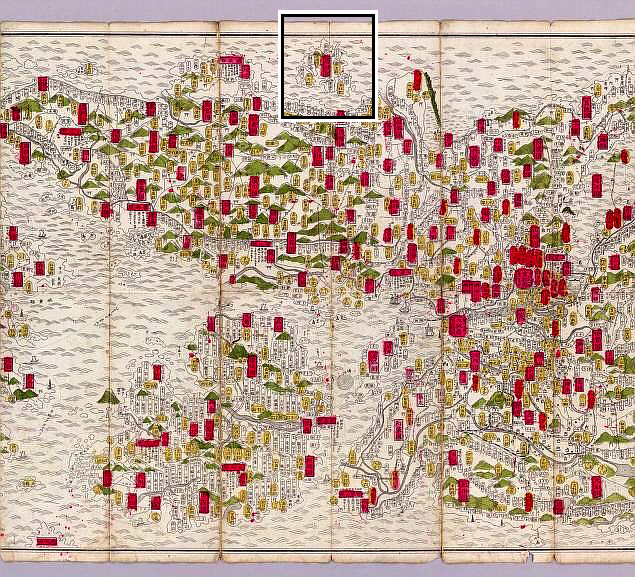
The following charts are Japanese historical maps with first an overview, then a general view and finally a close-up of the Oki Island region showing this region to be Japan’s territorial limit throughout the ages. The bottom two images of each group are clickable for higher detail.
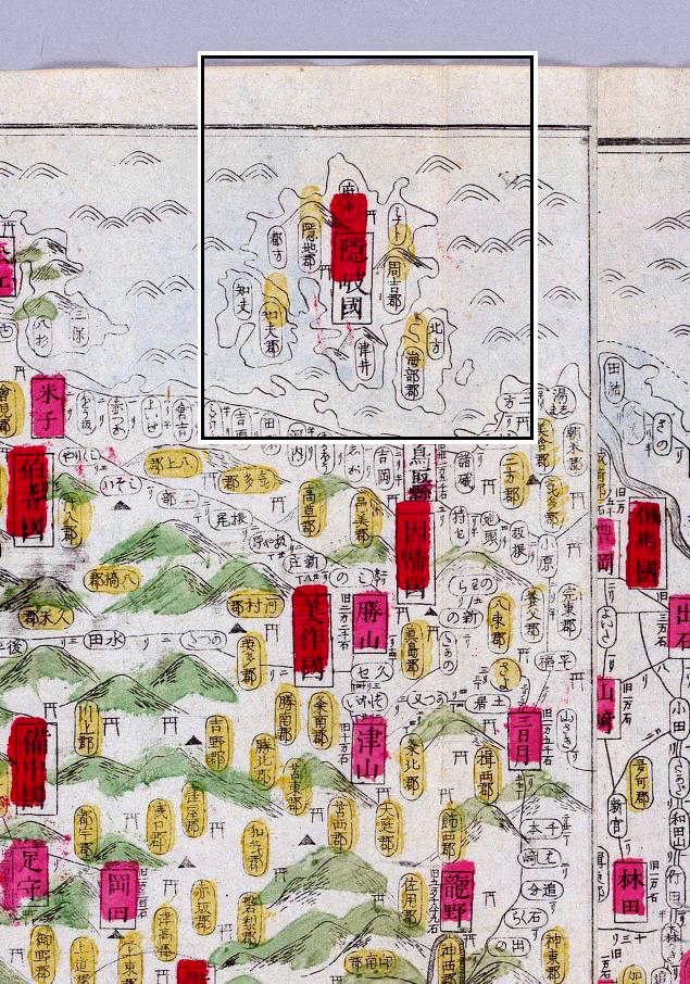
Map 1. Made in the year 1800 by Chisakukan Shyokuko

The above three images are from an 1800 map by Chisakukan Shyokuko. The top left image is a full view of the map and the bottom left shows the upper half. On the right is a close-up of the map’s border and the characters 隱岐 for Oki Island mark the North boundary of Japan.
Map 2. Map of Japan, 1891 by Fujitane Ihe

The above three images are from an 1891 map by Fujitane Ihe. The top left image is a full view of the map and the bottom left shows the upper half. On the right is a close-up of the map’s border and the characters 隱岐 for Oki Island mark the North boundary of Japan.
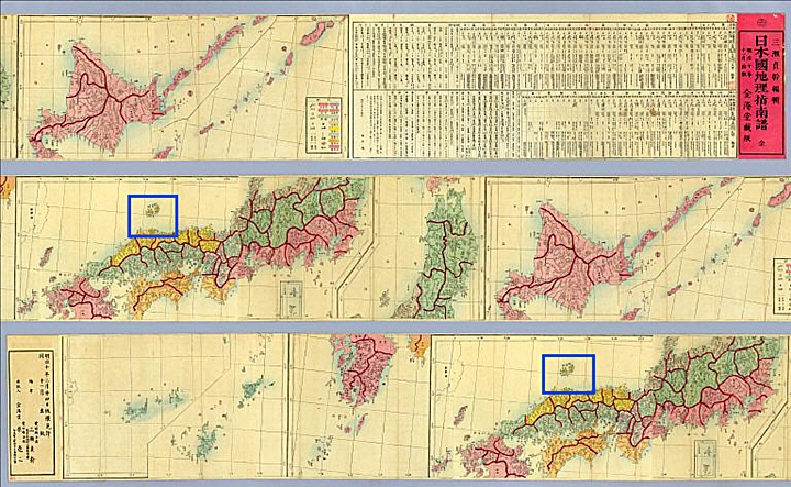
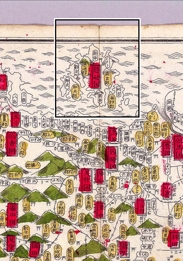
Map 3. Map of Japan, 1884 by Hashimoto Chogetsu
The above three images are from an 1884 map by Hashimoto Chogetsu. The top left image is a full view of the map and the bottom left shows the upper half. On the right is a close-up of the map’s border and the characters 隱岐 for Oki Island mark the North boundary of Japan.
Map 4. Map of Japan, 1892 by Sakata Ichiro
The above three images are from an 1892 map by Sakata Ichiro. The top left image is a full view of the map and the bottom left shows the upper half. On the right is a close-up of the map’s border and the characters 隱岐 for Oki Island mark the North boundary of Japan.
Japanese Ancient Maps Excluded Dokdo – Takeshima Part II – The Only Possible Conclusion
“Japan’s MOFA’s claims are false. Dokdo was never an inherent part of Japan…”
When studying historical maps to determine past territorial perceptions, one must first collect as many charts as possible of the region in question made by the nation that created them. From there, these maps must be examined and compared to find a dominant trend. With this in mind, there can be no other conclusion that Japan excluded Dokdo Island from her land throughout history. The islets were never part of Japan.
This page is just the second of a series. If the reader continues to read and observe the dozens of charts found here and on the following, pages it’s possible to conclude the following: Not only did Japan exclude Dokdo from her territory, she frequently labeled and drew the islets as Korean. Thus Japan’s MOFA claims of historical title to Dokdo are simply wrong. Dokdo island is not, and was not an inherent part of Japan.