A Japanese 19th Century Map Book – The Territorial Limits of Japan as of 1890
The following mapbook was found on Japan’s National Digital Archives Website (JACAR) with the intent of making one point. Throughout the ages Japanese national maps prove Dokdo -Takeshima (sometimes called Liancourt Rocks) was not considered an inherent part of Japan as their Foreign Ministry now boldly claims. For reference are two maps below. Oki Island has been boxed and a modern map at the top gives a geographical reference point for the viewer. From these maps, it’s a logical conclusion that for centuries before the annexation of Dokdo in 1905 the Japanese considered Oki Island (隱岐) as the Northwestern boundary of Japan. For higher magnification, each map is clickable.
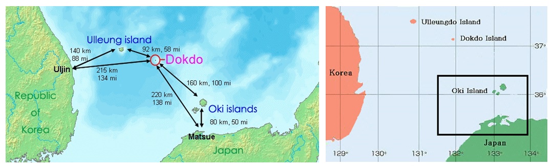
Above left: A map showing distances to Dokdo from Korean and Japanese nearest islands and landfalls. Above right: A map of the East Sea with Oki Island (隱岐) boxed in a black line.
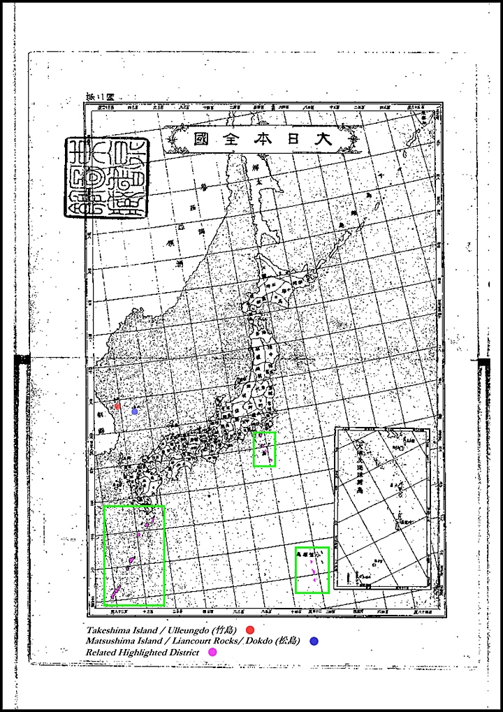
Dokdo – Takeshima is excluded from all Japanese prefectures at the turn of the 20th Century.
The following page, as the title suggests is an 1890 Japanese Map book displayed in its entirety for the reader to get a clear idea of the territorial perceptions of Japan as a nation in the late 19th Century. This map book shows all of Japan, prefecture by prefecture. Also all of Japan’s minor islands are included as either maps of their own or as appended to others. Each prefecture map has a copy of the national map next to it with the relevant region highlighted in pink for geographic reference. From this map we can determine if Dokdo – Takeshima was really considered part of Japanese territory in the years leading up to the 1905 annexation of the island.
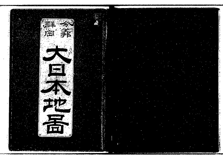
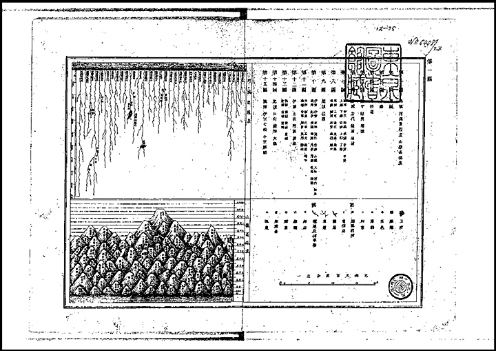
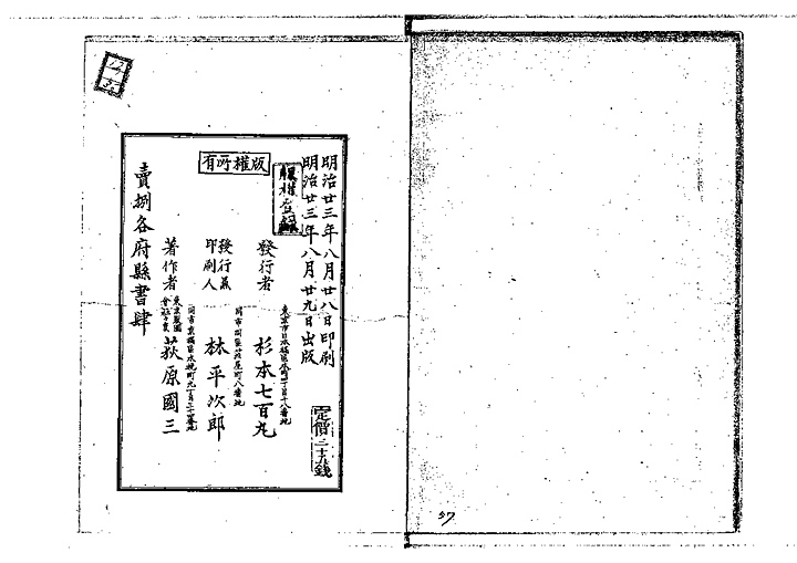
The three from above are (left to right) The cover of the 1890 Japanese Map Book, in the center is the index and to the right is the back cover with the date printed verifying this book was published in 1890.
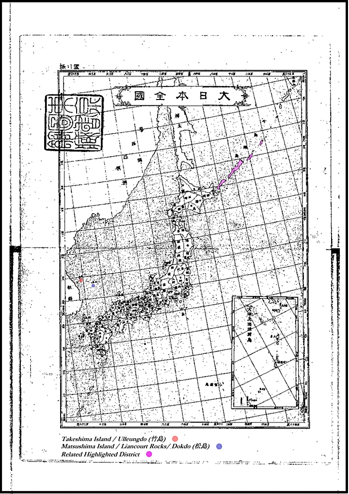
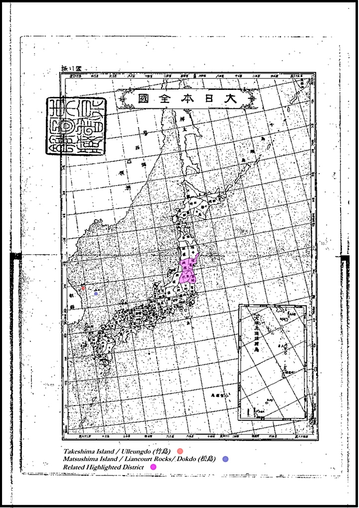
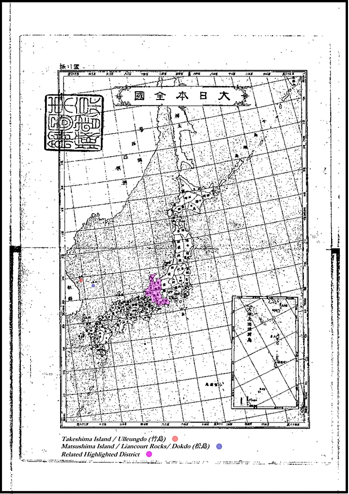
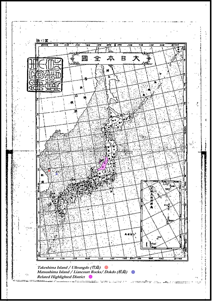
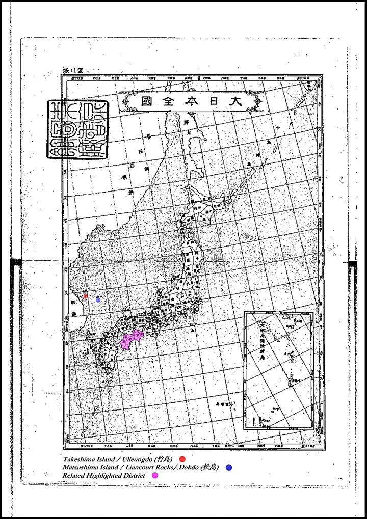
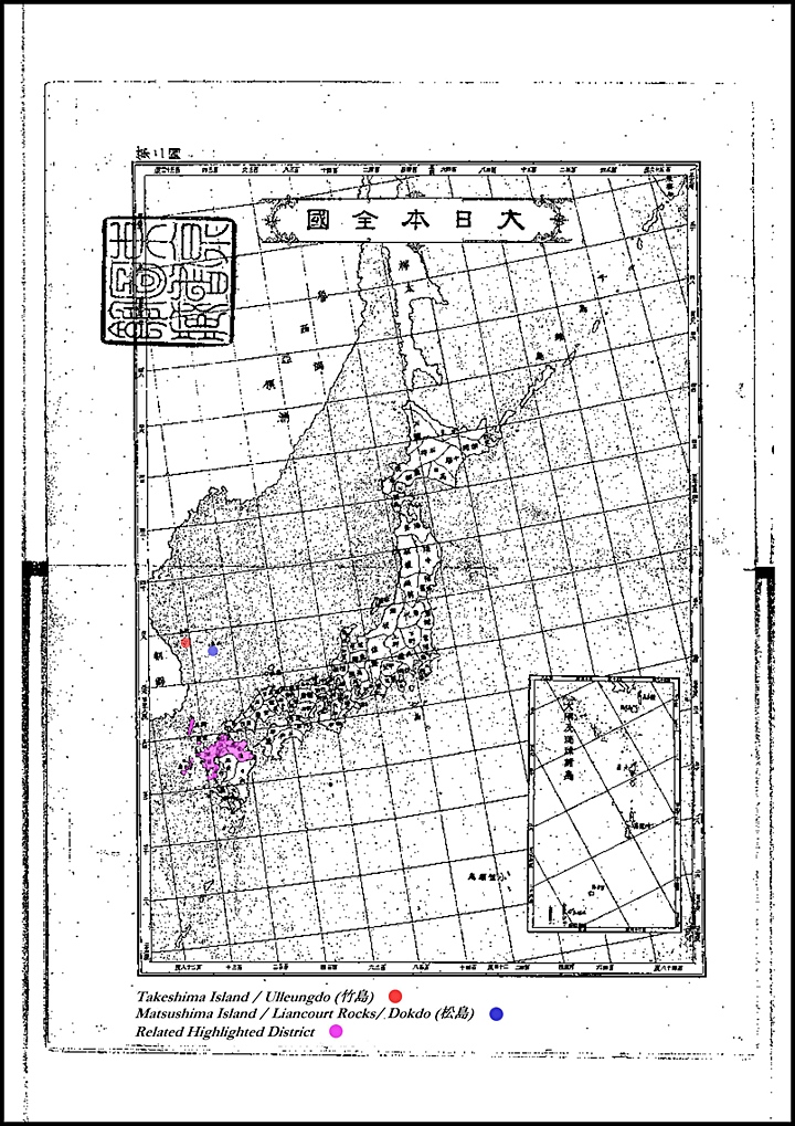
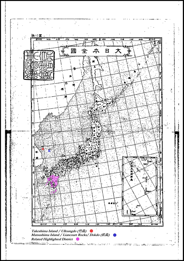
The 1890 Map Book’s Overall Region Showing Japan, East Korea, Ulleungdo and Dokdo.
This map book used modern western cartography techniques meaning smaller appended maps were used in cases where outlying islands were too distant to be included on maps of great scale. There are similar editions of this publication and the vast majority of books from this era show the same territorial limits of Japan.
From the start of the Meiji Era, the definition of Japanese territory began to change radically. With the “acquisition” of new lands such as the Ryukyus, Ogasawaras, Hokkiado etc, Japanese maps were altered with appended maps to display these outlying lands. The definition of Japan’s national boundary differed further at the turn of the century as she “acquired” Taiwan after the Sino Japanese War, in 1895 as shown on the next page of this series.
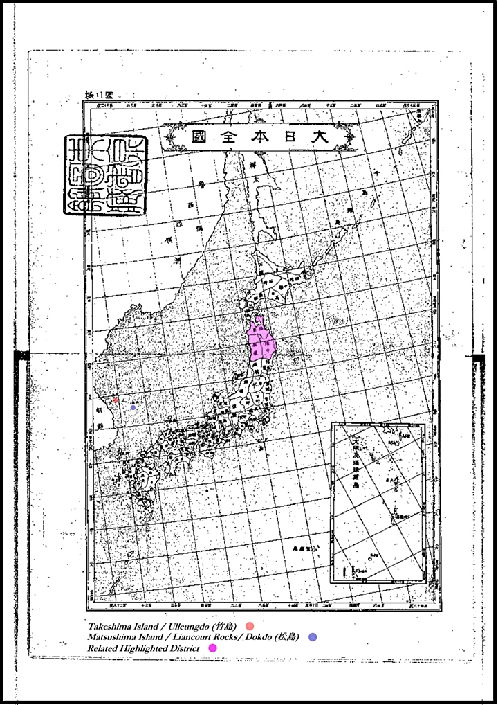
At the beginning of the Japanese Map Book there is an overall reference map of Japan’s surrounding region. At the bottom is a small legend has been added to highlight where 竹島 (Ulleungdo) and 松島 (Dokdo) are located. It should be noted Ulleungdo and Dokdo are shown in more westerly locations on this chart.
“However, was Dokdo part of Japan in 1890…?”
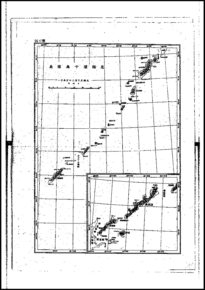
Map 1. The Kurile Islands North of Hokkaido
The Kuriles are situated North of Japan’s Hokkaido Island. The reference map above shows the Kuriles coloured in pink. The Treaty of Commerce, Navigation and Delimitation was concluded in 1855, and the border was established between Iturup and Urup. This border confirmed that Japanese territory stretched south from Iturup and Russian territory stretched north of Urup. Sakhalin remained a place where people from both countries could live. The Treaty of Saint Petersburg in 1875 resulted in Japan relinquishing all rights over Sakhalin in exchange for Russia ceding all of the Kuril Islands to Japan.
Above left: A map of the Kurile Islands group that were under Japanese jurisdiction as of 1890. Above right: The overall map shows the Kuriles highlighted in pink.
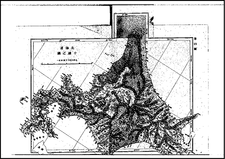
Map 2. Hokkaido Island
Hokkaido (北海道) literally “North Sea Circuit”, formerly known as Ezo, Yezo, Yeso, or Yesso, is Japan’s second largest island and the largest, northernmost of its 47 prefectural-level subdivisions. It became part of Japan in 1869, almost immediately after the start of the Meiji Era.
Above left: The 1890 Map book’s chart of Hokkaido. Above right: The overall map showing the related area highlighted in pink. (click )
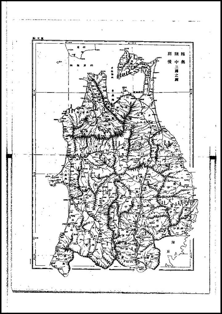
Map 3. North Tohoku Region
Tohoku is Japanese for “northeast”, and the Tohoku region occupies the northeastern portion of Honshū, the largest island of Japan. Dokdo Island is too far Southwest to have been considered part of this region
Above left: The 1890 Map book’s chart of North Tohoko. Above right: The overall map showing the related area highlighted in pink.
Map 4. South Tohoku Region (Fukushima~Yamagata~Miyagi Prefectures)
South Tohoku has only a small portion of coastal area on Japan’s western shore and thus is unlikely to have been historicaly related to Dokdo Island. This region consists of six prefectures: Akita, Aomori, Fukushima, Iwate, Miyagi and Yamagata Prefectures.
Above left: The 1890 Map book’s chart of South Tohoku Region. Above right: The overall map showing the related area highlighted in pink.
Map 5. Kanto Region
The Kantō region (関東地方, Kantō-chihō?) is a geographical area of Honshū, the largest island of Japan. The region encompasses seven prefectures which overlaps the Greater Tokyo Area: Gunma, Tochigi, Ibaraki, Saitama, Tokyo, Chiba, and Kanagawa.
Above left: The 1890 Map book’s chart of Kanto region. Above right: The overall map showing the related area highlighted in pink.
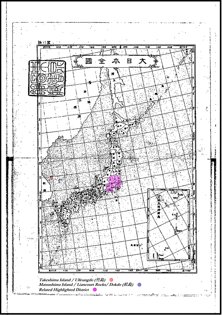
Map 6. Chubu Region
The Chūbu region (中部地方, Chūbu-chihō?) is the central region of Honshū, Japan’s main island. Chūbu, which means “central region”, encompasses nine prefectures: Aichi, Fukui, Gifu, Ishikawa, Nagano, Niigata, Shizuoka, Toyama, Yamanashi, and often Mie. It is located directly between the Kantō region and the Kansai region and includes the major city of Nagoya as well as long Pacific and East Sea (Sea of Japan) coastlines, extensive mountain resorts, and Mount Fuji. As shown below, Dokdo Island is not drawn as part of this region.
Above left: The 1890 Map book’s chart of Chubu Region. Above right: The overall map showing the related area highlighted in pink.
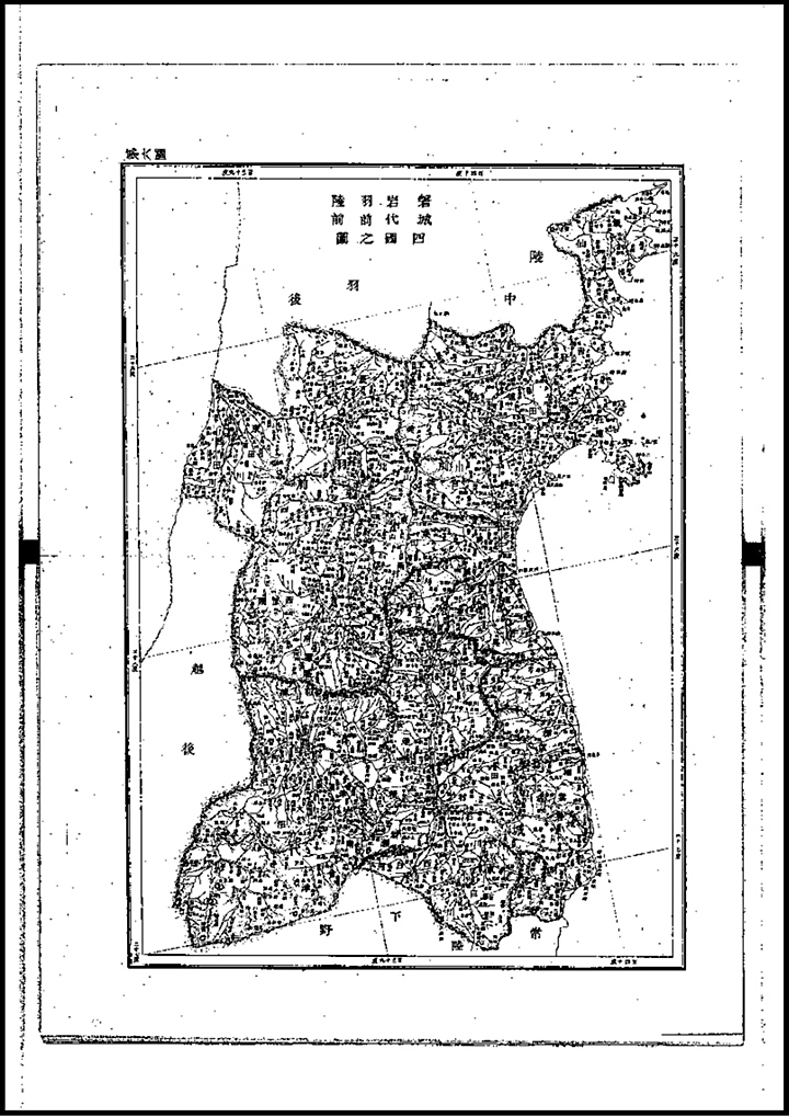
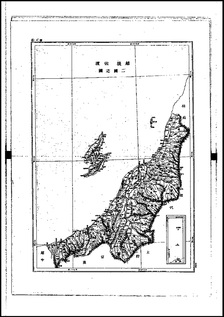
Map 7. Niigata Prefecture
Niigata prefecture (新潟県, Niigata-ken) is a prefecture of Japan located on Honshū island on the coast of the East Sea (Sea of Japan). The capital is the city of Niigata. The name Niigata literally means “new lagoon”.
Above left: The 1890 Map book’s chart of Niigata Prefecture. Above right: The overall map showing the related area highlighted in pink.
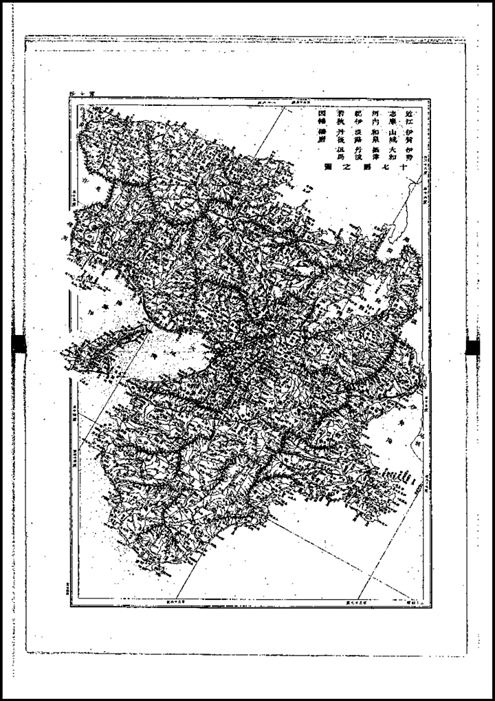
Map 8. Kansai Region
The Kansai region (関西地方, Kansai-chihō?) or the Kinki region (近畿地方, Kinki-chihō?) lies in the southern-central region of Japan’s main island Honshū. The region includes the prefectures of Mie, Nara, Wakayama, Kyoto, Osaka, Hyōgo, and Shiga.
Above left: The 1890 Map book’s chart of Kansai Region. Above right: The overall map showing the related area highlighted in pink.
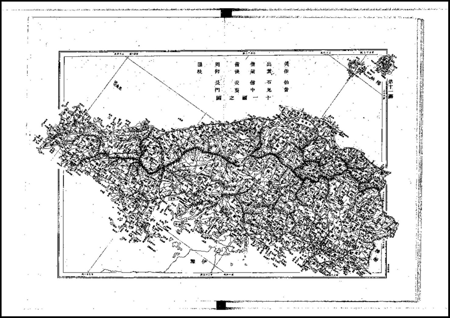
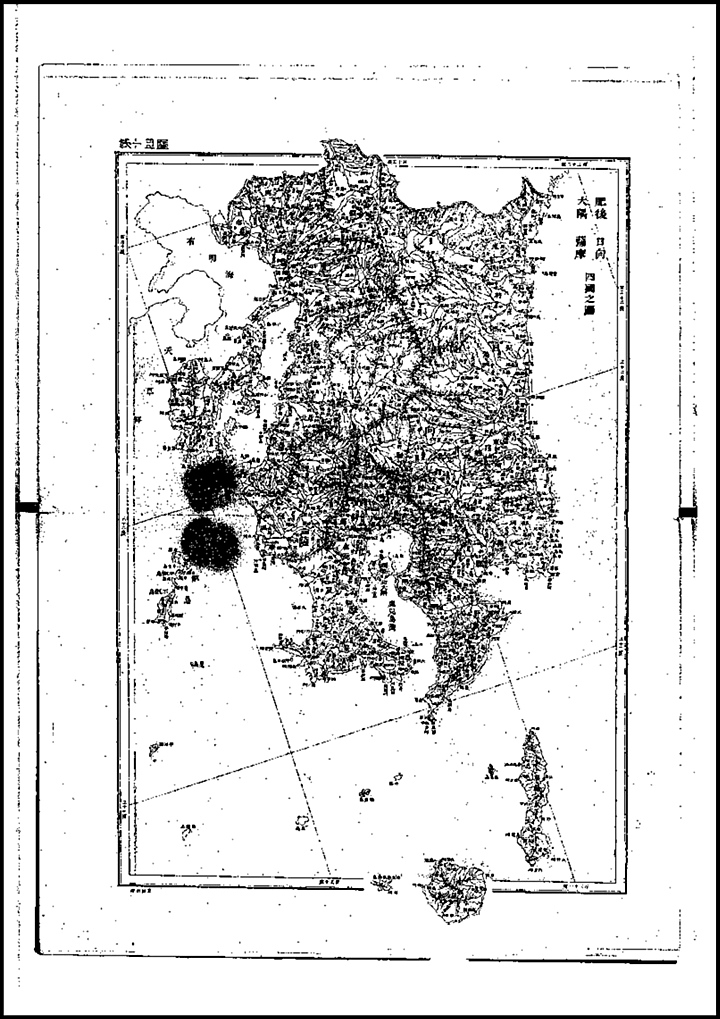
Map 9. Chugoku Region Shimane – Tottori and Oki Prefectures
This region of Japan is the most critical when trying to determine if Dokdo – Takeshima was part of Japan in the late 19th Century. Being the most proximate region adjacent to Dokdo, surely if Japan thought the islets were a part of her nation they should be part of the map above but we can see this is not the case. Also we can’t say this maps lacks the detail to include small minor islands because tiny Minoshima (見島) can be seen off the coast of South Shimane Prefecture. This map of Shimane, like all historical maps of this prefecture, fail to show Dokdo as part of Japan. As always Japan’s Okinoshimas are the western limit of Japan. Many more historical maps of Shimane can be seen here. (link)
Above left: The 1890 Map book’s chart of Shimane- Tottori and Oki Islands. Dokdo Island is not shown as part of Japan’s most proximate prefectures. Above right: The overall map showing the related area highlighted in pink.
Map 10. Shikoku Region
Shikoku (四国 “four provinces”) is the smallest (225 km long and between 50 and 150 km wide) and least populous (4,141,955 as of 2005) of the four main islands of Japan, located south of Honshū and east of the island of Kyūshū. Its ancient names include Iyo-no-futana-shima (伊予之二名島), Iyo-shima (伊予島), and Futana-shima (二名島).
Above left: The 1890 Map book’s chart of Shikoku Region. Above right: The overall map showing the related area highlighted in pink.
Map 11. West Kyushu and Tsushima Island
Kyūshū (九州, Nine Provinces.) or Kyushu is the 3rd-largest island of Japan and most southwesterly of its four main islands. Its alternate ancient names include Kyūkoku (九国 Nine States), Chinzei (鎮西 West of the Pacified Area), and Tsukushi-no-shima (筑紫島 Island of Tsukushi). The historical regional name Saikaidō (西海道 West Sea Circuit) referred to Kyūshū and its surrounding islands.
Above left: The 1890 Map book’s chart of West Kyushu. Above right: The overall map showing the related area highlighted in pink.
Map 12. Southeast Kyushu and Adjacent Islands
Kyūshū (九州, Nine Provinces.) or Kyushu is the 3rd-largest island of Japan and most southwesterly of its four main islands. The two islands to the South of Kyushu are Tanegashima and Yakushima.
Above left: The 1890 Map book’s chart of South Kyushu and adjacent islands. Above right: The overall map showing the related area highlighted in pink.
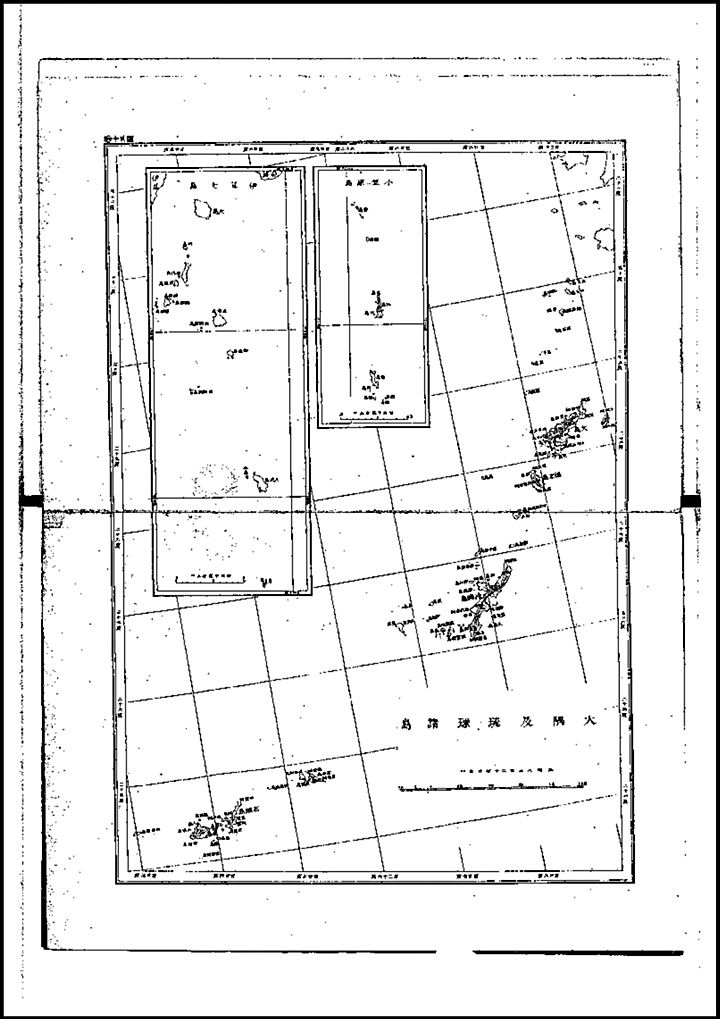
The final map of this book shows in detail Japanese distant outlying islands. Even the tiny Ogasawaras which are barely even habitable are on this map. Thus, if Dokdo were said to be included with the territory of Japan the islets should have at least been included on this page but Dokdo is not anywhere to be found.
Above left: The 1890 Map book’s chart of Japanese outlying islands Ryukyus, Ogasawaras and Miyake Islands. Above right: The overall map showing Japan’s outlying minor islands boxed in bright green (click).
The 1890 Japanese Map Book – A Conclusion Based on the Evidence
The above publication represents the true territorial limits of Japan as of 1890. It is quite an accurate map book using modern cartographic techniques (ie appended maps) for remote islands. All of Japan’s regions are accounted for. In addition, Japan’s minor outlying islands such as the Bonin Islands and Ryukus are on the last map. Some of these tiny island groups are almost 1000 kms away from Japan’s main island but were consistently included on national maps of Japan during the late 19th Century.
Takeshima (Ulleungdo) and Matsushima (Dokdo) can be seen on the overall map of Japan’s surrounding waters. However, these islands are not drawn as part of any region or prefecture of Japan. The only natural conclusion is Japan as a nation did not include either Takeshima or Matsushima as part of Japan around the turn of the 20th Century. There are no less than four pages of Japanese historical maps both national and regional that show Japan continually excluded Ulleungdo and Dokdo from what defined Japan’s boundary.

 This map book used modern western cartography techniques meaning smaller appended maps were used in cases where outlying islands were too distant to be included on maps of great scale. There are similar editions of this publication and the vast majority of books from this era show the same territorial limits of Japan.